Books For Sale
List Results
Showing 121 - 144 out of 212
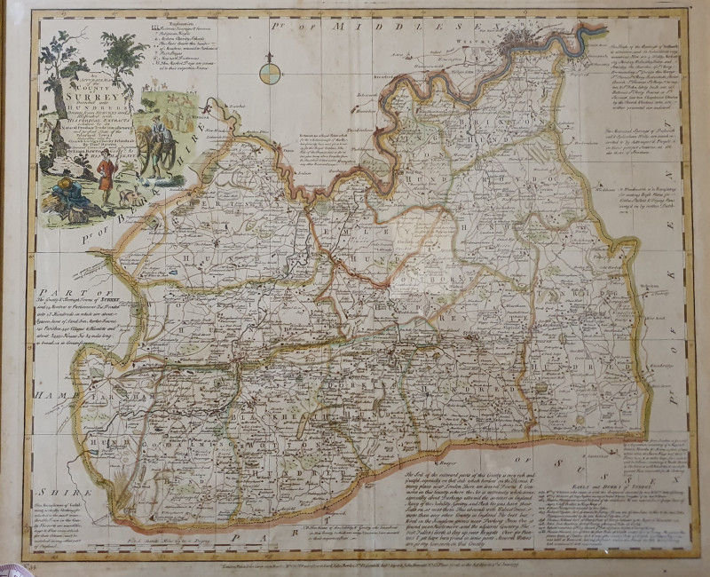
AN ACCURATE MAP OF THE COUNTY OF SURREY DIVIDED IN...
Emanuel and Thomas Bowen
Printed for Carington Bowles
£350.00
Offered by Alastor Rare Books
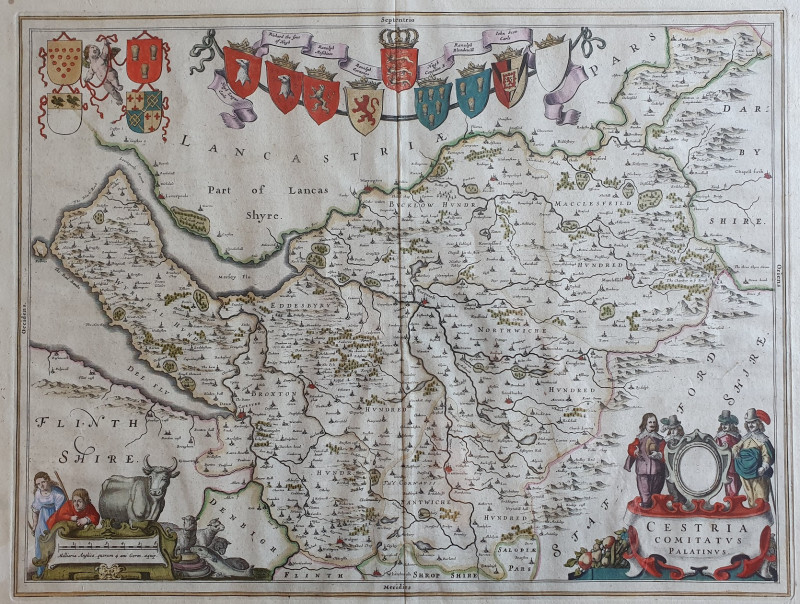
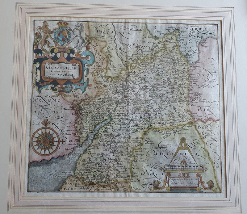
Glocestriæ Comitatus olim sedes Dobunorum
Christopher Saxton
From the 1637 edition of Camden's Britannia.
£275.00
Offered by Alastor Rare Books
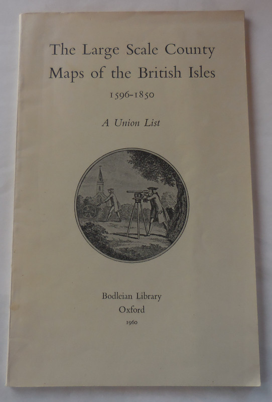
The Large Scale County Maps of the British Isles 1...
Rodger, Elizabeth M.
Bodleian Library
£8.50
Offered by Missing Books
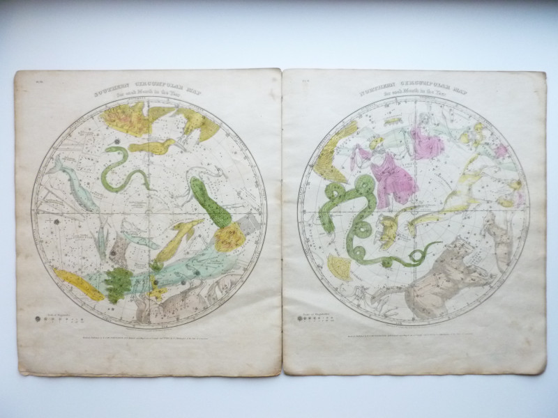
Atlas, designed to illustrate the geography of the...
BURRITT, Elijah H.
New York: Published by F.J. Huntington and Co, 174 Pearl Street
£300.00
Offered by Christian F Verbeke Rare Books
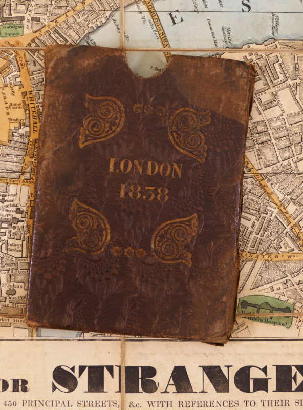
Wallis's Guide for Strangers through London, 1838
Wallis (Edward)
£750.00
Offered by Robert Hall Pictures
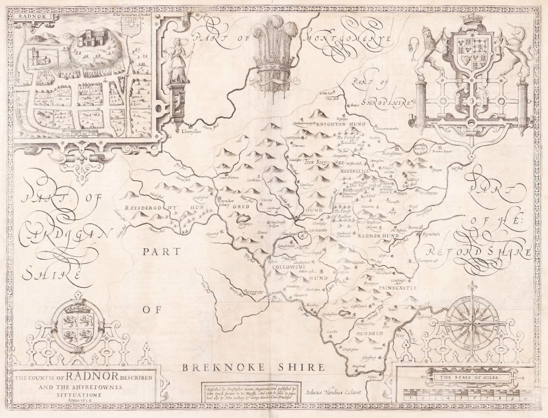
The Countie of Radnor Described, and the Shyretown...
Speed (John)
imprint of John Subdbury and George Humble [but William Humble]
£225.00
Offered by Robert Hall Pictures
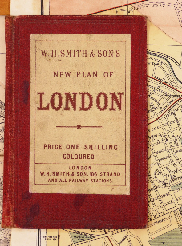
W.H. Smith & Son's Plan of London
Smith (W.H., & Son) (Publisher)
W.H. Smith & Son
£240.00
Offered by Robert Hall Pictures
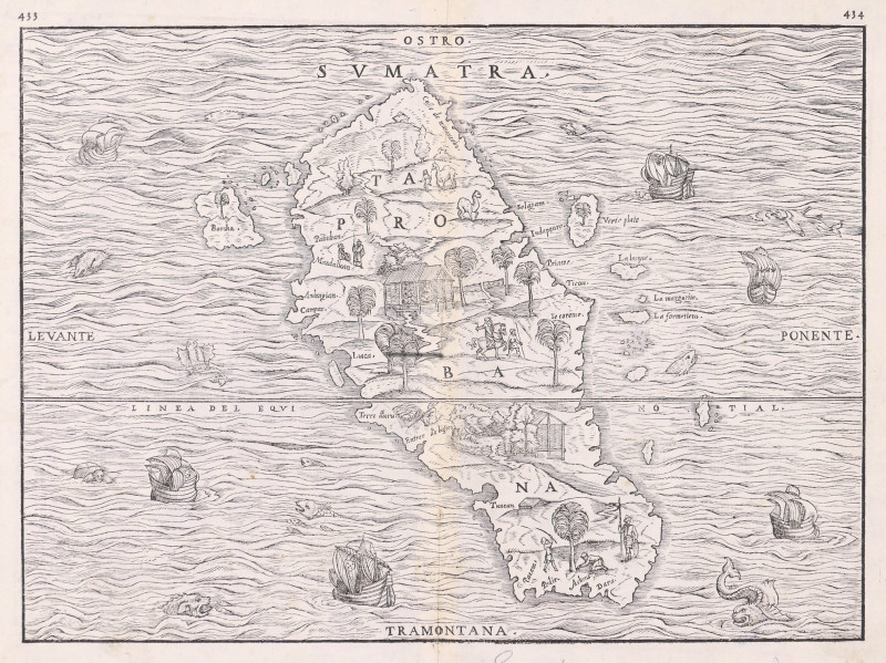
Sumatra, Taprobana,
Ramusio (Giovanni Battista)
Venice, Tommaso Giunti,
£795.00
Offered by Robert Hall Pictures
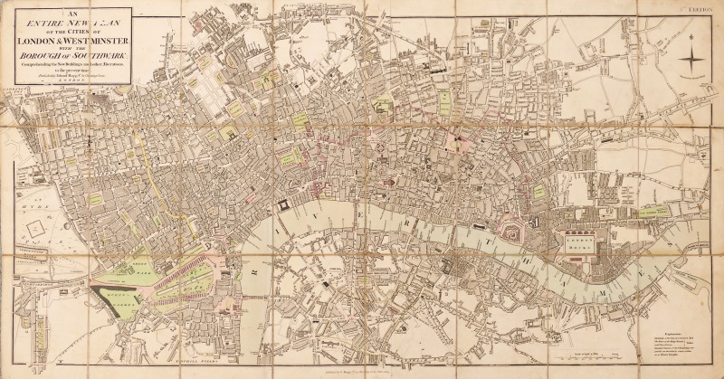
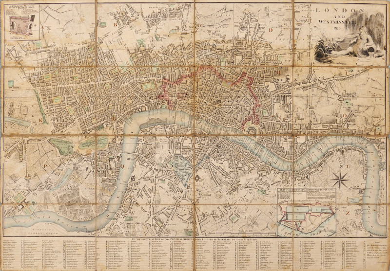
An Entire New Plan of the Cities of London & Westm...
Mogg (Edward)
£525.00
Offered by Robert Hall Pictures
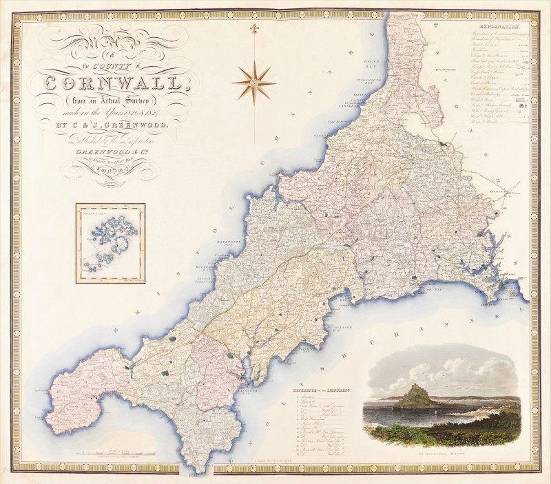
Map of the County of Cornwall from an Actual Surve...
Greenwood (Christopher and John)
Greenwood & Co
£250.00
Offered by Robert Hall Pictures
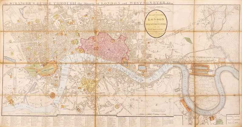
The Stranger's Guide Through the Streets of London...
Darton (William)
£750.00
Offered by Robert Hall Pictures
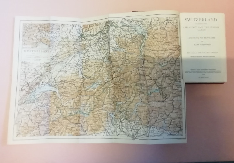
SWITZERLAND with Chamonix & the Italian Lakes.1928
Baedeker. Karl (in DUSTWRAPPER)
BAEDEKER.LEIPZIG.
£60.00
Offered by Black Cat Bookshop
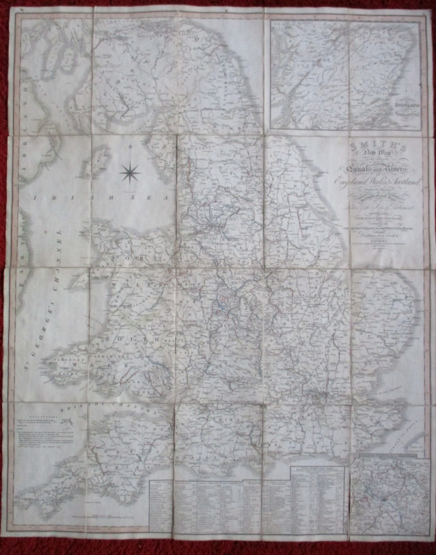
A Collection of early 19th Century Maps of Norther...
None
N/A
£150.00
Offered by Colin Baker Books for the Collector
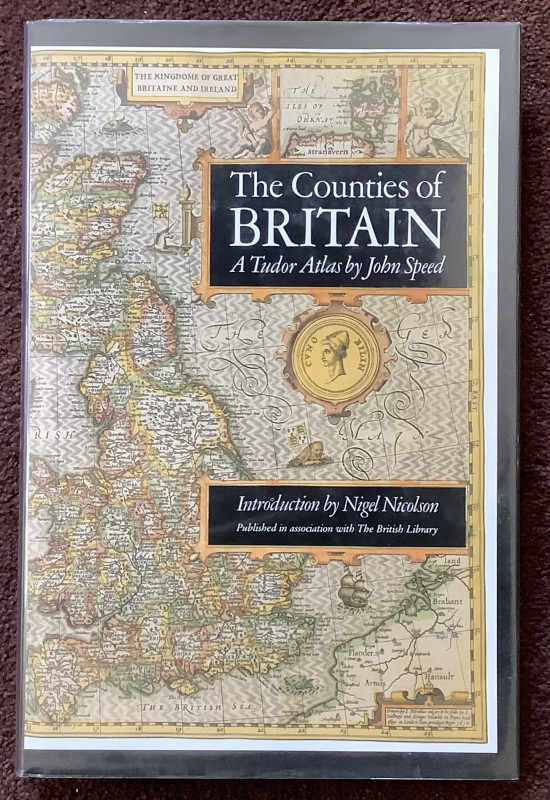
A Tudor Atlas. The Counties of Britain.
John Speed / Nigel Nicolson.
Pavilion / British Library.
£14.00
Offered by Colin Baker Books for the Collector
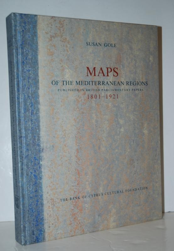
Maps of the Mediterranean Regions Published in Bri...
Gole, Susan
Bank of Cyprus Cultural Foundation
£160.00
Offered by Nugget Box
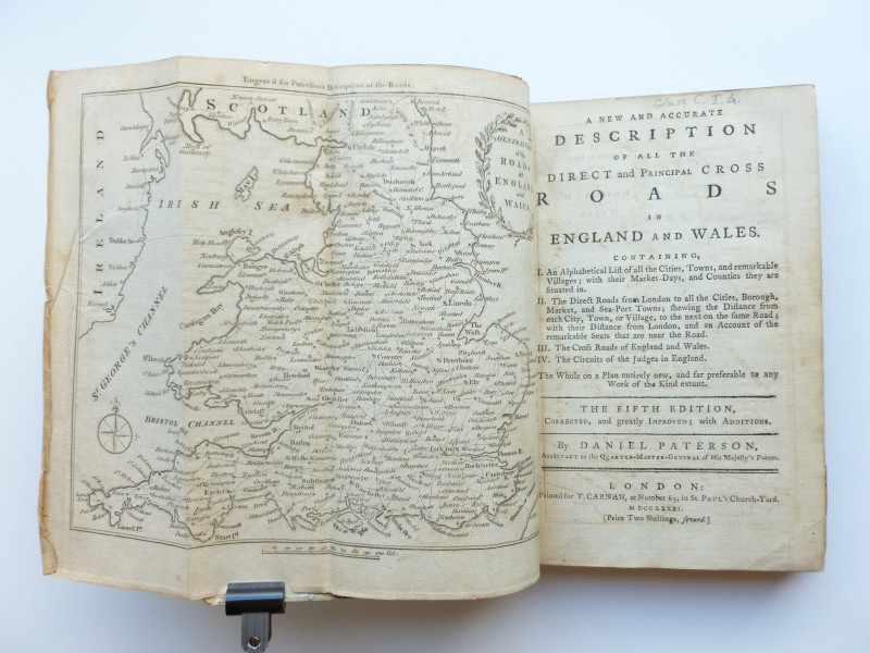
Paterson's Roads
Daniel Paterson
London, Printed for T. Carnan
£50.00
Offered by Christian F Verbeke Rare Books
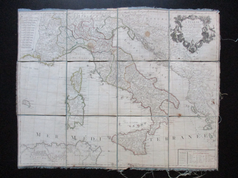
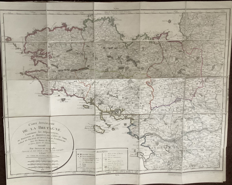
Map of Italy. L'Italie Dresse sur les Observations...
Delisle
Dezauche
£105.00
Offered by Arthur Hook
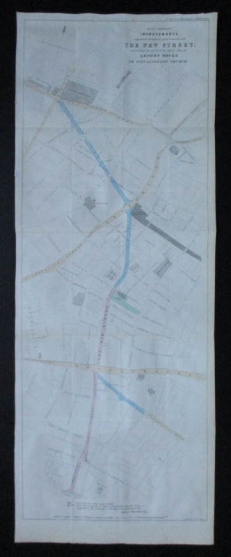
Plan Shewing Improvements suggested in extension o...
Pennethorne
Hansard
£75.00
Offered by Arthur Hook

Grafton Regis - The History of a Northamptonshire...
Charles FitzRoy and Keith Harry - Editors
Merton Priory Press
£15.00
Offered by Colin Baker Books for the Collector
Friends of the PBFA
Please email info@pbfa.org for more information