York Shire
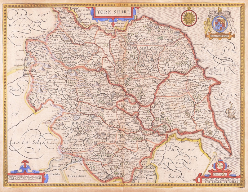
Book Description
Dealer Notes
Other books
If you liked the book you've just seen, you might be interested in other books from the same dealer below.
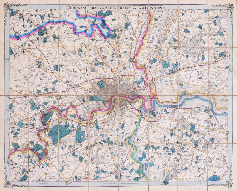
from the Ordnance Map of the Country 14 Miles roun...
Cruchley (George Frederick)
George Frederick Cruchley, London
£375.00
Offered by Robert Hall Pictures
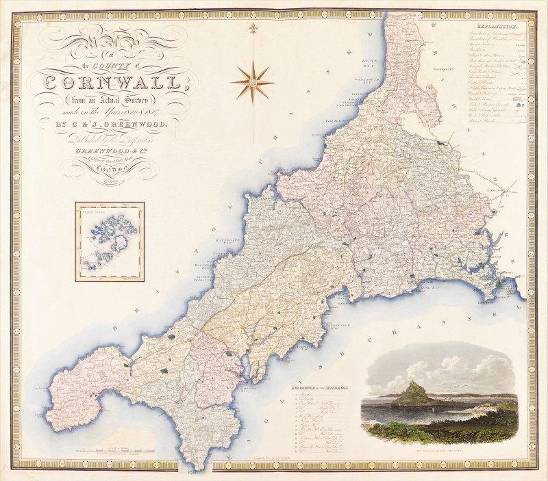
Map of the County of Cornwall from an Actual Surve...
Greenwood (Christopher and John)
Greenwood & Co
£250.00
Offered by Robert Hall Pictures
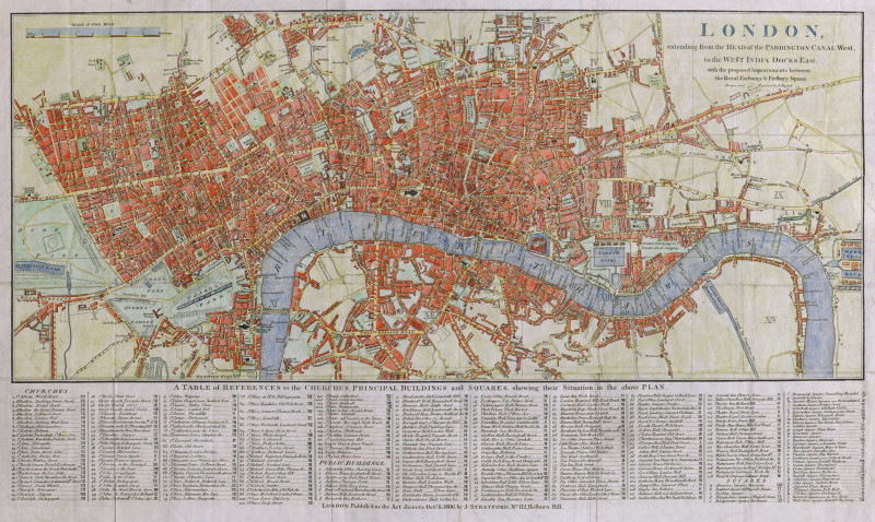
London, extending from the Head of the Paddington...
Russell (John)
James Stratford, London
£375.00
Offered by Robert Hall Pictures
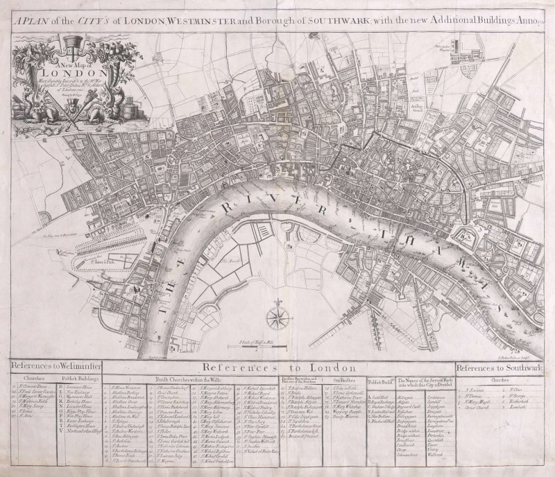
A Plan of the City's of London, Westminster and Bo...
Parker (Samuel)
John Senex, London
£1250.00
Offered by Robert Hall Pictures
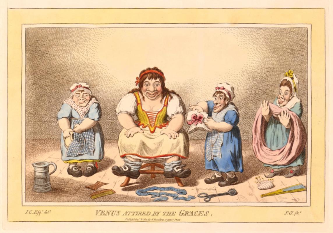
Venus attired by the Graces.
Gillray (James)
Hannah Humphrey
£275.00
Offered by Robert Hall Pictures
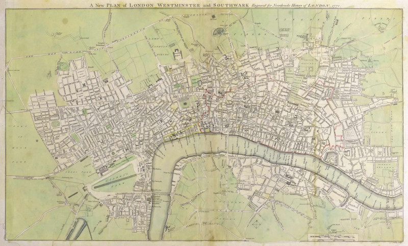
A New Plan of London Westminster and Southwark,
Noorthouck (John)
John Noorthouck, London
£750.00
Offered by Robert Hall Pictures
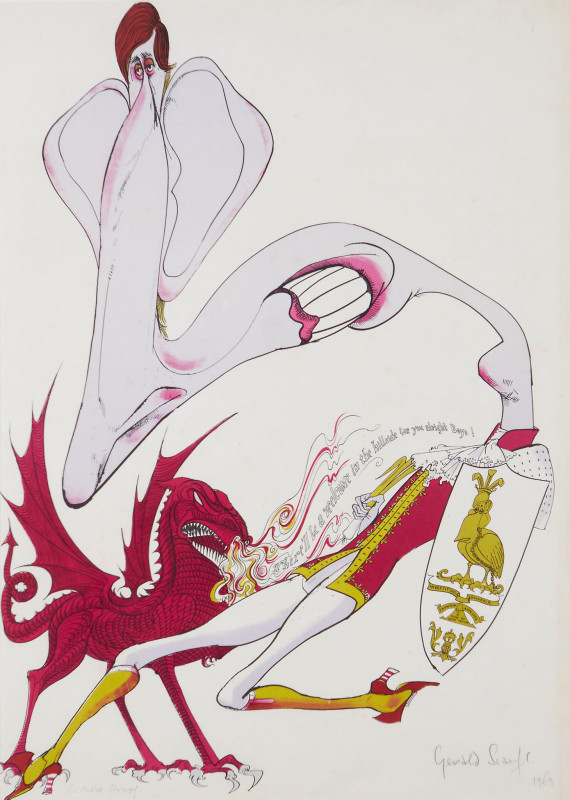
"There'll be a welcome in the hillside for you boy...
Scarfe (Gerald, C.B.E.)
Curwen Studio
£495.00
Offered by Robert Hall Pictures
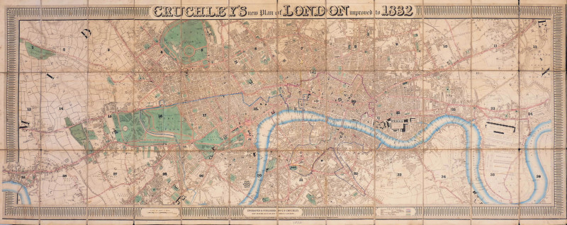
Cruchley's New Plan of London improved to 1832
Cruchley (George Frederick)
George Frederick Cruchley
£2400.00
Offered by Robert Hall Pictures
Friends of the PBFA
Please email info@pbfa.org for more information