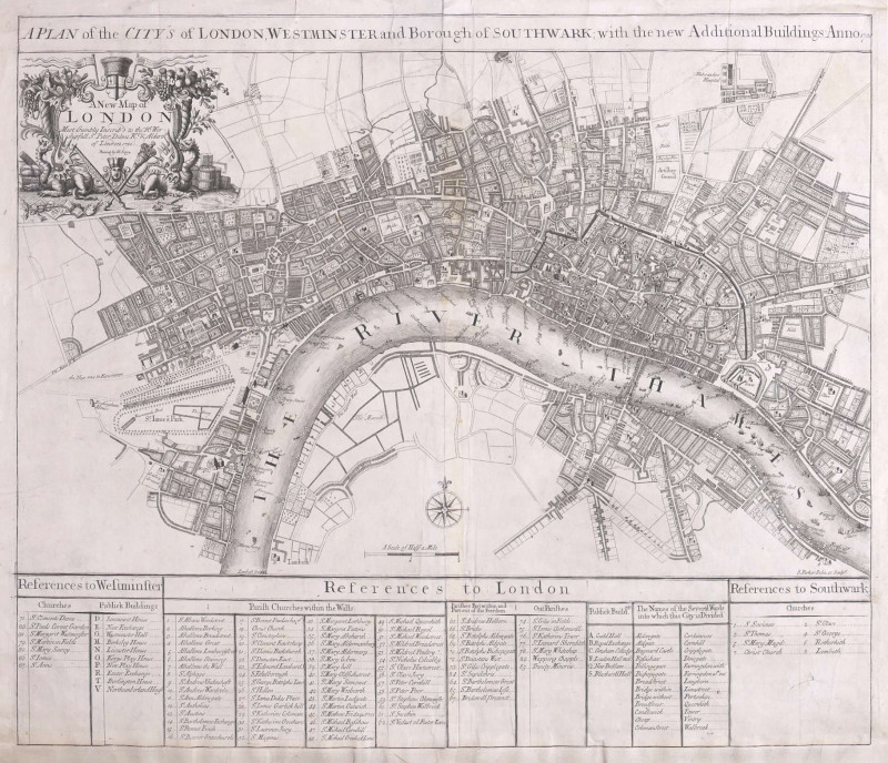
A Plan of the City's of London, Westminster and Borough of Southwark, with the new Additional Buildings, Anno 1720,
Book Description
Dealer Notes
Other books
If you liked the book you've just seen, you might be interested in other books from the same dealer below.
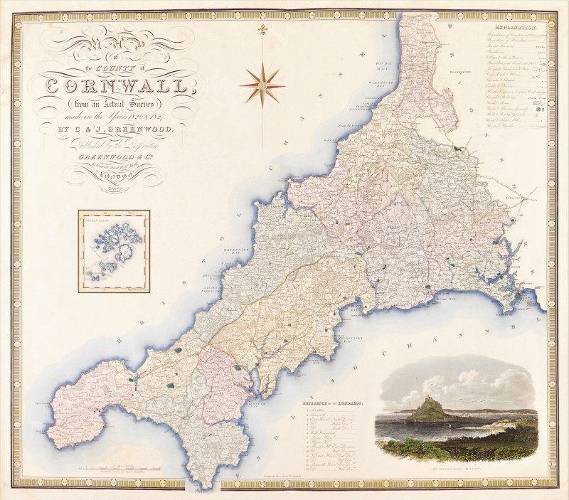
Map of the County of Cornwall from an Actual Surve...
Greenwood (Christopher and John)
Greenwood & Co
£250.00
Offered by Robert Hall Pictures
Westmorland, Cumberland, Durham, & Northumberland,...
Rose (Thomas) and Thomas Allom.
London, Fisher, Son
£100.00
Offered by Robert Hall Pictures
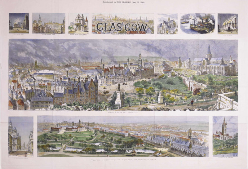
Glasgow, Supplement to The Graphic, May 12, 1888
Brewer (Henry William)
The Graphic, London
£875.00
Offered by Robert Hall Pictures
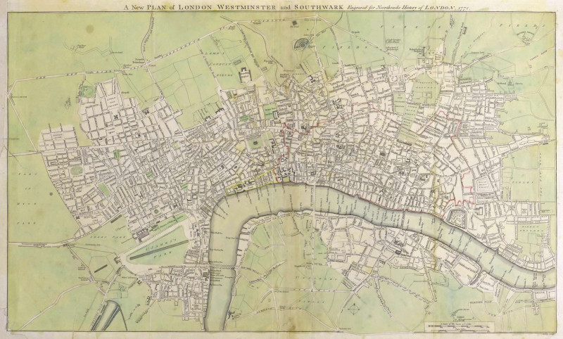
A New Plan of London Westminster and Southwark,
Noorthouck (John)
John Noorthouck, London
£750.00
Offered by Robert Hall Pictures
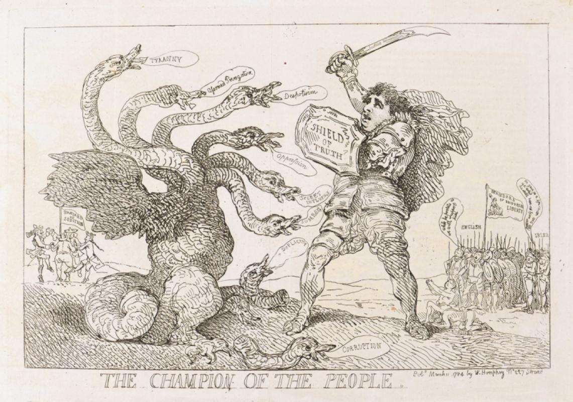
The Champion of the People.
Rowlandson (Thomas)
William Humphrey
£175.00
Offered by Robert Hall Pictures
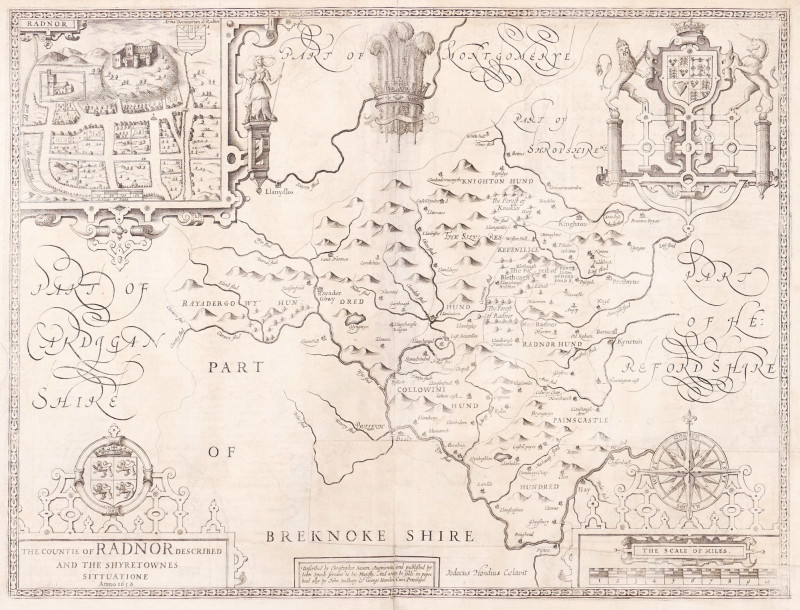
The Countie of Radnor Described, and the Shyretown...
Speed (John)
imprint of John Subdbury and George Humble [but William Humble]
£225.00
Offered by Robert Hall Pictures
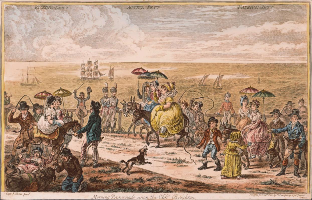
Morning Promenade upon the Cliff, Brighton,
Gillray (James)
Hannah Humphrey
£950.00
Offered by Robert Hall Pictures
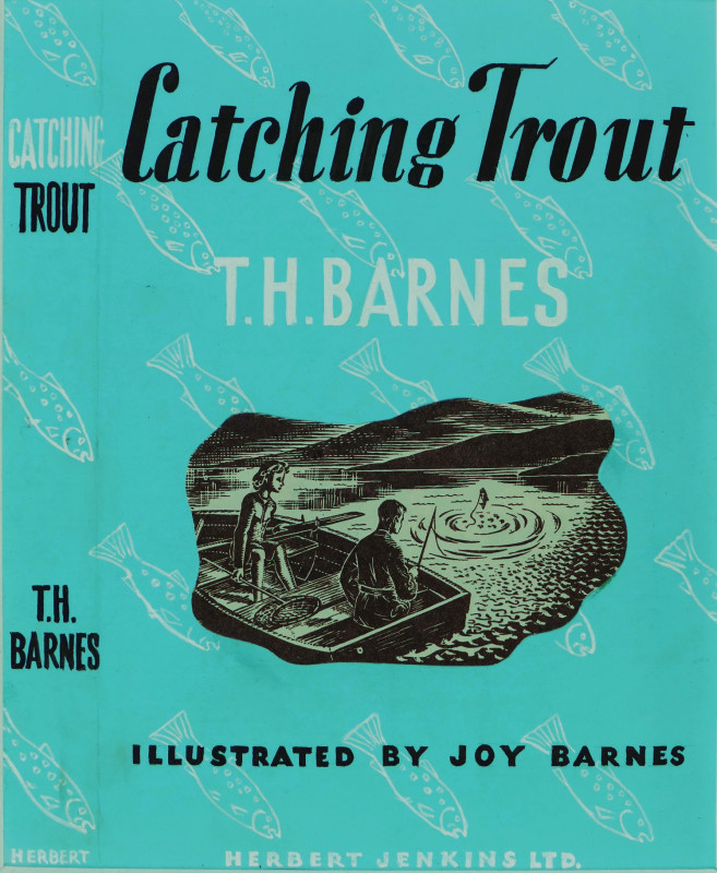
Original dust-jacket artwork for 'Catching Trout'...
Barnes (Joy)
£180.00
Offered by Robert Hall Pictures
Friends of the PBFA
Please email info@pbfa.org for more information