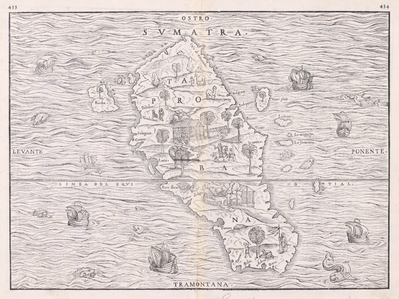
Sumatra, Taprobana,
Book Description
woodcut map, 265 x 365 mm. (10 1/2 x 14 3/8 in), slight browning around the central vertical fold, [Suarez p.157, fig.77]
Dealer Notes
important early map of Southeast Asian interest, being the first to focus on a single island and be based on up to date empirical information. Its level of accuracy is thanks to it being derived from the voyage of the French Parmentier brothers, Jean and Raoul, who managed to break the Portuguese blockade on the region in the late 1520s, the Portuguese, themselves, having first arrived there in 1512. Sadly, both brothers perished there of fever in 1529, and their crew returned with very little of commercial interest to encourage any further French designs on the area. But the information gleaned fitted well with the plan of Giovanni Battista Ramusio (1485-1557), a senior diplomatic secretary in Venice, to revise and update the classical geography then mostly in use, as he was well placed to record and translate such data from the latest voyages for use by this important maritime state.
The map, itself, uses both the names of Sumatra and Taprobana, the latter being the Greek-derived name also used for Sri Lanka, an obvious source of confusion thought likely to be deliberate in order to obscure the real source of the valuable spices and other commodities sourced in either location. It is oriented with south at the top and, although rich in detail, it must have been a deliberate compositional choice to omit the neighbouring coastlines of Java and the Malay Peninsula and present it in isolation. It is surrounded by western galleons, turtles and sea monsters, and between the hills, trees and native buildings on stilts shown inland are many vignettes of a pastoral life, shepherding, leading camels, and gathering fruit or nuts. Thought to have been cut by Giacomo Gastaldi, this is the second block from which the map was printed, the first having been destroyed in a fire. It, therefore, has printed the revised folio numbers of 433 and 434, often seen corrected by hand in the earlier state. Having first appeared as one of only nine maps in volume III of Ramusio’s ‘Navigationi e Viaggi’, first issued in 1556, this map is from the second edition of 1565.
The map, itself, uses both the names of Sumatra and Taprobana, the latter being the Greek-derived name also used for Sri Lanka, an obvious source of confusion thought likely to be deliberate in order to obscure the real source of the valuable spices and other commodities sourced in either location. It is oriented with south at the top and, although rich in detail, it must have been a deliberate compositional choice to omit the neighbouring coastlines of Java and the Malay Peninsula and present it in isolation. It is surrounded by western galleons, turtles and sea monsters, and between the hills, trees and native buildings on stilts shown inland are many vignettes of a pastoral life, shepherding, leading camels, and gathering fruit or nuts. Thought to have been cut by Giacomo Gastaldi, this is the second block from which the map was printed, the first having been destroyed in a fire. It, therefore, has printed the revised folio numbers of 433 and 434, often seen corrected by hand in the earlier state. Having first appeared as one of only nine maps in volume III of Ramusio’s ‘Navigationi e Viaggi’, first issued in 1556, this map is from the second edition of 1565.
Author
Ramusio (Giovanni Battista)
Date
[1565]
Publisher
Venice, Tommaso Giunti,
Other books
If you liked the book you've just seen, you might be interested in other books from the same dealer below.
A New Plan of London Westminster and Southwark,
Noorthouck (John)
John Noorthouck, London
£750.00
Offered by Robert Hall Pictures
A New Map of Derbyshire, Divided into Hundreds, Ex...
Cary (John)
£90.00
Offered by Robert Hall Pictures
Westmorland, Cumberland, Durham, & Northumberland,...
Rose (Thomas) and Thomas Allom.
London, Fisher, Son
£100.00
Offered by Robert Hall Pictures

Designs for a curtain cornice, door furniture, and...
Adam (Robert, Architect), after.
[Peter Elmsly]
£450.00
Offered by Robert Hall Pictures
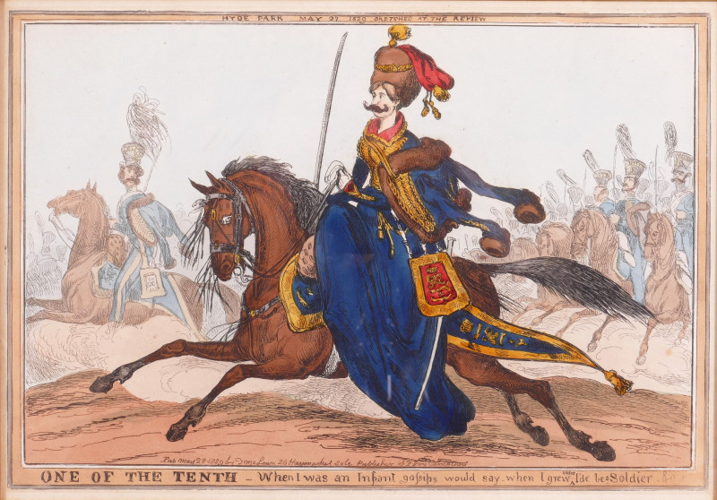
One of the Tenth, Hyde Park May 27 1829 Sketched a...
Heath (William)
Thomas McLean
£120.00
Offered by Robert Hall Pictures
Northern Part of England [with] Southern Part of E...
Thomson (John)
£270.00
Offered by Robert Hall Pictures
A Topographical Plan of Manchester and Salford wit...
Laurent (Charles)
John Stockdale, London
£570.00
Offered by Robert Hall Pictures
Friends of the PBFA
For £10 get free entry to our fairs, updates from the PBFA and more.
Please email info@pbfa.org for more information