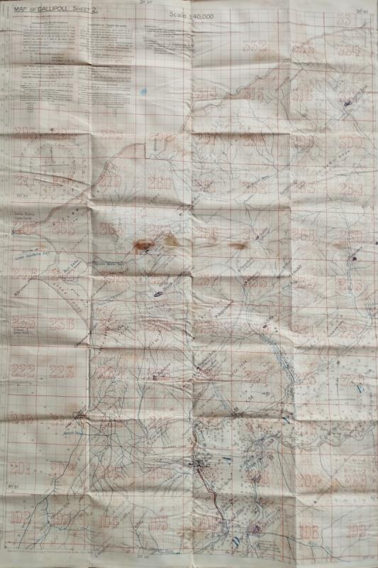
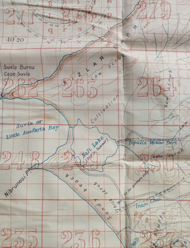
Map of Gallipoli. Sheet 2 [Sulva Bay]
Book Description
Dealer Notes
The landing of Sulva Bay was designed to coincide with an attack at Sari Bair to break the Ottoman lines. However, Leiutenant General Stopford - who was organising the attack - was elderly and had limited experience as a wartime leader. His decision to consolidate the Allied positions (rather than advancing), allowed the Ottoman and German armies to reinforce and occupy the high ground. Subsequently, the Allies suffered nearly 20,000 casulties at Sulva Bay and Stopford was relieved of his command in August 1915.
These maps derived from the 1908, 1:63,360 map and was issued to officers in the Mediterranean Expeditionary Force. However, once the M.E.F. had landed, it was found that they were dangerously inaccurate. All copies were destroyed as soon as more accurate maps became available in July and August 1915 (the Allies fortuitously captured a six-part set of newly published Ottoman maps of the Dardanelles. These maps were sent to the Arab Bureau in Cairo where a team - led by T.E Lawrence - translated and enlarged them).
Rare. OCLC locates a single holding at the National Library of New Zealand. This cataloguer then locates two holdings at the Australian War Memorial and the ANZAC Memorial, Sydney.
Other books
If you liked the book you've just seen, you might be interested in other books from the same dealer below.
Colloquial Omani for English Speakers
ARABIAN GULF
HQ Education Services, The Sultan’s Armed Forces
£350.00
Offered by Peffers Rare Books Ltd.
A guide to the Arab Museum at Khan Marjan in Bagha...
[IRAQ]
Government Press
£250.00
Offered by Peffers Rare Books Ltd.
Guide to Cairo and environs – Catalogues to the Mu...
[EGYPT] GROFF (Florence), LEROUX (ed. Ernest).
£125.00
Offered by Peffers Rare Books Ltd.

Views around South Persia
[WALSH (C.W)] [HOLTON (G.F)]
Bristol & London, Vandyck Printers
£400.00
Offered by Peffers Rare Books Ltd.
Map of Gallipoli. Sheet 2 [Sulva Bay]
[ARAB BUREAU]
Survey of Egypt
£650.00
Offered by Peffers Rare Books Ltd.
Three Egyptian theatre & cinema programmes
[ALEXANDRIA]
p.rs: Imp. C Campanille or Soc. De Pubu. Egyptiennes.
£200.00
Offered by Peffers Rare Books Ltd.
The Traditional Construction of Early Twentieth Ce...
[MAJED (Ebrahim Essa)]
Doha, The Arab Gulf States Folklore Centre.
£300.00
Offered by Peffers Rare Books Ltd.
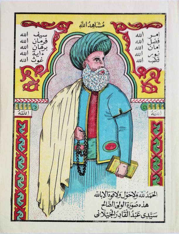
God's witness [Print of Abdel Kader Al-Djilani]
[CHROMOLITHOGRAPHY]
[BONSTEVE]
£250.00
Offered by Peffers Rare Books Ltd.
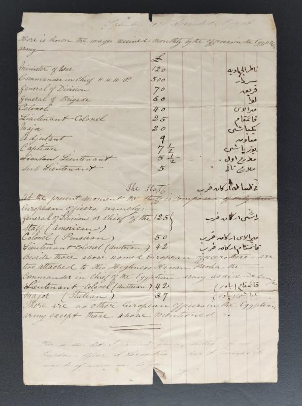
[Ledger page outlining the wages of the Egyptian A...
[ALEXANDRIA][UNIDENTIFIED AUTHOR]
n.p.
£175.00
Offered by Peffers Rare Books Ltd.
Photo map, City of Jeddah, Saudi Arabia
SAUDI ARABIA
AERO SERVICE CORP.
£950.00
Offered by Peffers Rare Books Ltd.
Friends of the PBFA
Please email info@pbfa.org for more information