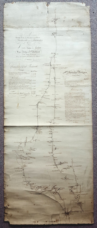
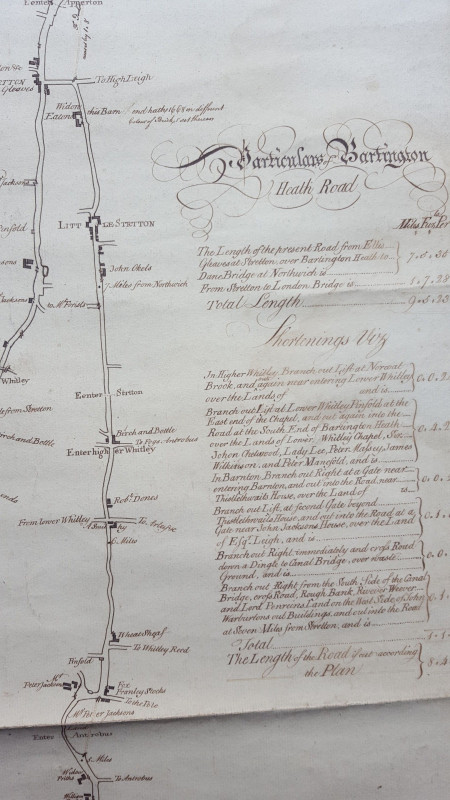
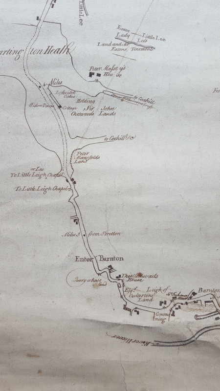
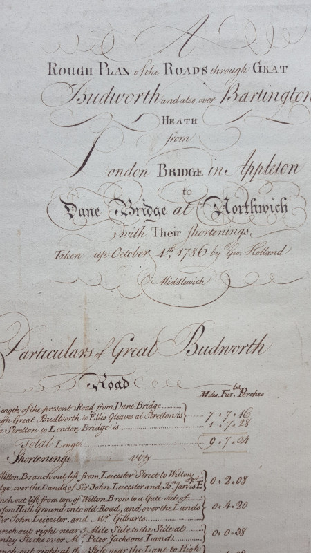
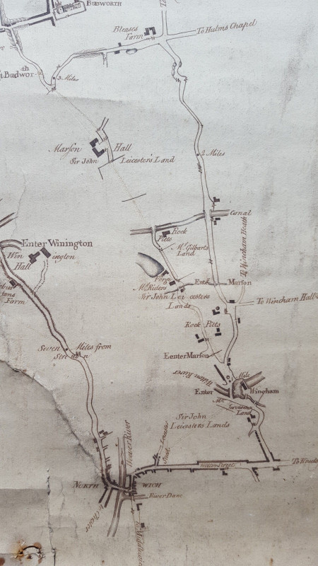
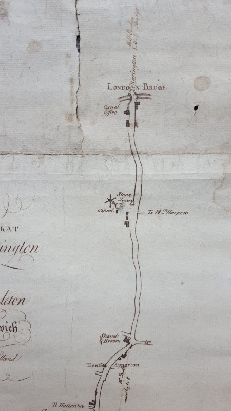
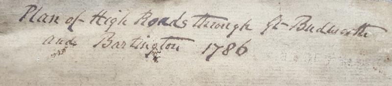
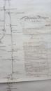
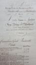
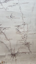
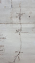
1786 Manuscript Road Map Cheshire

Book Description
Other books
If you liked the book you've just seen, you might be interested in other books from the same dealer below.
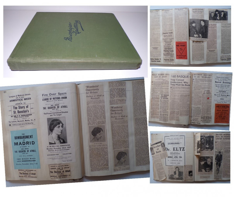
LEAGUE OF NATIONS UNION
One Hundred and Ten Page Scrapbook
(1931-1945)
£125.00
Offered by Andrew Cox
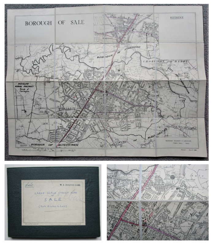
LARGE SCALE STREET PLAN OF SALE
W. E. Bingham-Gadd, Borough Engineer & Surveyor,
Trafford, Greater Manchester
£75.00
Offered by Andrew Cox
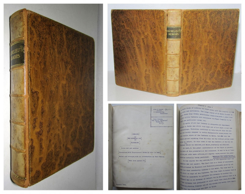
Letters of The Marechal Duc Le Richelieu
310-Page Typescript with Manuscript Corrections,
a seemingly unpublished original work
£450.00
Offered by Andrew Cox
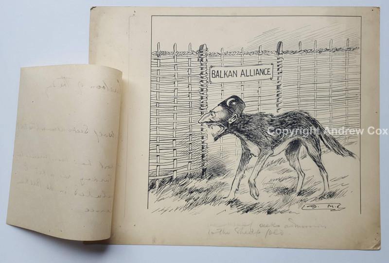
TURKEY & THE BALKAN ALLIANCE
ARTHUR MORELAND
Original Political Cartoon by Arthur Moreland dating to circa 1912
£295.00
Offered by Andrew Cox
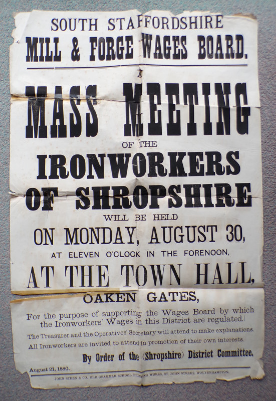
1880 MEETING OF THE IRONWORKERS OF SHROPSHIRE
South Staffordshire Mill & Forge Wages Board
John Steen & Co
£85.00
Offered by Andrew Cox
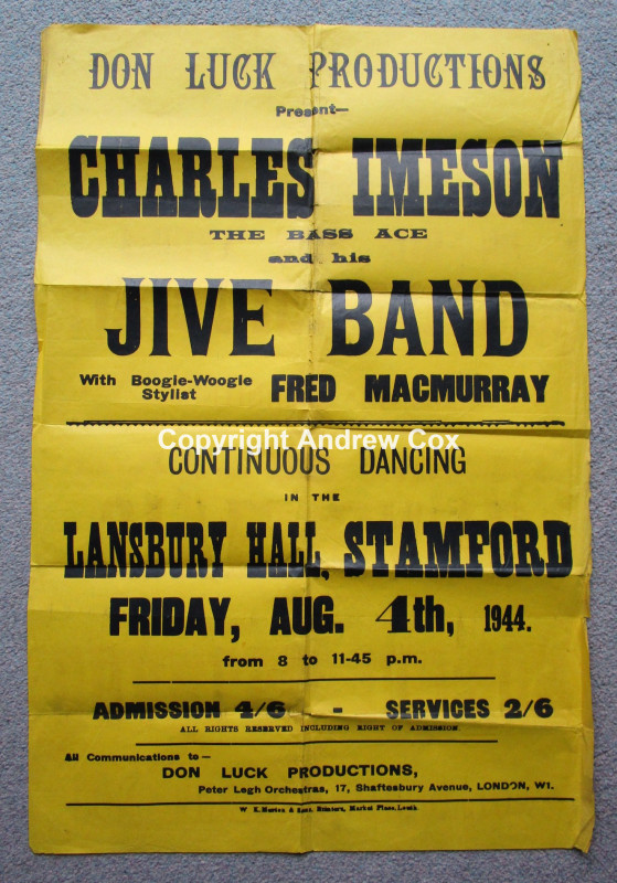
CHARLES IMESON THE BASS ACE AND HIS JIVE BAND
LANSBURY HALL, STAMFORD Friday August 4th 1944
WARTIME DANCE / CONCERT POSTER
£55.00
Offered by Andrew Cox
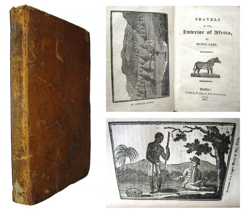
TRAVELS INTO THE INTERIOR OF AFRICA By Mungo Park
Seemingly Unrecorded Irish Dublin Printed Edition
W. Epsy
£150.00
Offered by Andrew Cox
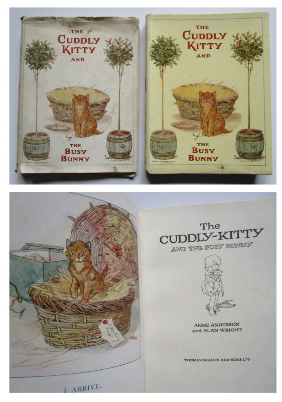
Anne Anderson and Alan Wright
THE CUDDLY KITTEN AND THE BUSY BUNNY
WITH THE RARE DUSTJACKET
£65.00
Offered by Andrew Cox
Friends of the PBFA
Please email info@pbfa.org for more information