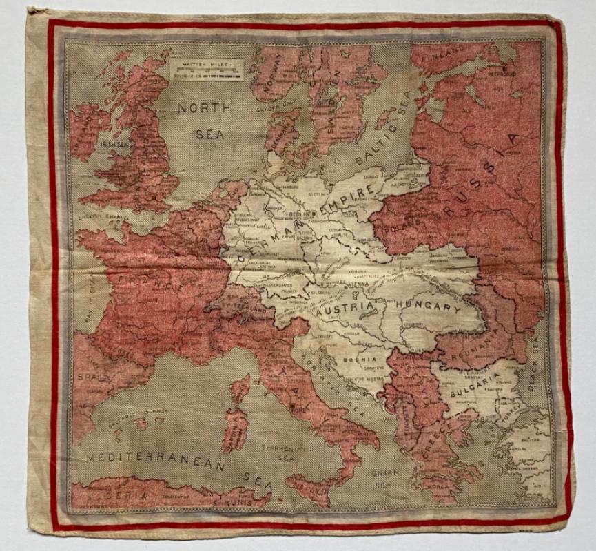
European and East Asian Situation War Map
Book Description
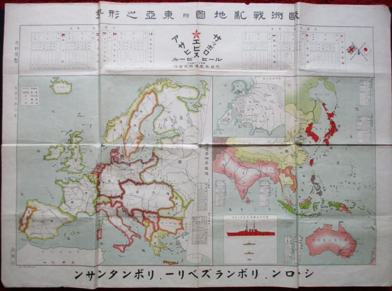
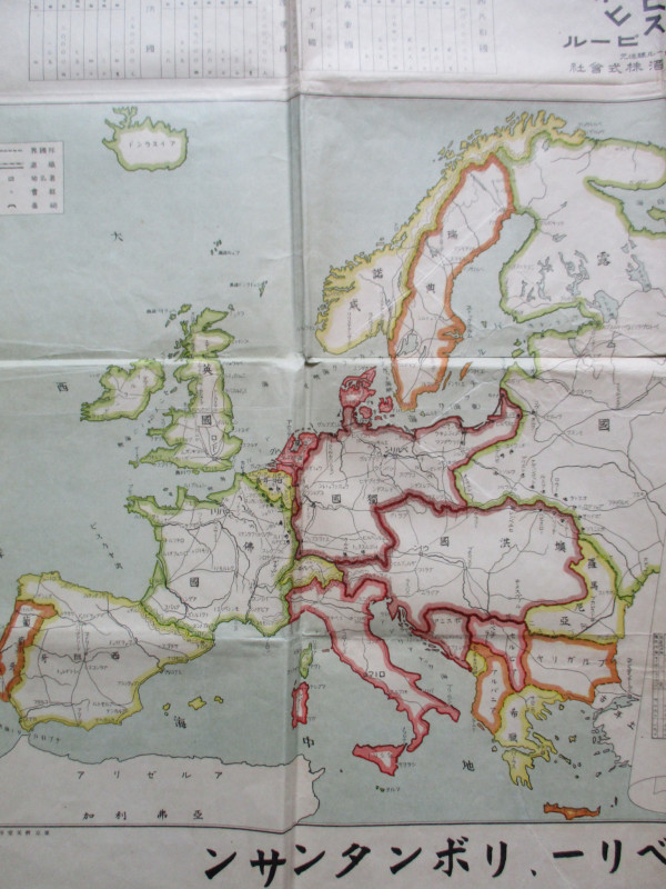
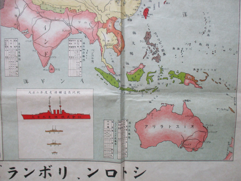
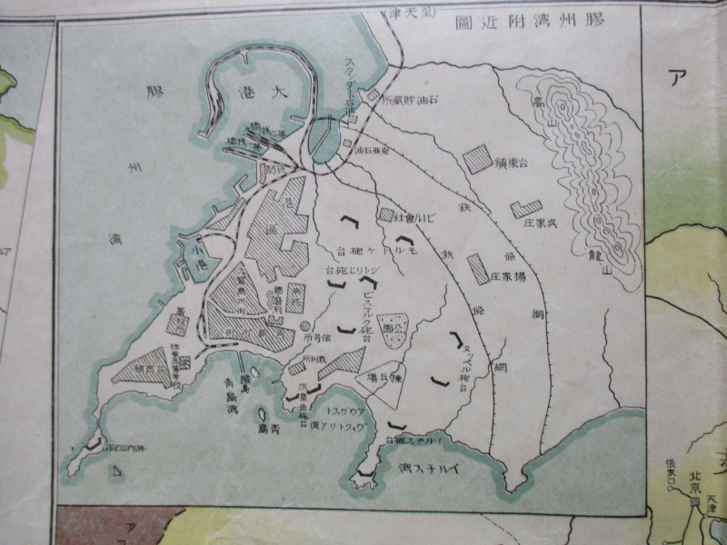
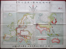
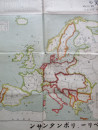
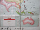
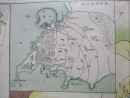
European and East Asian Situation War Map. Printed by Mikyoto, printed in Kyoto and published in 1918, the map shows the European and Far Eastern Fronts and the strength of the fleets of the Great Powers in 1915. On paper size 109 by 79 cm. Colour. The map celebrates the Anglo-Japanese alliance. It includes two large maps of the European and east Asian regions plus an inset map of the German settlement in Tsingtao or Qingdau taken by the Japanese in 1914 that shows the town and its defences in some detail. Various keys and inset tables provide information on cities, roads, railways, mineral resources, the Japanese, German and British navies and on the armies in China. No text to reverse: this may have been a poster or intended for educational purposes. Good to VG condition.
Author
Anon
Date
1918
Publisher
Mikyoto
Condition
Good to VG
Other books
If you liked the book you've just seen, you might be interested in other books from the same dealer below.
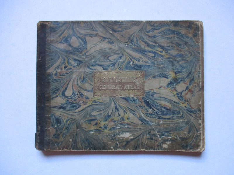
Bradshaw’s General Atlas with the latest Discoveri...
Bradshaw
Bradshaw
£325.00
Offered by Arthur Hook
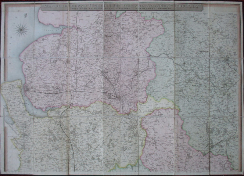
Map of the Grand Junction Railway and Adjacent Cou...
Cheffins
Cheffins
£350.00
Offered by Arthur Hook
Map of the British Colonies in North America
Russell
Rivington, Wilkie and others
£100.00
Offered by Arthur Hook
Friends of the PBFA
For £10 get free entry to our fairs, updates from the PBFA and more.
Please email info@pbfa.org for more information