Three Maps showing the position of the Principal Goods Depots in the Metropolis and its Neighbourhood, 1904

Book Description
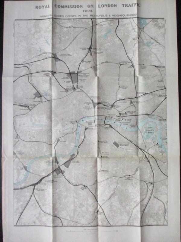
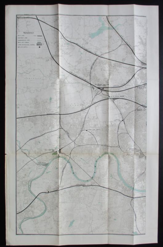
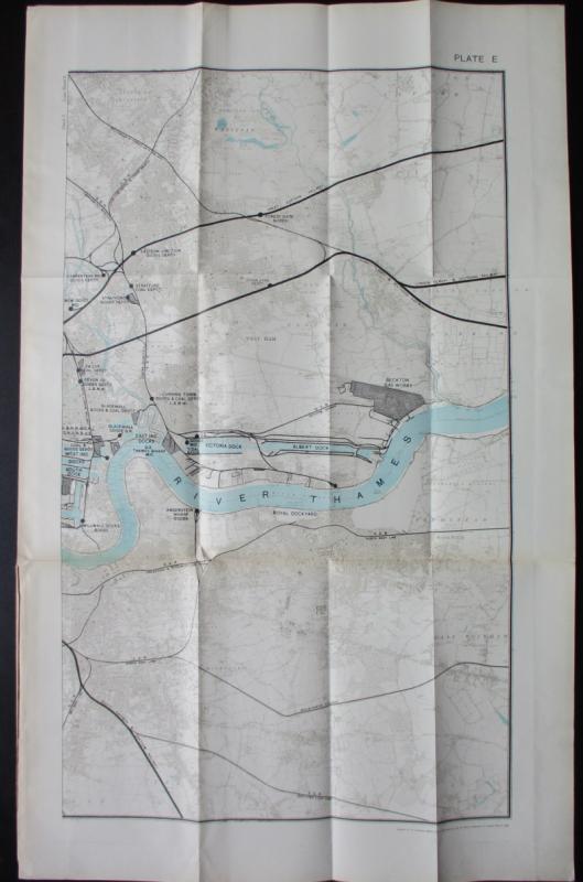
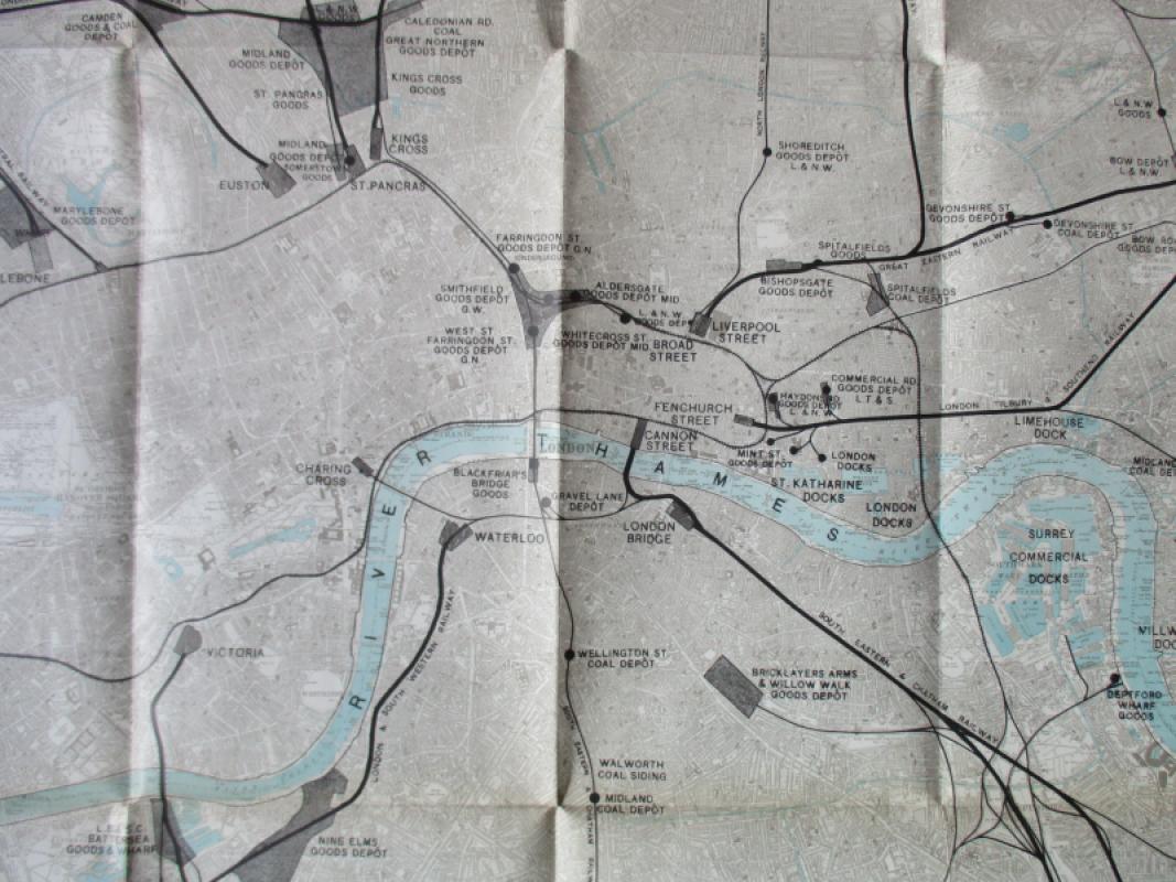
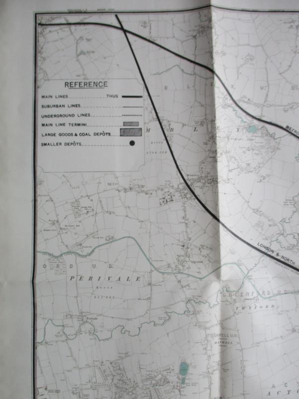
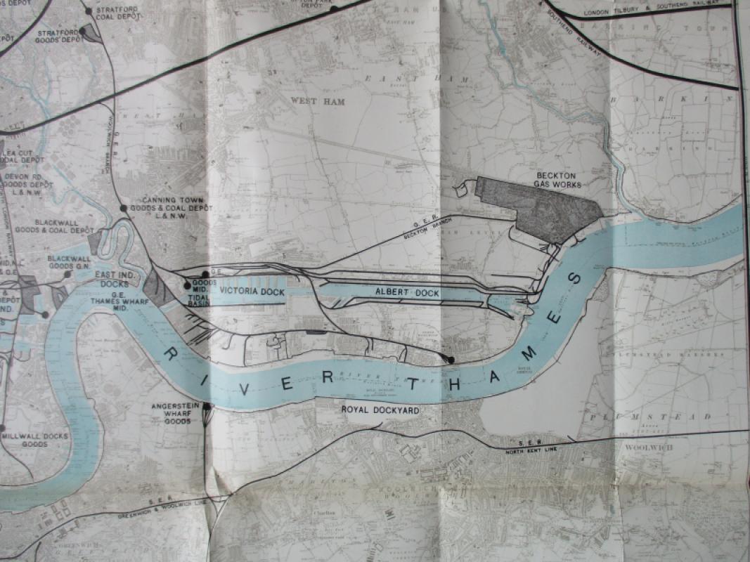
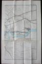
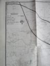
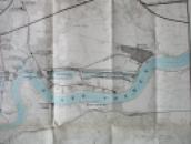
Three Maps showing the position of the Principal Goods Depots in the Metropolis and its Neighbourhood, 1904. A set of three large folding maps of London based on the Ordnance Survey for the Royal Commission on London Traffic, published by Hansard for the House of Commons 1904. Scale 3 inches to the mile. The west sheet covers an area from Wembley down to Richmond and Twickenham (size 90 by 56 cm.); the east sheet covers an area as far as Ilford in the north and to east Kent in the south and includes the eastern docks (size 90 by 66 cm); the central sheet covers an area from Hampstead across to Hackney in the north and from Earlsfield across to Forest Hill in the south, and includes the western part of London docks to Millwall.(size 91 by 66 cm.). A key provides information on main railway lines, suburban lines, underground lines, main line termini, large goods and coal depots and to smaller depots. All streets are shown and the railway lines and depots are emphasised in bold black print. The three maps could be joined together as a tryptich or composite whole to create a large map of Edwardian London. On good quality paper which has been folded. No text to the reverse, where there are some small clear library stamps. Good to VG condition.
Author
Royal Commission on London Traffic
Date
1904
Publisher
Hansard
Condition
VG
Pages
3
Other books
If you liked the book you've just seen, you might be interested in other books from the same dealer below.
A Descriptive Catalogue of the Objects Exhibited i...
Max Herz
National Printing Department, Cairo
£115.00
Offered by Arthur Hook
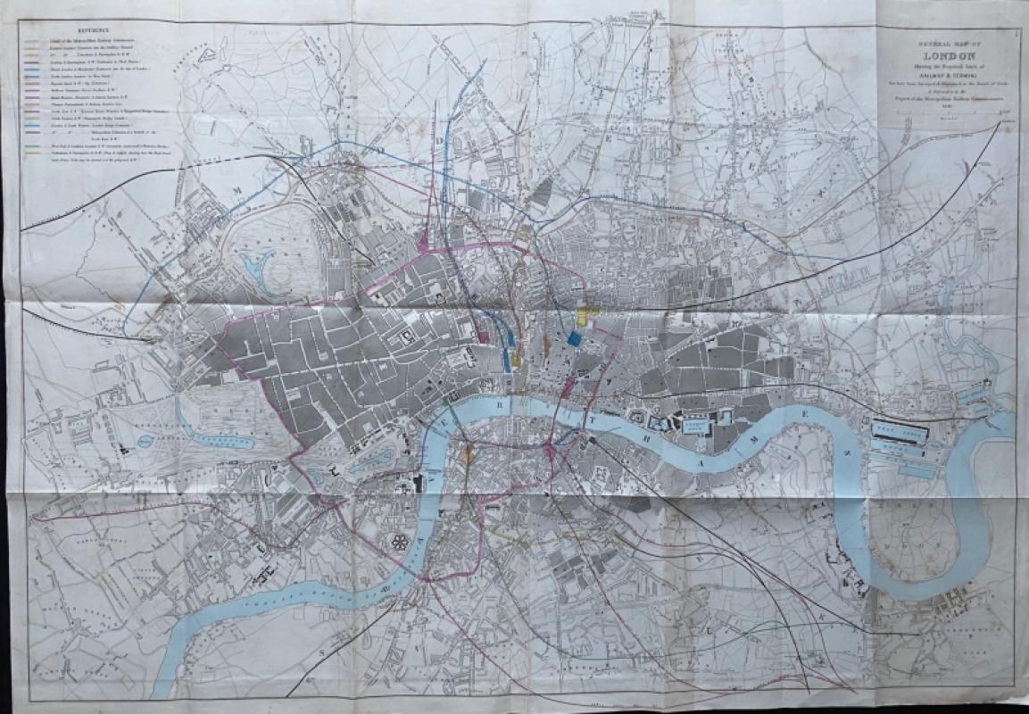
General Map of London Shewing the Proposed Lines o...
Pennethorne
Hansard
£225.00
Offered by Arthur Hook
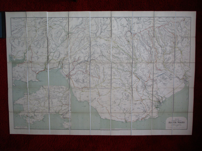
Railway Clearing House Map of South Wales 1926
Emslie
Railway Clearing House
£125.00
Offered by Arthur Hook
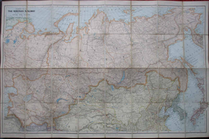
Stanford’s Map of the Siberian Railway: The Great...
Stanford
Stanford
£595.00
Offered by Arthur Hook
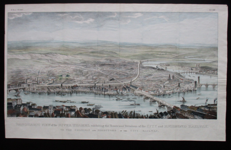
Panoramic View of the River Thames exhibiting the...
Schulthess
City and Richmond Railway
£310.00
Offered by Arthur Hook
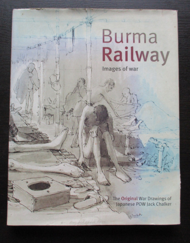
Burma Railway Images of War. The original war draw...
Chalker
Mercer Books
£45.00
Offered by Arthur Hook
Friends of the PBFA
For £10 get free entry to our fairs, updates from the PBFA and more.
Please email info@pbfa.org for more information