The Daily Telegraph Picture Map of London

Book Description
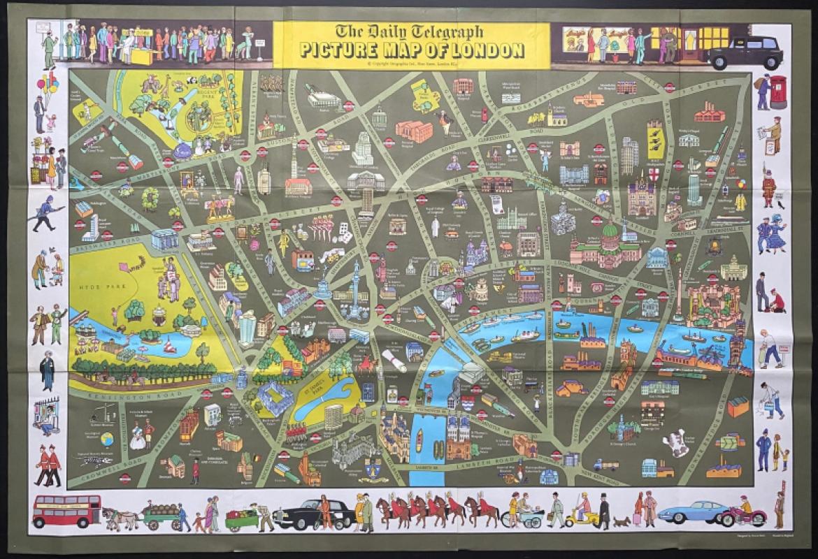
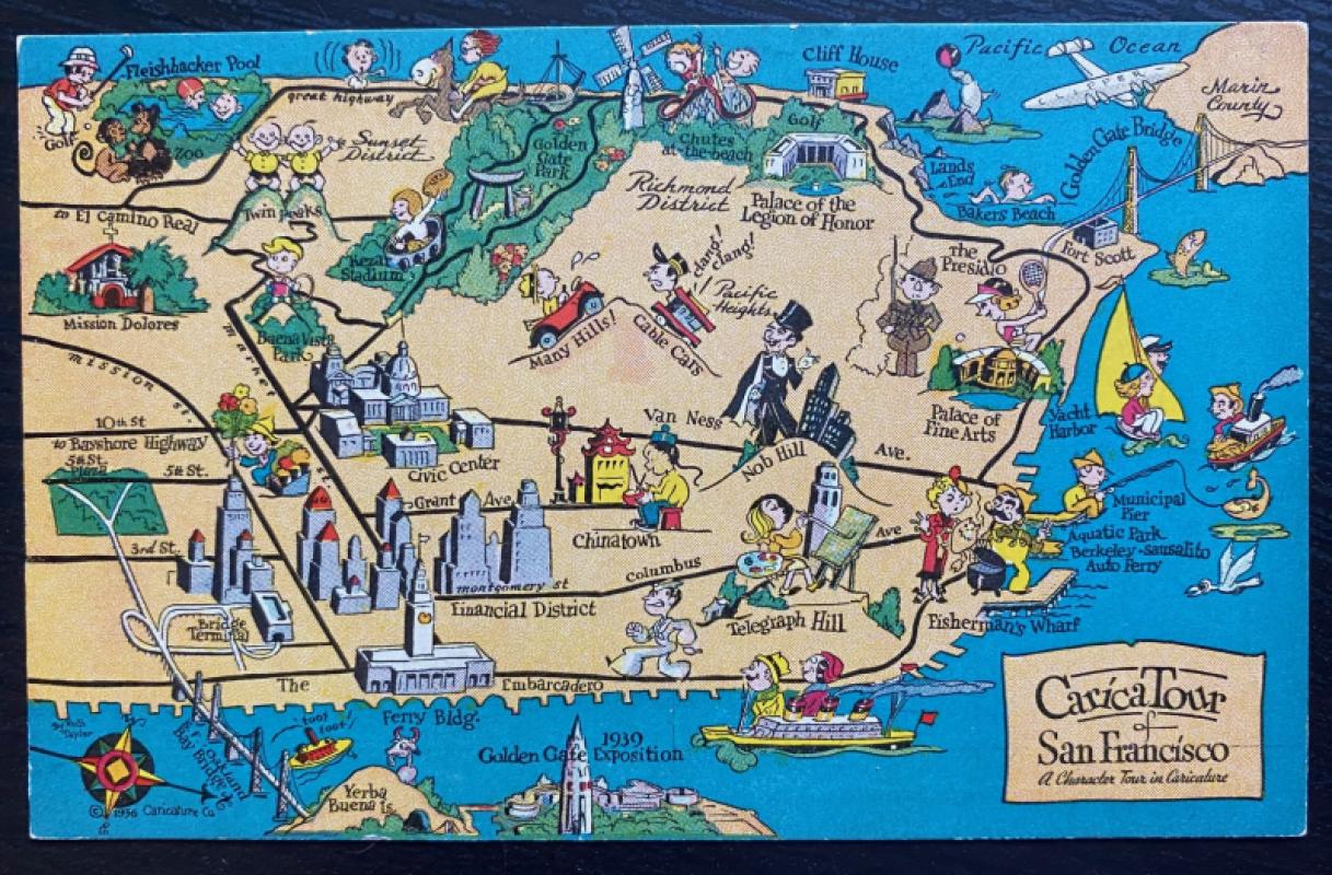
The Daily Telegraph Picture Map of London designed by Simon Stern and published by Geographia for the Telegraph, London circa 1965. A folding map on paper opening to 95 by 64 cm. Full colour. The map includes images of the historic sights of London such as the Tower, Buckingham Palace, Nelson’s Column and Regent’s Park Zoo on their locations plus some essential 1960s images including Carnaby Street, the Post Office Tower, Centrepoint and the London Hilton. Around the borders are more images of London scenes and characters; beefeaters, pearly queens, the horse guards, buskers, a red bus, a horse-drawn brewer’s delivery cart, a barrow boy, a black taxi cab etc. Covers an area from Lord’s Cricket Ground across to Old Street and Moorfields in the north and from the Natural History Museum to Guy’s Hospital and Tower Bridge Road in the south. Has been folded. One small pin hole to each corner. Good condition.
Author
Stern
Date
1965
Publisher
Geographia
Illustrator
Stern
Condition
Good to VG
Other books
If you liked the book you've just seen, you might be interested in other books from the same dealer below.
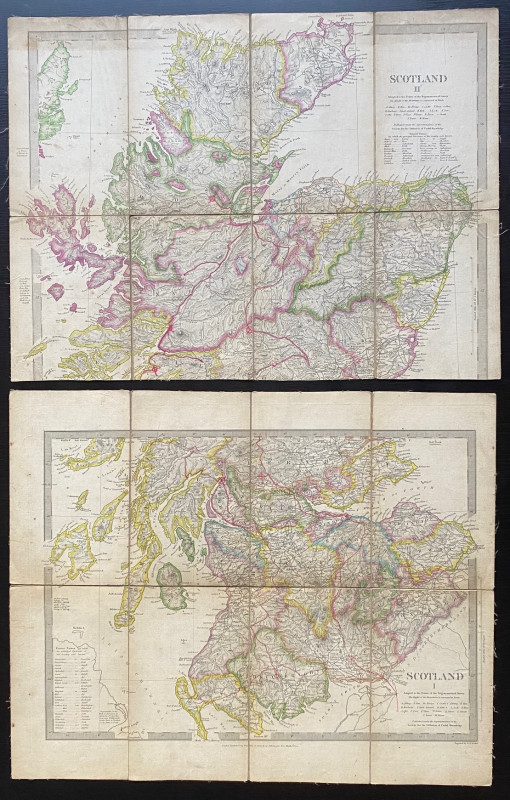
Map of Scotland with a Plan of Edinburgh 1834
Baldwin and Cradock
Baldwin and Cradock
£275.00
Offered by Arthur Hook
Friends of the PBFA
For £10 get free entry to our fairs, updates from the PBFA and more.
Please email info@pbfa.org for more information