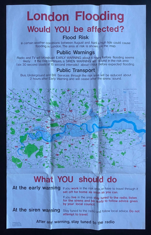
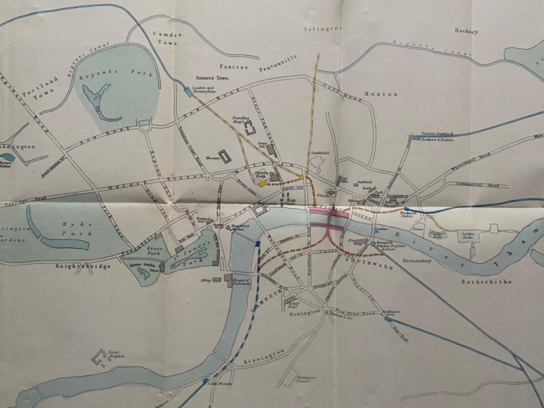
London Flooding Would You Be Affected? A poster map
Book Description
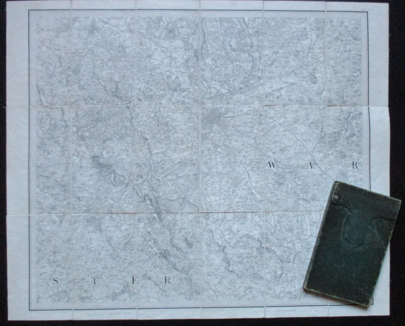
London Flooding Would You Be Affected? A poster map of London published by the GLC in cooperation with the Government and Transport Authorities and printed by Cook, Hammond and Kell, London circa 1982. On paper size 101 by 63 cm. Colour. The poster warns of areas of London at risk of future Thames flooding. The map covers the river from Hampton to Erith and Dartford and an area of London north to Wood Green and south to Mitcham and Bromley. A key provides information on British Rail lines and underground lines liable to be closed in the event of flooding; BR and underground stations liable to be closed and terminal points for rail and tube services if lines are closed. Has been folded. No tears or loss. Good to VG condition.
Author
Anon
Date
1982
Publisher
GLC
Condition
Good to VG
Other books
If you liked the book you've just seen, you might be interested in other books from the same dealer below.
Early Ordnance Survey Map Birmingham Area circa 18...
Colby
Ordnance Survey
£100.00
Offered by Arthur Hook
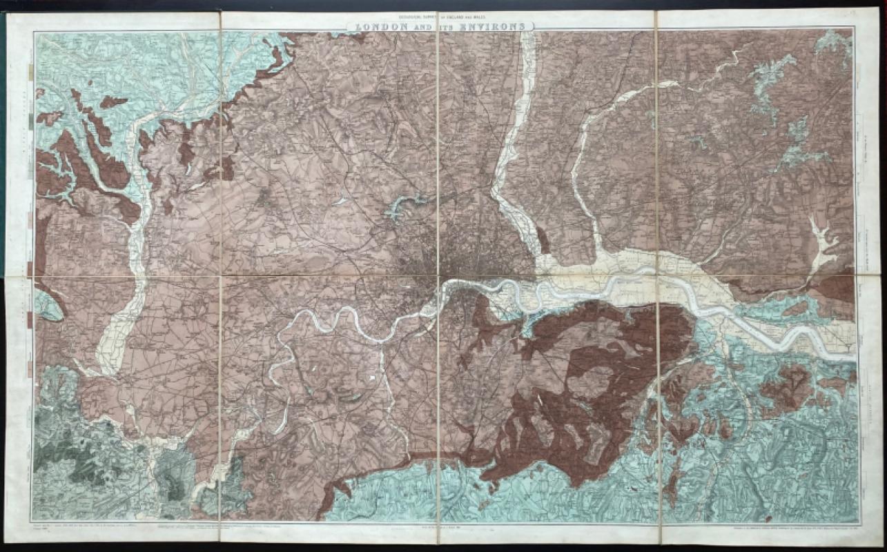
Geological Survey of England and Wales: two maps o...
James
Ordnance Survey
£675.00
Offered by Arthur Hook
Map of London: a Plan for The General Metropolitan...
Arrowsmith
House of Commons
£135.00
Offered by Arthur Hook
Friends of the PBFA
For £10 get free entry to our fairs, updates from the PBFA and more.
Please email info@pbfa.org for more information