Cruchley’s New Map of England and Wales 1827
Book Description
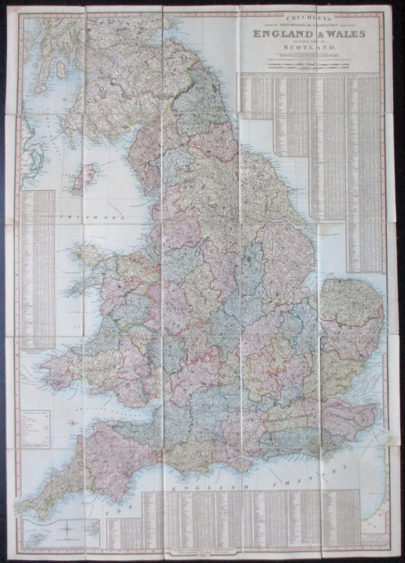
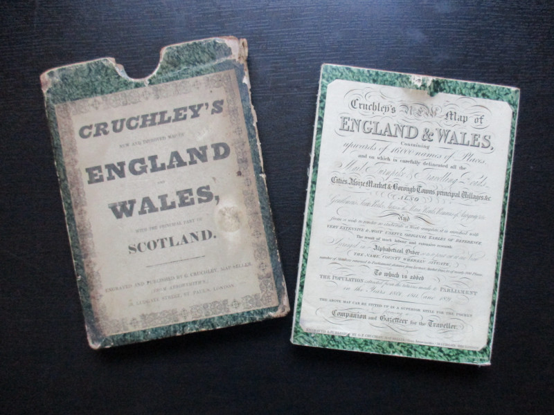
Cruchley’s New Map of England and Wales, published by Cruchley, London 1827. On folding linen in 25 sections, size 98 by 69 cm. Scale 10 miles to the inch. Includes an inset map of the Scilly Isles. Hand-coloured. Heights shown by shading. A key provides information on canals, roads- including turnpike roads, Roman roads, mail roads-, post towns, castles, tunnels etc. -and there are tables of data on hundreds of towns and cities that include information on market days, distances from London, their population in 1801, 1811 and 1821, and counties with population figures from 1700, 1750 and 1801. Folds into marbled covers and into the original Cruchley slipcase (rubbed). Map in Vg condition.
Author
Cruchley
Date
1827
Binding
Map on linen in slipcase
Publisher
Cruchley
Illustrator
Cruchley
Condition
VG
Other books
If you liked the book you've just seen, you might be interested in other books from the same dealer below.
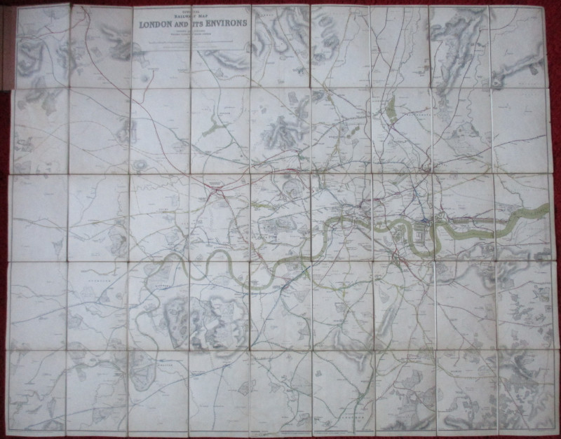
Official Railway Clearing House Map of London and...
Emslie
Railway Clearing House
£220.00
Offered by Arthur Hook
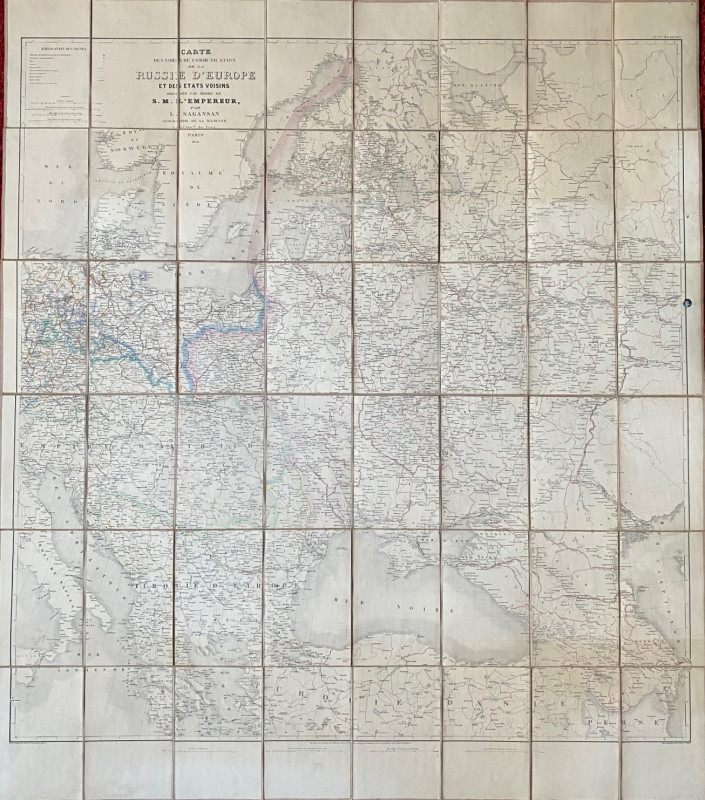
Map of European Russia and neighbouring states 185...
Sagansan
Avril Frėres
£185.00
Offered by Arthur Hook
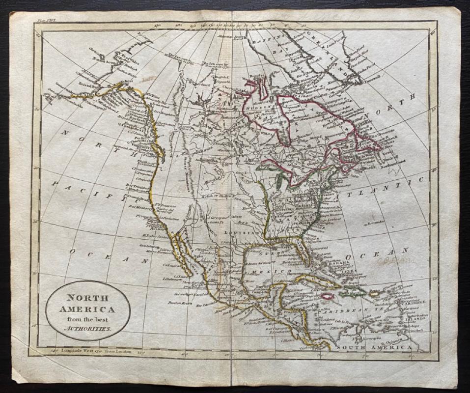
Map of North America from the Best Authorities
Russell
Rivington, Wilkie and others
£100.00
Offered by Arthur Hook

Friends of the PBFA
For £10 get free entry to our fairs, updates from the PBFA and more.
Please email info@pbfa.org for more information