The Enlarged Pictorial Plan of London in 1909

Book Description
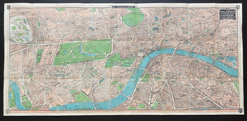
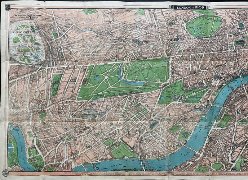
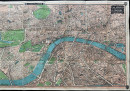
The Enlarged Pictorial Plan of London in 1909. Published by Charles Baker, London 1909. On paper size 97 by 46 cm. A view of the city as if from the air drawn from above south London. Covers an area from the site of the Imperial Exhibition of 1909 and the White City across to Bethnal Green Road in the north and from Putney Bridge, Hammersmith Bridge and Barnes Reservoirs eastwards to the Grand Surrey Canal and Peckham in the south. A detailed birds-eye view in colour. Some promotional advertising for Baker and information on cab fares etc. to the reverse. Has been folded. Good to VG condition
Author
Baker
Date
1909
Publisher
Baker
Condition
Good to VG
Other books
If you liked the book you've just seen, you might be interested in other books from the same dealer below.
Map of the Gulf of Aden 1956
US Army Map Service, Corps of Engineers
US Army Map Service, Corps of Engineers
£50.00
Offered by Arthur Hook

Friends of the PBFA
For £10 get free entry to our fairs, updates from the PBFA and more.
Please email info@pbfa.org for more information