Jigsaw Maps of the World, Europe and of France 1855

Book Description
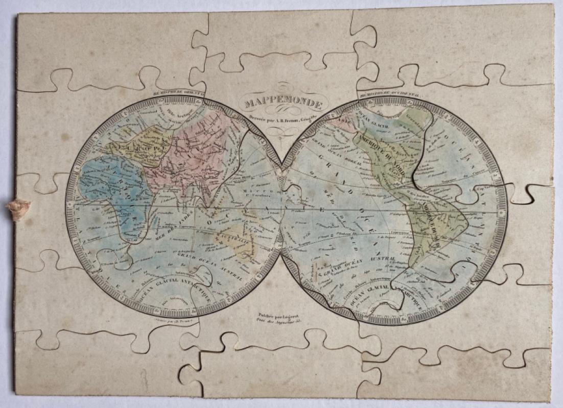
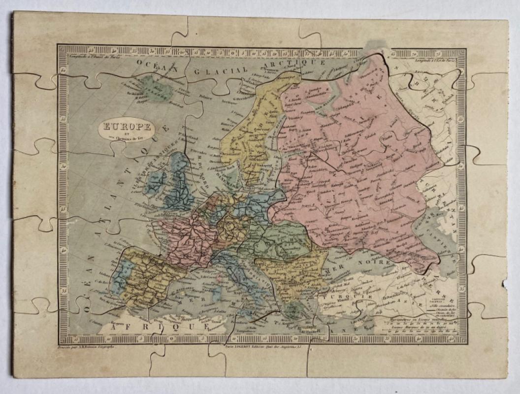
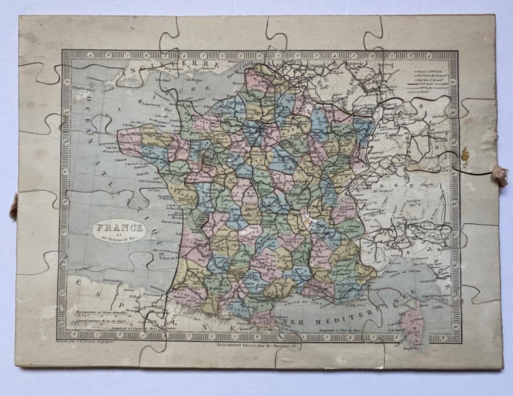
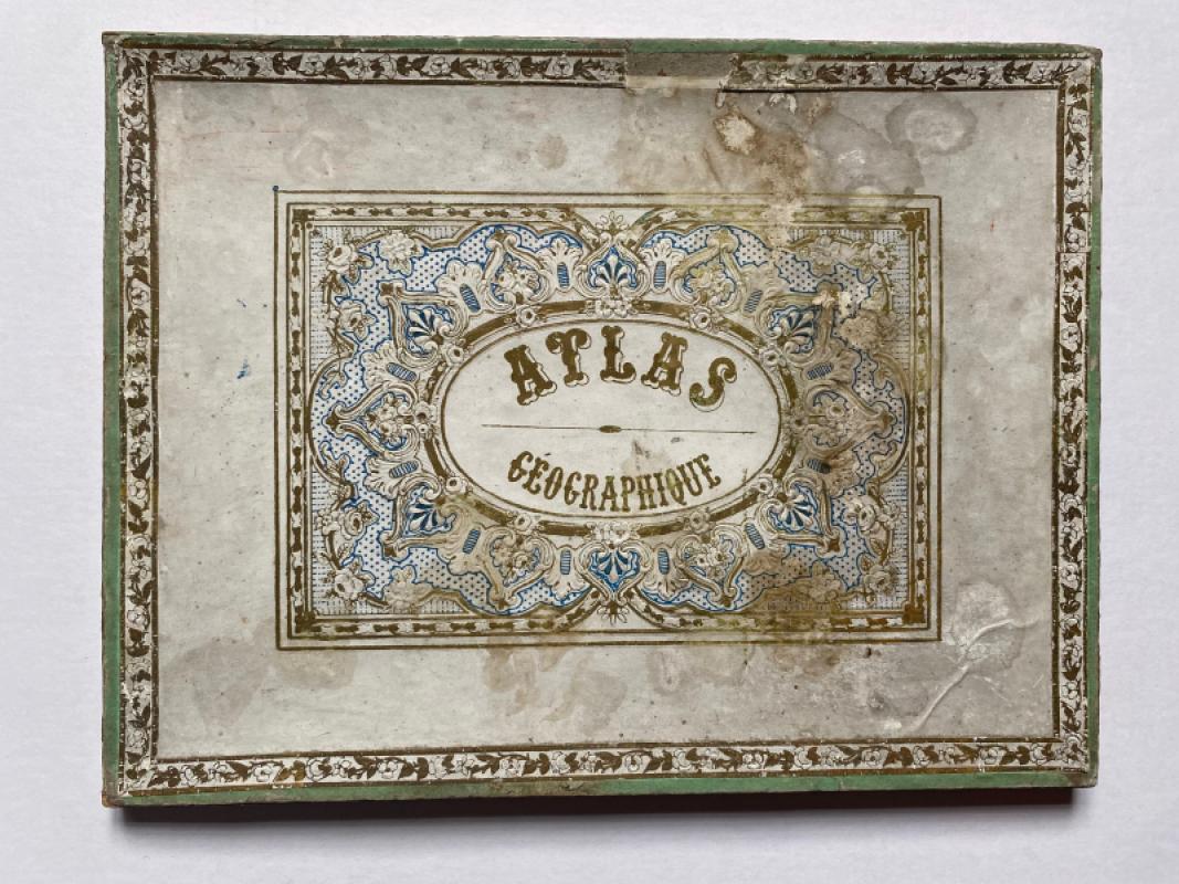
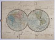
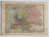
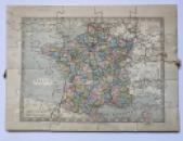
Jigsaw Maps of the World, Europe and of France. Three maps by Frémin published by Logerot, Paris circa 1855. All three are size 32 by 23 cm. and in their original card box. Maps are on wood and separated by a card layer beneath each one for ease of access. 1.Mappemonde, the world map; 2.a map of Europe- Europe et ses chemins de fer-has a key to railways and two scales; 3.a map of France with two scales and a key to railways built, railways under construction, canals and to important towns in each department. This third map is divided into many small pieces, one for each of the departments. All maps complete and hand-coloured. Some wear to the box and to a couple of pieces of the map of France. Occasional age toning.
Author
Frémin
Date
1855
Binding
In original box
Publisher
Logerot
Condition
Good
Other books
If you liked the book you've just seen, you might be interested in other books from the same dealer below.
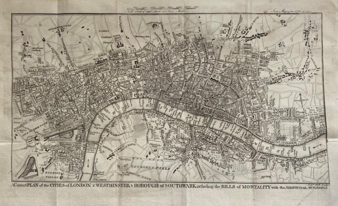
A Correct Plan of the Cities of London and Westmin...
Rocque
The Scots Magazine
Reserved
Offered by Arthur Hook
Railway Clearing House Map of South Wales 1926
Emslie
Railway Clearing House
£125.00
Offered by Arthur Hook
Friends of the PBFA
For £10 get free entry to our fairs, updates from the PBFA and more.
Please email info@pbfa.org for more information