London Underground Railway Map 1937


Book Description
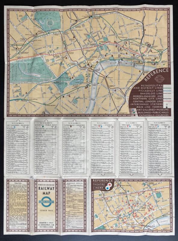
Underground Railway Map published by London Transport, London 1937. Edition number one. On paper size 60 by 45 cm. Colour. One side has a a full-page map of the underground network with a colour-coded key to the various lines, authorised extensions and the Southern and London Midland railways, the other has a map of the central London area with a key to underground lines, interchange stations, main line termini, galleries, museums, public buildings, churches and cathedrals. This side also has a smaller map of cinemas and theatres in the central area and information on the location of the features in the key. Folds to pocket size. Good condition.
Author
London Transport
Date
1937
Publisher
London Transport
Condition
Good
Other books
If you liked the book you've just seen, you might be interested in other books from the same dealer below.
The Nautical Almanac and Astronomical Ephemeris fo...
Maskelyne
John Murray for the Commissioners of Longitude
£175.00
Offered by Arthur Hook
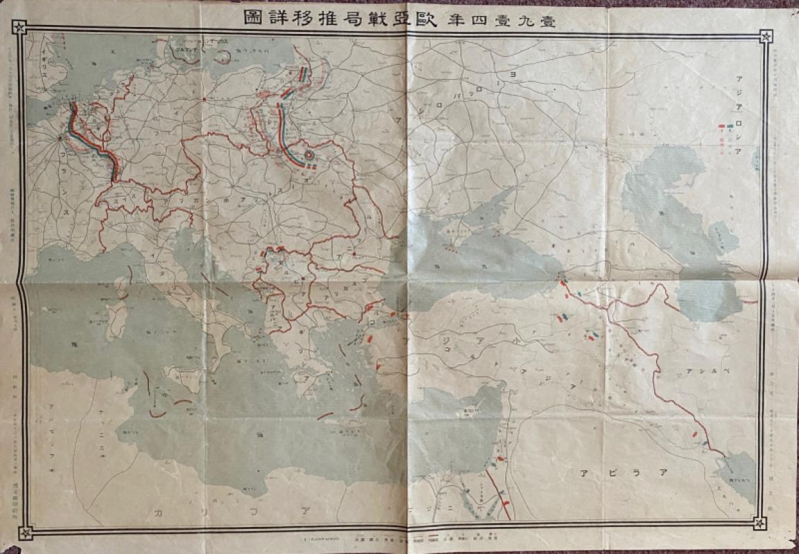
Japanese Map of the First World War in Europe and...
Hasegawa
Scichisaku
£75.00
Offered by Arthur Hook
Friends of the PBFA
For £10 get free entry to our fairs, updates from the PBFA and more.
Please email info@pbfa.org for more information