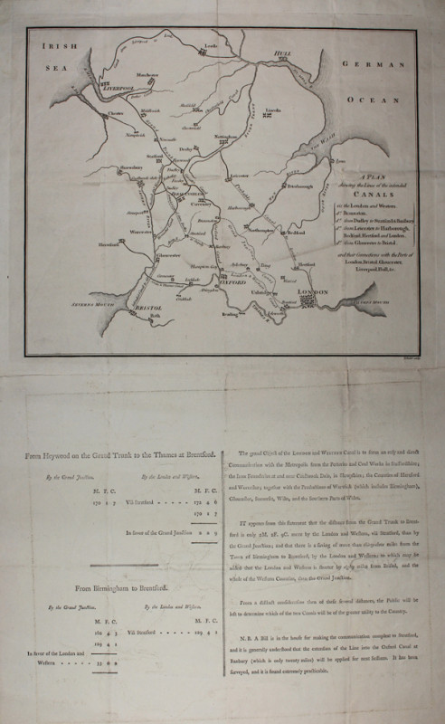
A Plan shewing the Lines of the intended Canals
Book Description
Other books
If you liked the book you've just seen, you might be interested in other books from the same dealer below.
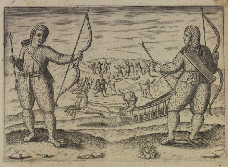
The second Dutch mission to China and Maluka
[Anonymous]
[Tot Amsterdam, Ghedruckt by Iudocum Hondium, woonende inde Calver-Straet, inden Wackeren Hont. Anno 1614. Met Privilegie.]
£120.00
Offered by Sanders of Oxford Ltd
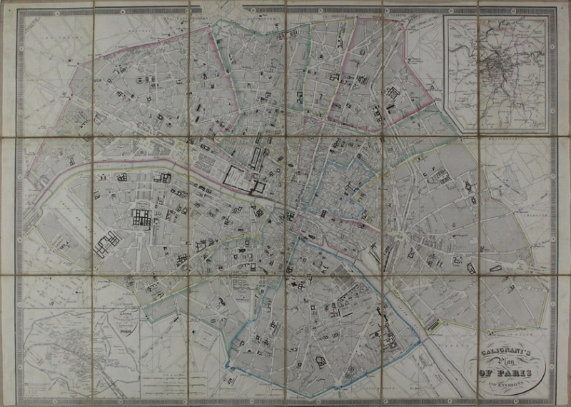
Galignani's Plan of Paris and Environs
Hacq, J.M. after Achin
Drawn by Achin. Engraved by Hacq [Paris, c.1850]
£200.00
Offered by Sanders of Oxford Ltd
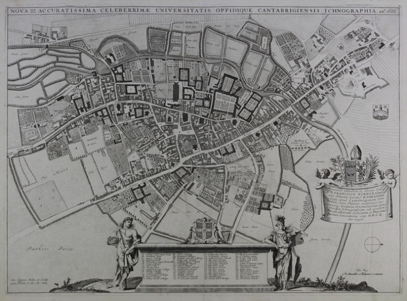
Nova & Accuratissima Celeberrimæ Universitatis Opp...
Loggan, David
Dav. Loggan Delin. et Sculp. cum Privil. S.R.M. 1688
£1750.00
Offered by Sanders of Oxford Ltd
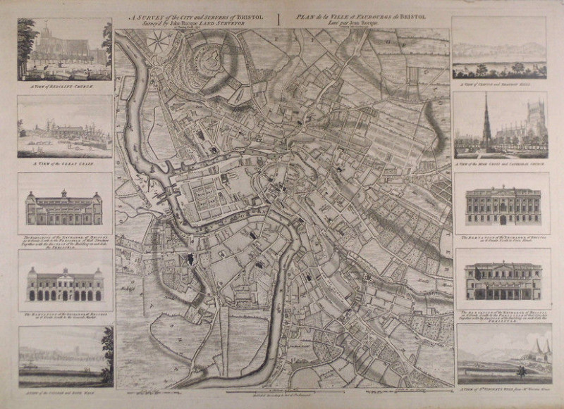
A survey of the city and suburbs of Bristol survey...
Rocque, John
at Charing Cross 1750. Publish’d According to Act of Parlaiment
£2500.00
Offered by Sanders of Oxford Ltd
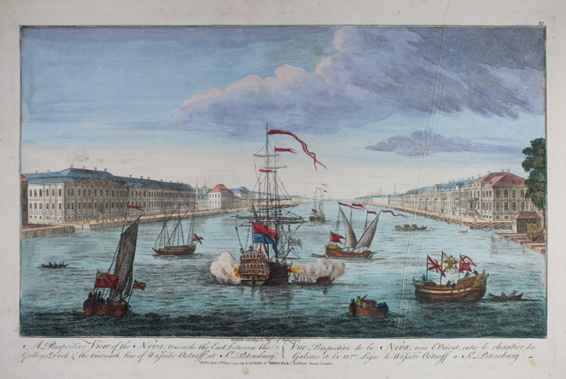
A Perspective View of the Neva, towards the East,...
[Anonymous]
Published according to Act of Parliament. Published 12th May 1794, Laurie & Whittle, 53 Fleet Street, London.
£200.00
Offered by Sanders of Oxford Ltd
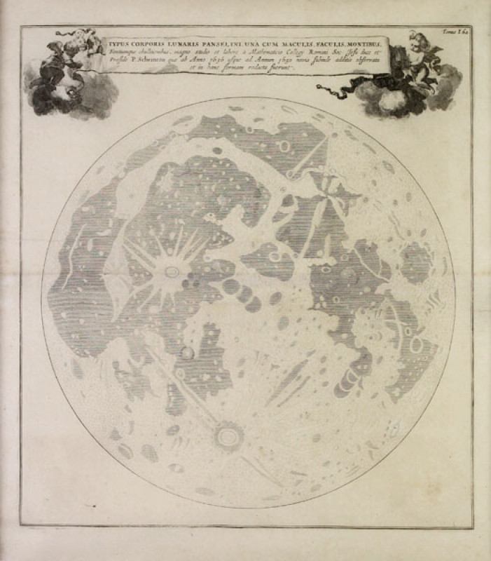
Typus Corporis Lunaris Panselini
Kircher, Athanasius
[Amstelodami, Apud Joannem Janssonium & Elizeum Weyerstraten, Anno MDCLXV Cum Privilegiis 1665]
£1500.00
Offered by Sanders of Oxford Ltd
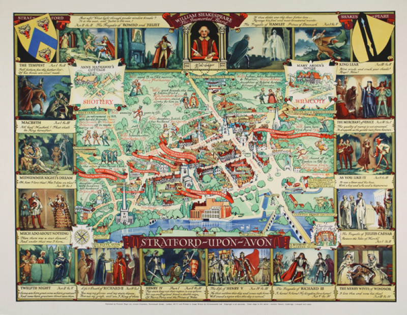
Stratford-upon-Avon
Lee, Kerry
Published by Pictorial Maps Ltd., Lincoln Chambers, Portsmouth Street, London, W.C.2 and Printed in Great Britain by Chromoworks Ltd. Copyright in all countries. [London, c.1950]
£500.00
Offered by Sanders of Oxford Ltd
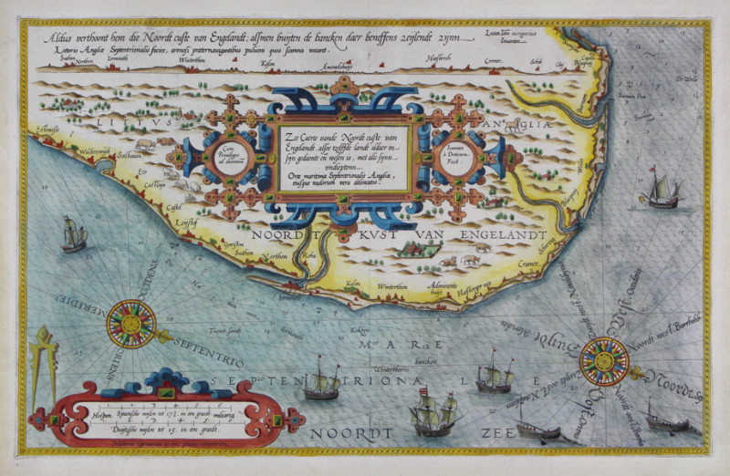
Orae maritimae Septentrionalis Angliae, eiusque va...
Waghenaer, Lucas Janszoon
Lucas Ioannes aurigarius Inuentor. Ioannes a Doetecum Fecit. Cum Priuilegio ad decennium [1584 Latin edition]
£1600.00
Offered by Sanders of Oxford Ltd
A Plan shewing the Lines of the intended Canals
Baker, Benjamin
B. Baker sculp. [London, c.1790]
£375.00
Offered by Sanders of Oxford Ltd
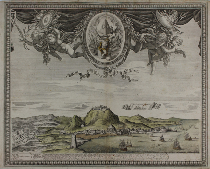
Das von denen Spaniern in Anno 1727 Belagerte Gibr...
Bodenehr, Gabriel
G. Bodenehr fecit et exc. Aug. Vind. [Augsburg, c.1740]
£800.00
Offered by Sanders of Oxford Ltd
Friends of the PBFA
Please email info@pbfa.org for more information