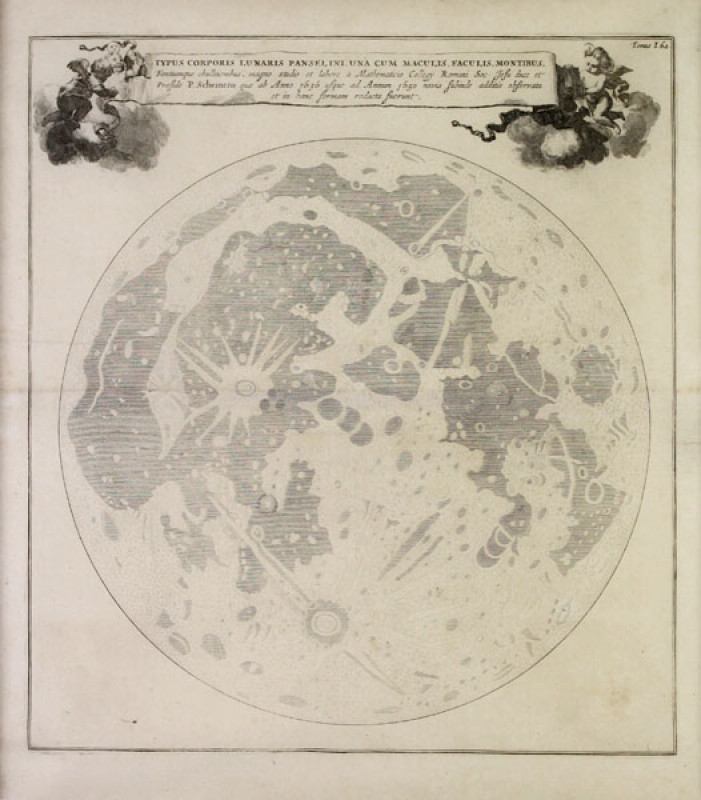
Typus Corporis Lunaris Panselini
Book Description
Other books
If you liked the book you've just seen, you might be interested in other books from the same dealer below.
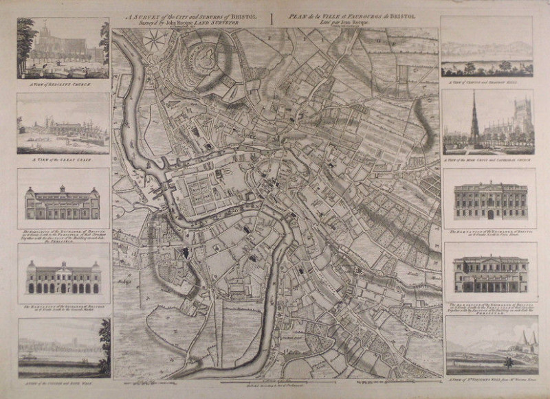
A survey of the city and suburbs of Bristol survey...
Rocque, John
at Charing Cross 1750. Publish’d According to Act of Parlaiment
£2500.00
Offered by Sanders of Oxford Ltd
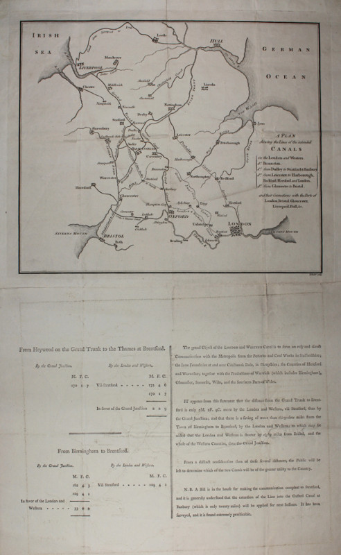
A Plan shewing the Lines of the intended Canals
Baker, Benjamin
B. Baker sculp. [London, c.1790]
£375.00
Offered by Sanders of Oxford Ltd
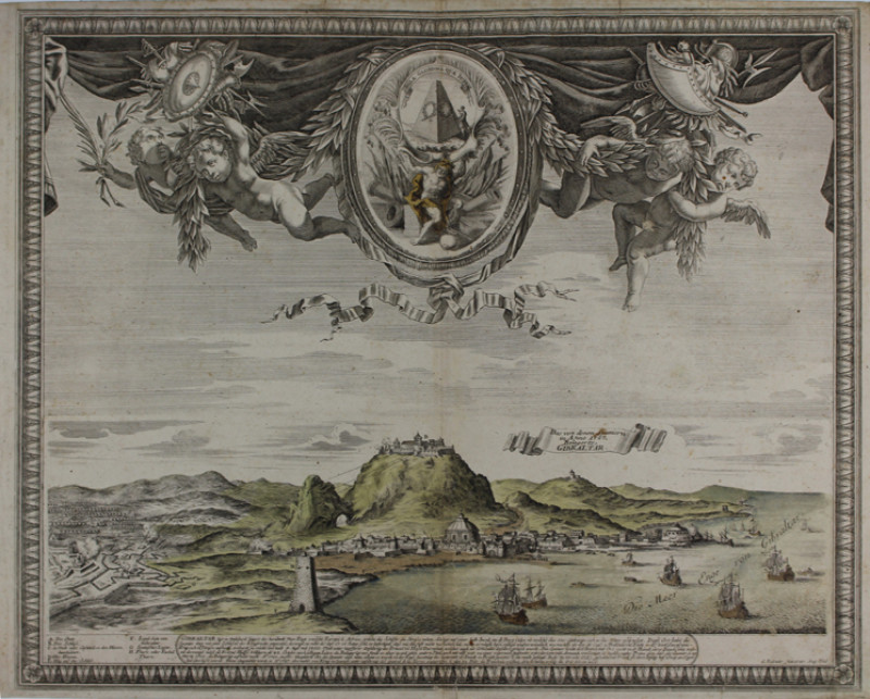
Das von denen Spaniern in Anno 1727 Belagerte Gibr...
Bodenehr, Gabriel
G. Bodenehr fecit et exc. Aug. Vind. [Augsburg, c.1740]
£800.00
Offered by Sanders of Oxford Ltd
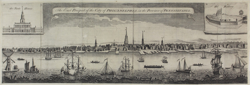
The East Prospect of the City of Philadelphia, in...
After George Heap
[Engraved for the London Magazine. 1761]
£1000.00
Offered by Sanders of Oxford Ltd
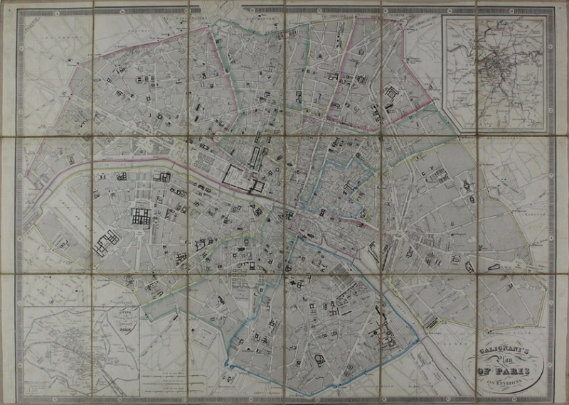
Galignani's Plan of Paris and Environs
Hacq, J.M. after Achin
Drawn by Achin. Engraved by Hacq [Paris, c.1850]
£200.00
Offered by Sanders of Oxford Ltd
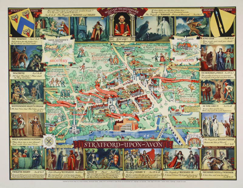
Stratford-upon-Avon
Lee, Kerry
Published by Pictorial Maps Ltd., Lincoln Chambers, Portsmouth Street, London, W.C.2 and Printed in Great Britain by Chromoworks Ltd. Copyright in all countries. [London, c.1950]
£500.00
Offered by Sanders of Oxford Ltd
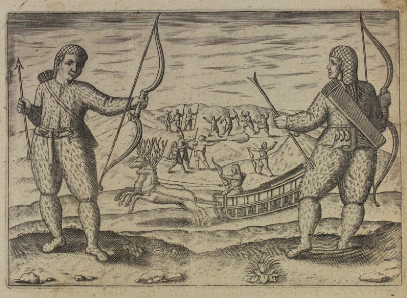
The second Dutch mission to China and Maluka
[Anonymous]
[Tot Amsterdam, Ghedruckt by Iudocum Hondium, woonende inde Calver-Straet, inden Wackeren Hont. Anno 1614. Met Privilegie.]
£120.00
Offered by Sanders of Oxford Ltd
Typus Corporis Lunaris Panselini
Kircher, Athanasius
[Amstelodami, Apud Joannem Janssonium & Elizeum Weyerstraten, Anno MDCLXV Cum Privilegiis 1665]
£1500.00
Offered by Sanders of Oxford Ltd
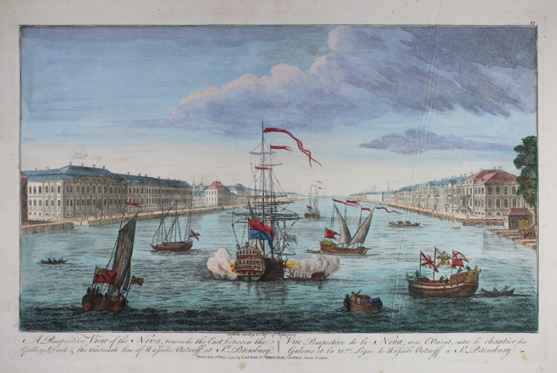
A Perspective View of the Neva, towards the East,...
[Anonymous]
Published according to Act of Parliament. Published 12th May 1794, Laurie & Whittle, 53 Fleet Street, London.
£200.00
Offered by Sanders of Oxford Ltd
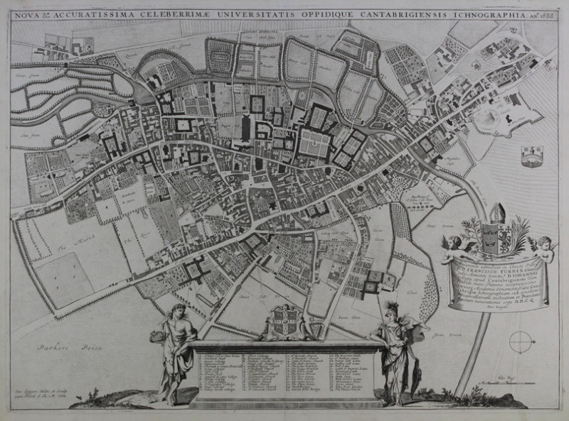
Nova & Accuratissima Celeberrimæ Universitatis Opp...
Loggan, David
Dav. Loggan Delin. et Sculp. cum Privil. S.R.M. 1688
£1750.00
Offered by Sanders of Oxford Ltd
Friends of the PBFA
Please email info@pbfa.org for more information