A Map of Yorkshire by Estra Clark 1949

Book Description
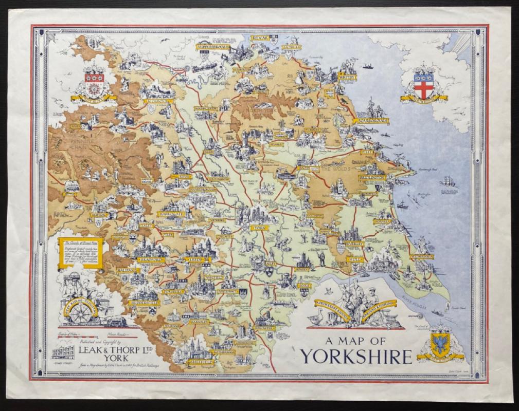
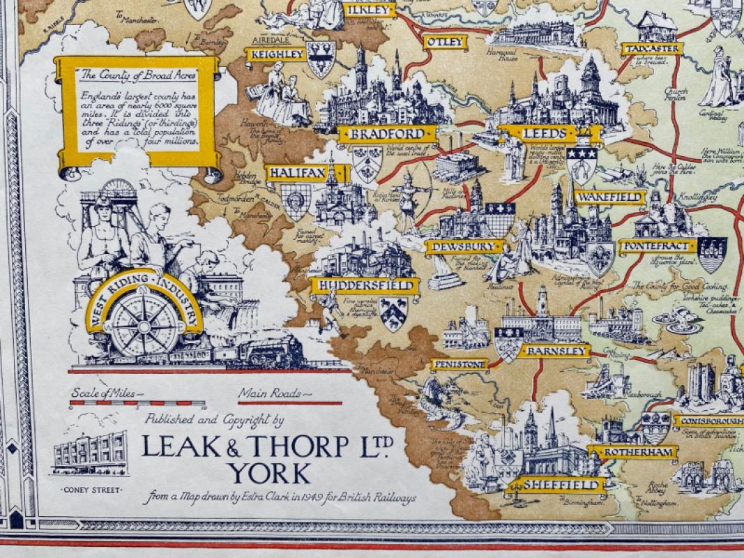
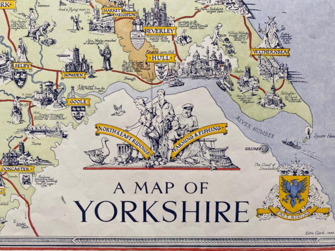
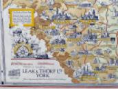
A Map of Yorkshire by Estra Clark. Published by Leak and Thorp, York 1949. On good quality paper size 57 by 44 cm. Scale 5 miles to the inch. Colour. Clark focuses on the social and industrial history of the county. The coats of arms of the three Ridings appear in three of the four corners and there are vignettes of the West Riding that depict its industries and of the North and East Ridings that include representations of farming and fishing. The cities and major towns are shown with their coats of arms and with a stylised image of their major trades and industries. Estra Clark was a Yorkshire-born teacher and artist who specialised in creating maps that were amusing and informative, capturing the optimism of the post war period The map appears to be a smaller version of a larger poster map of Yorkshire that Clark drew for British Railways in the same year. Slight creasing outside the decorative borders but otherwise VG to Mint condition
Author
Clark
Date
1949
Publisher
Leak and Thorp
Illustrator
Clark
Condition
Good to VG
Other books
If you liked the book you've just seen, you might be interested in other books from the same dealer below.
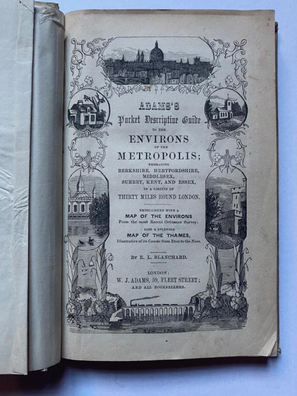
Adams's Pocket Descriptive Guide to the Environs o...
Blanchard
Adams
£125.00
Offered by Arthur Hook
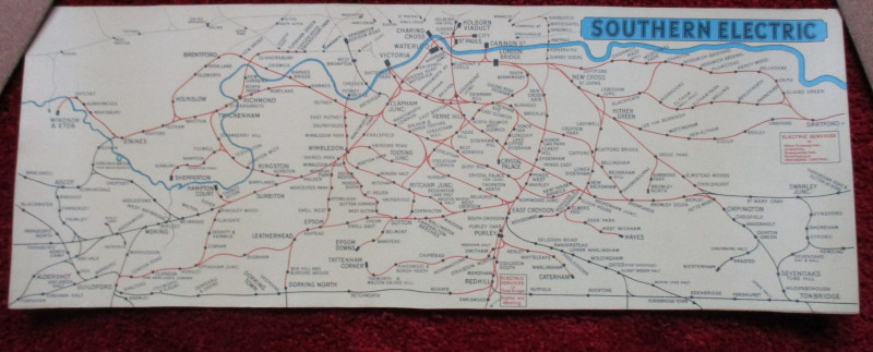
London Railway Map Carriage Print. Southern Electr...
Southern Electric
Southern Electric
£90.00
Offered by Arthur Hook
Friends of the PBFA
For £10 get free entry to our fairs, updates from the PBFA and more.
Please email info@pbfa.org for more information