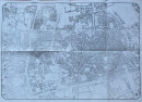
Republic of Yemen City Map of Sana
Book Description
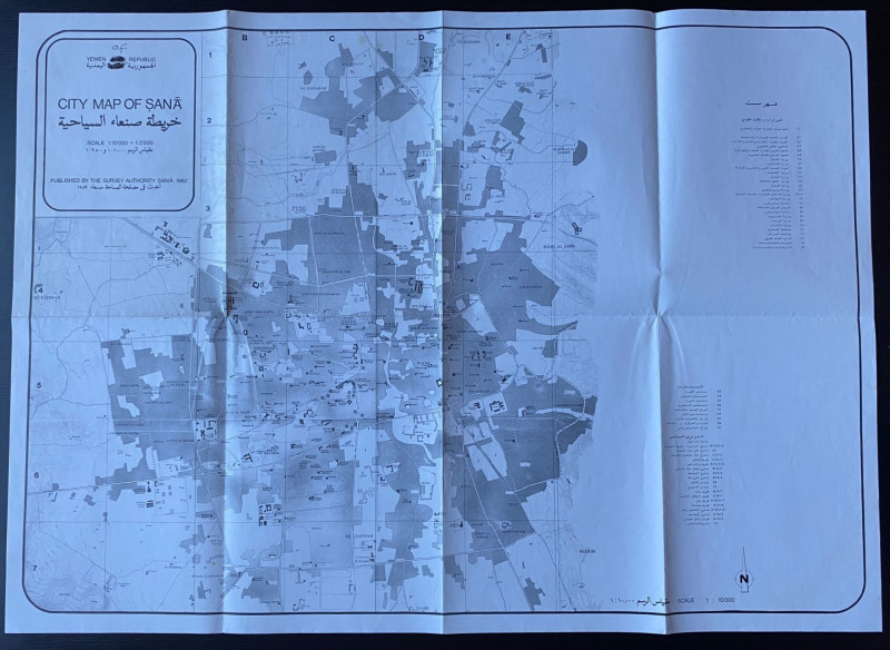
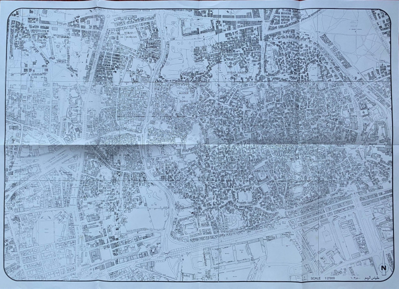
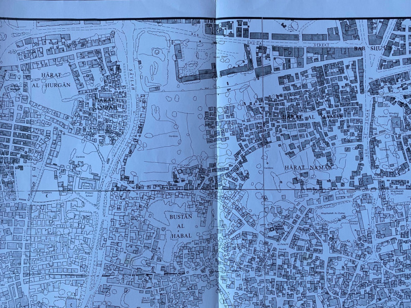
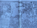
Republic of Yemen City Map of Sana, published by the Survey Authority Sana 1982. On paper size 75 by 54 cm. A double-sided map with one side showing the centre of the city on a scale of 1:2,500 that includes all streets and buildings, many identified by name. The second side, which has the main title and details of publication, is on a scale of 1:10,000 and covers the rest of Sana and its immediate environs. A key to this map provides information on 27 features including banks, health centres, hospitals, markets, streets and squares. This map covers an area from Al Hasabah and As Sadayn in the north to As Safiya and Harat An Nur in the south, and as far as Qa Fatima in the west. There is a second key on the same side that gives detailed information on government buildings and administrative offices. Uncoloured. Has been folded. Slight fading to part of the large scale map and one ink amendment to the title. Good to VG condition.
Author
Survey Authority Sana
Date
1982
Publisher
Survey Authority Sana
Condition
Good to VG
Other books
If you liked the book you've just seen, you might be interested in other books from the same dealer below.

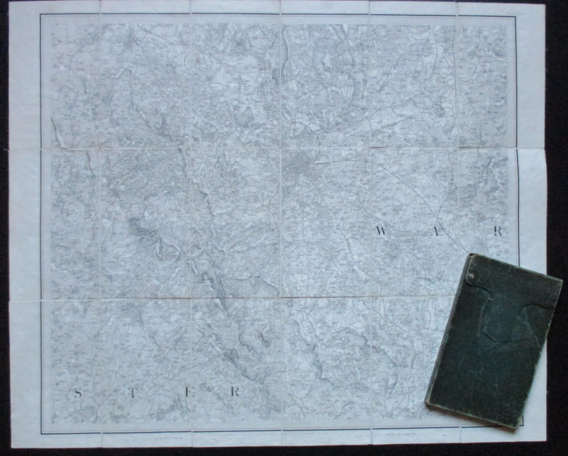
Early Ordnance Survey Map Birmingham Area circa 18...
Colby
Ordnance Survey
£100.00
Offered by Arthur Hook

Geological Map of England and Wales with all the R...
Murchison
Stanford
£75.00
Offered by Arthur Hook
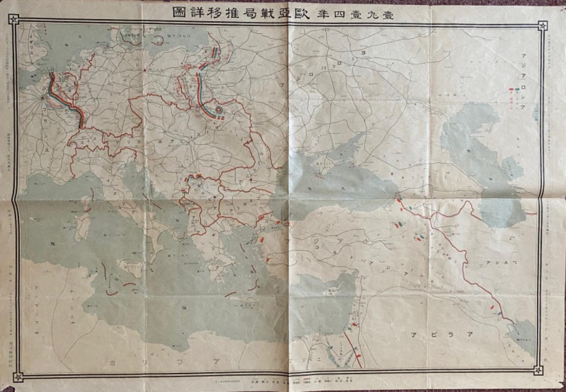
Japanese Map of the First World War in Europe and...
Hasegawa
Scichisaku
£75.00
Offered by Arthur Hook
The London Almanack for the Year of Christ 1841
Anon
The London Company of Stationers
£125.00
Offered by Arthur Hook


Friends of the PBFA
For £10 get free entry to our fairs, updates from the PBFA and more.
Please email info@pbfa.org for more information