Survey of the Estuary of the Thames and Medway with the coast from Thorpness to Dover and the Rivers to London and Rochester

Book Description
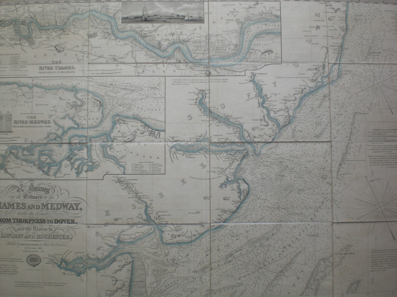
Survey of the Estuary of the Thames and Medway with the coast from Thorpness to Dover and the Rivers to London and Rochester published by Richard Laurie, London July 1831. Constructed from original surveys by John Purdey and engraved by Alexander Findlay. Improved edition 1832. Two maps on folding linen, each in16 sections, size 100 by 66 cm. Scale one inch to the mile. One large map comprises a survey to the north of the river, the other the southern channels of the Thames with the Downs. The northern sheet includes the decorative title, detailed inset maps of the Thames from London to Sea Reach and of the River Medway from Rochester to the Nore and a vignette of Tilbury Fort; the southern sheet-with the title a Survey of the Southern Channels of the Thames, with the Downs etc. includes an inset map of the Isle of Thanet, a small inset plan of Ramsgate Harbour and a vignette of Reculver plus a small engraving to accompany notes of how to enter the Gull Stream by the North Foreland. A detailed map which includes all coastal features, harbours and creeks and also serves as a marine chart with information on depths and currents. Hand-coloured. In original slipcase (slight fraying to base but otherwise Good to VG). Map VG to Mint condition
Author
Findlay
Date
1831
Binding
Map on linen in slipcase
Publisher
Laurie
Illustrator
Findlay
Other books
If you liked the book you've just seen, you might be interested in other books from the same dealer below.
The Atlas Volume from The Cyclopaedia or Universal...
Rees
Longman, Hurst, Rees, Orme and Brown
£345.00
Offered by Arthur Hook
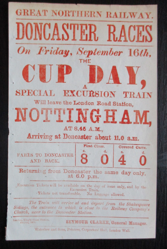
Doncaster Races by Great Northern Railway 1870
Anon
Great Northern Railway
£45.00
Offered by Arthur Hook
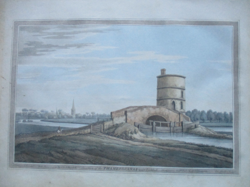
An engraving of the Junction of the Thames and Can...
Boydell.
Boydell
£50.00
Offered by Arthur Hook
Parliamentary Reports on London and the Survey of...
House of Commons
Hansard
£235.00
Offered by Arthur Hook
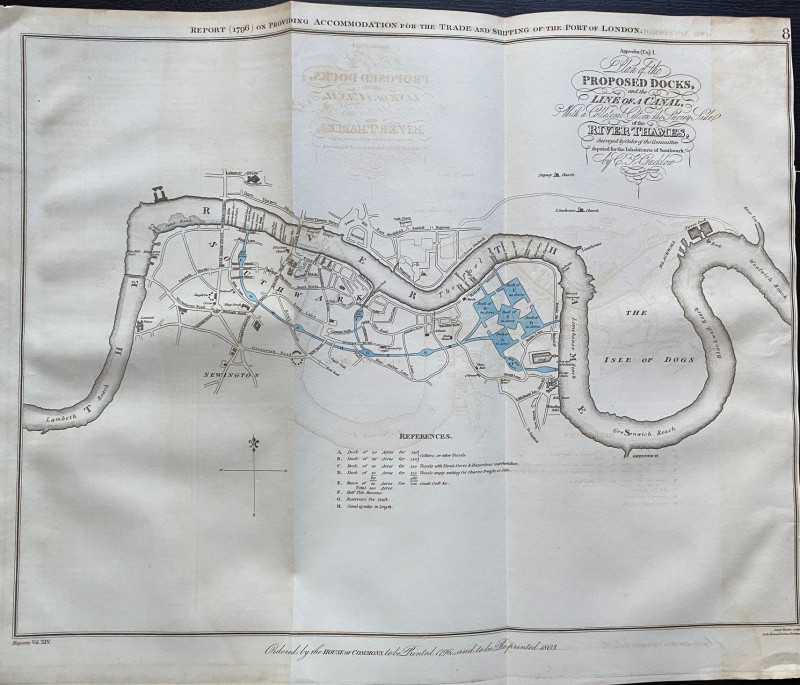
A Plan of the Proposed Docks and Line of a Canal w...
Cracklow
Hansard
£95.00
Offered by Arthur Hook
Friends of the PBFA
For £10 get free entry to our fairs, updates from the PBFA and more.
Please email info@pbfa.org for more information