Railway Clearing House Map of London 1915
Book Description
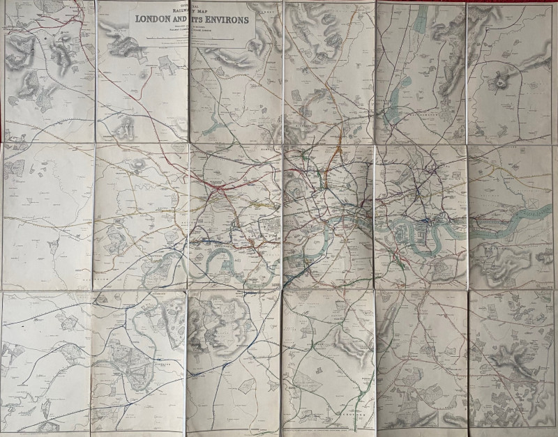
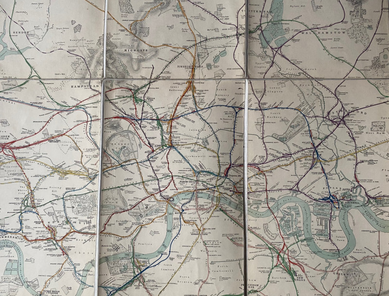
Railway Clearing House Map of London published by the RCH London 1915. Engraved by Emslie. On folding linen in 45 sections size 133 by 103 cm. Scale two inches to the mile. The lines are coloured to show the various operating companies and the names of the companies are also printed by each line. Heights are indicated by shading or hachuring. Covers an area from Rickmansworth across to Loughton in Essex in the north and from Weybridge to Orpington in the south. Also shows the various underground railways of London. Folds into original black boards with title on a Great Northern Railway label to the front. This might have been an office copy; a planned line linking Finsbury Park to Tottenham appears as a faint pencil line. There are a couple of small ink dots but otherwise the map and boards are in VG condition.
Author
Emslie
Date
1915
Binding
Folds into stiff boards
Publisher
Railway Clearing House
Condition
Good to VG
Other books
If you liked the book you've just seen, you might be interested in other books from the same dealer below.
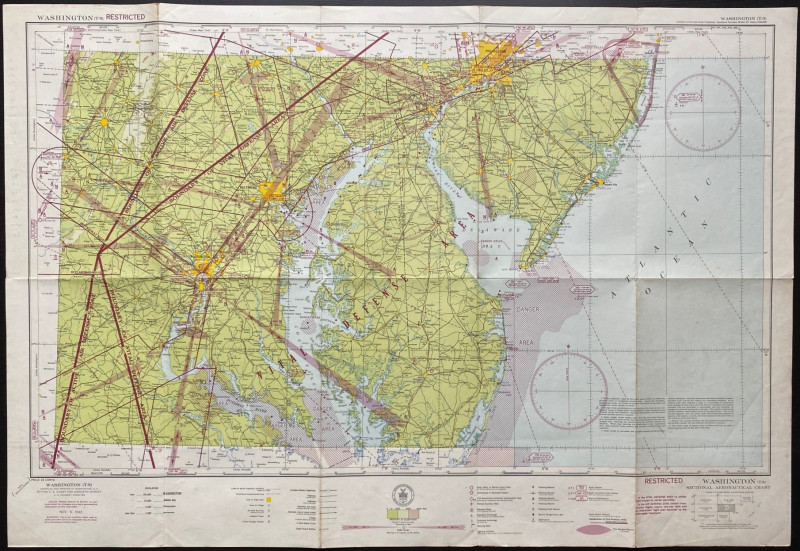
Map of Washington Air Defence Zone 1942
Colbert
US Coast and Geodetic Survey
Reserved
Offered by Arthur Hook
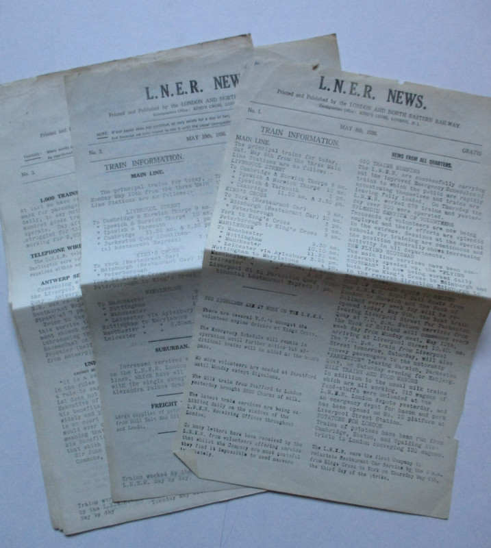
LNER General Strike Newsletter 1926
London and North Eastern Railway
London and North Eastern Railway
£50.00
Offered by Arthur Hook

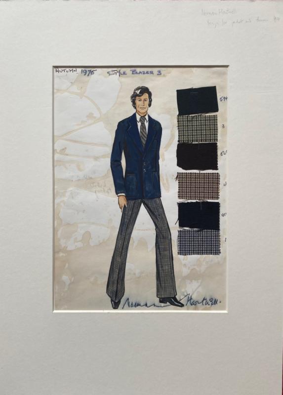
Norman Hartnell original sketched design with fabr...
Hartnell
Unpublished
£175.00
Offered by Arthur Hook
Friends of the PBFA
For £10 get free entry to our fairs, updates from the PBFA and more.
Please email info@pbfa.org for more information