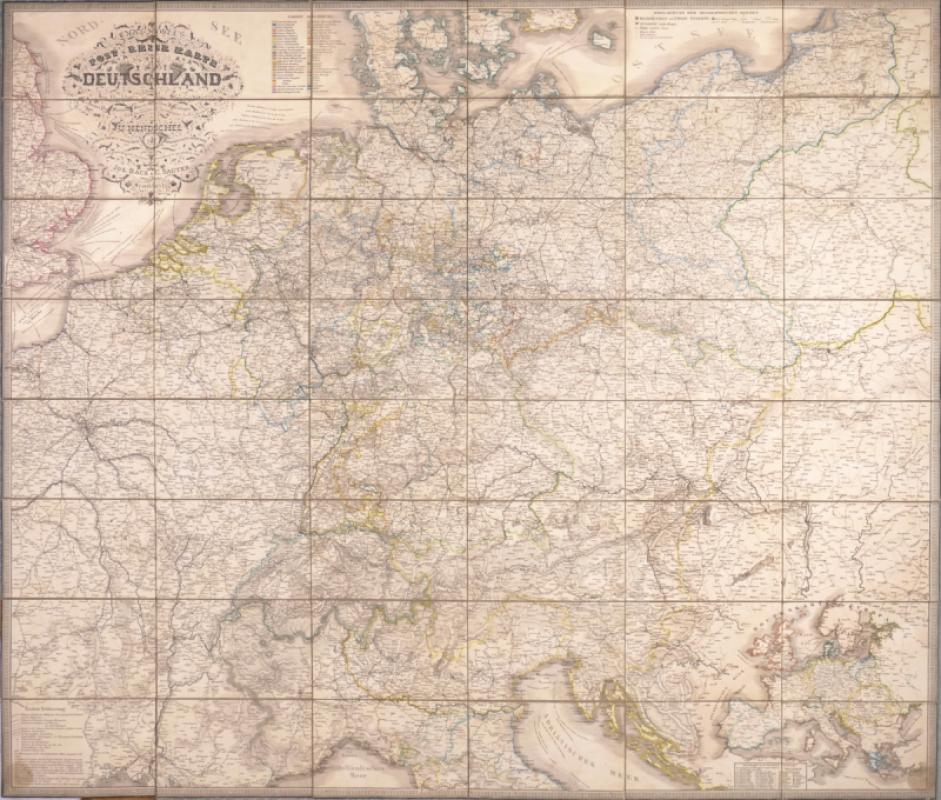
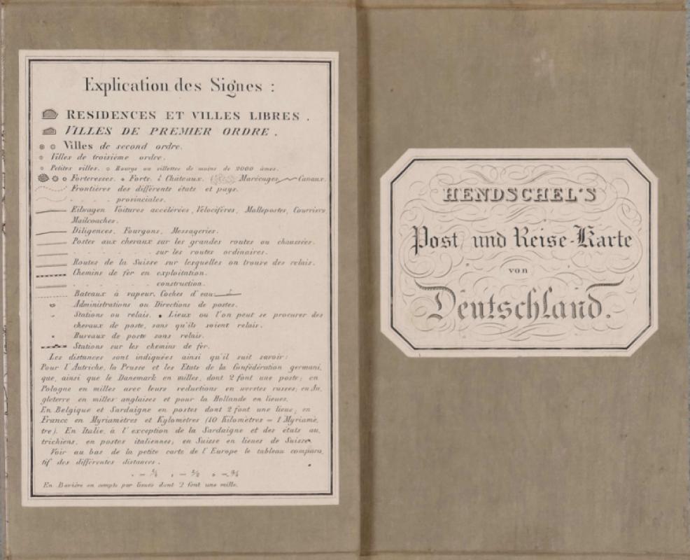
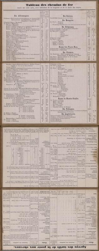
Post- und Eisenbahn-Karte von Deutschland


Book Description
Dealer Notes
Other books
If you liked the book you've just seen, you might be interested in other books from the same dealer below.
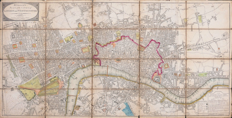
Wallis’s Plan of the Cities of London and Westmins...
Wallis (John)
John Wallis, London
£600.00
Offered by Robert Hall Pictures

One of the Tenth, Hyde Park May 27 1829 Sketched a...
Heath (William)
Thomas McLean
£120.00
Offered by Robert Hall Pictures
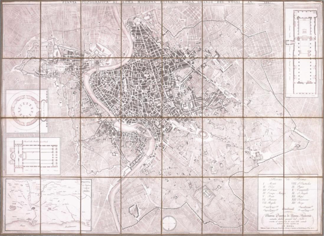
Pianta Topografica di Roma Moderna
Mondaldini (Venanzio)
Rome
£450.00
Offered by Robert Hall Pictures
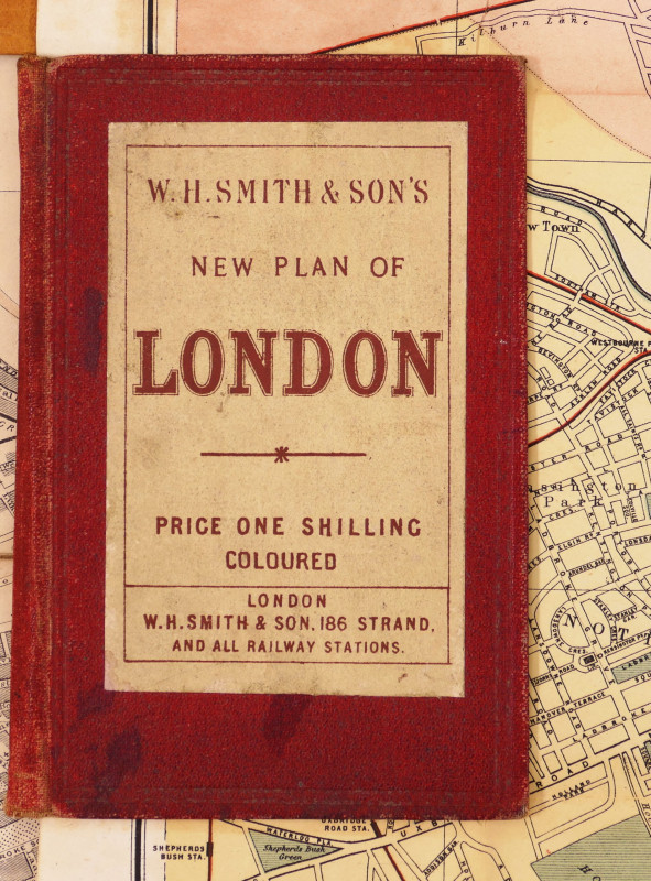
W.H. Smith & Son's Plan of London
Smith (W.H., & Son) (Publisher)
W.H. Smith & Son
£240.00
Offered by Robert Hall Pictures

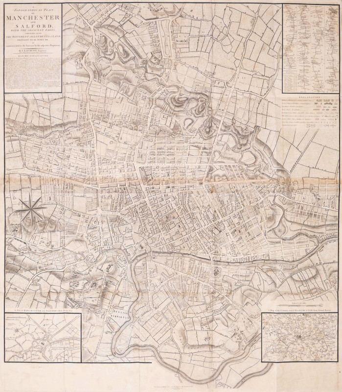
A Topographical Plan of Manchester and Salford wit...
Laurent (Charles)
John Stockdale, London
£570.00
Offered by Robert Hall Pictures
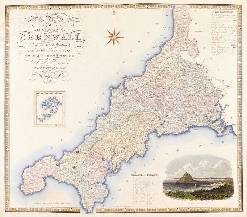
Map of the County of Cornwall from an Actual Surve...
Greenwood (Christopher and John)
Greenwood & Co
£250.00
Offered by Robert Hall Pictures
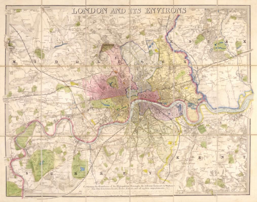
London and its Environs, Containing the Boundaries...
Davies (Benjamin Rees)
C.F. Cheffins, Davies, Mogg...
£780.00
Offered by Robert Hall Pictures
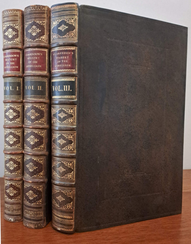
The History of the Rebellion and Civil Wars in Eng...
Clarendon (Edward, Earl of)
Oxford, at the Theatre
£1250.00
Offered by Robert Hall Pictures
Friends of the PBFA
Please email info@pbfa.org for more information