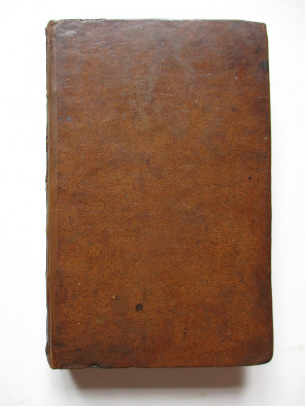
Map of the Country Twenty-Two Miles Round London compiled from Actual Surveys on a scale of Half an Inch to a Mile
Book Description
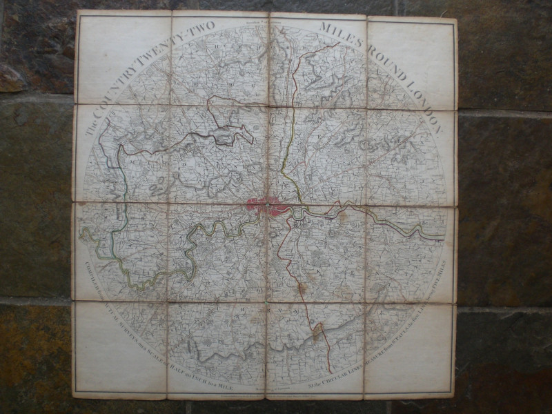
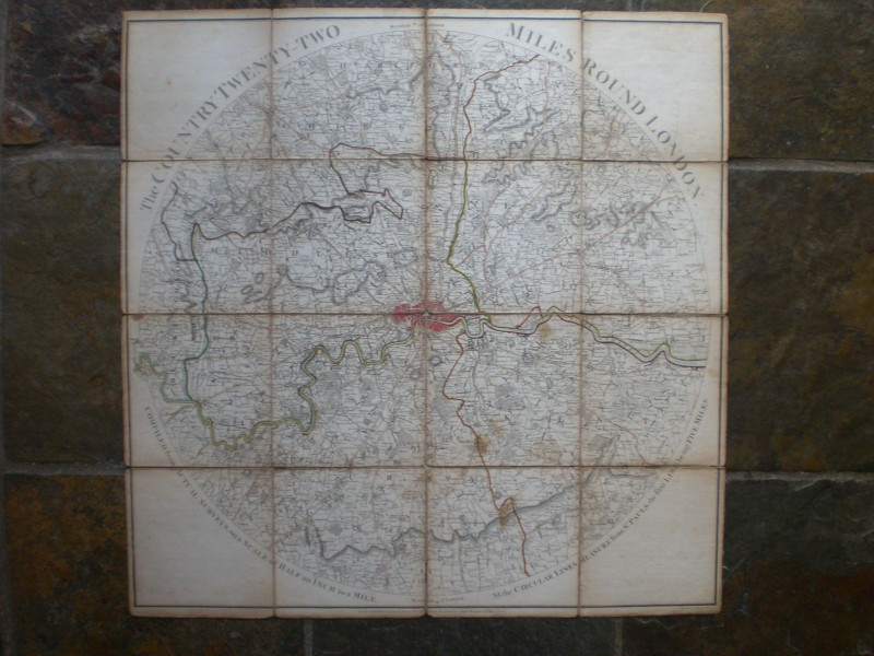
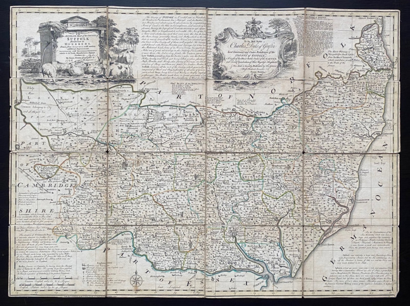
Map of the Country Twenty-Two Miles Round London compiled from Actual Surveys on a scale of Half an Inch to a Mile by Wallis, published by J Wallis, London 1783. Engraved by Woodman and Mutlow. On folding linen in 16 sections. Covers an area that has Ware in the extreme north; Redhill in the south; Slough in the west and Tilbury in the east. Heights shown by shading or hachuring. Some hand-colouring. A series of feint circular lines are shown at regular intervals from the city and according to text around the borders of the map “the circular lines measure from St. Pauls, the first Line being Five Miles”. A detailed map which shows roads, settlements, rivers, parks, woods, great houses , county boundaries etc. Four small clear stains or foxing marks. The reverse is foxed and has been strengthened at two folds with archival quality tape. Good condition.
Author
Wallis
Date
1783
Publisher
1783
Illustrator
Wallis
Condition
Good
Other books
If you liked the book you've just seen, you might be interested in other books from the same dealer below.
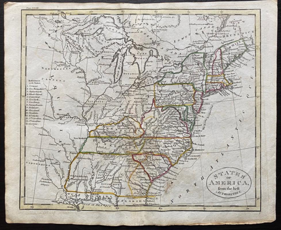
Map of States of America from the Best Authorities
Russell
Rivington, Wilkie and others
Reserved
Offered by Arthur Hook
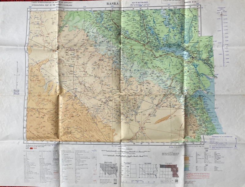
British Army Map of Basra 1941
British Army
British Army 512 Forward Survey Company, Royal Engineers
£85.00
Offered by Arthur Hook
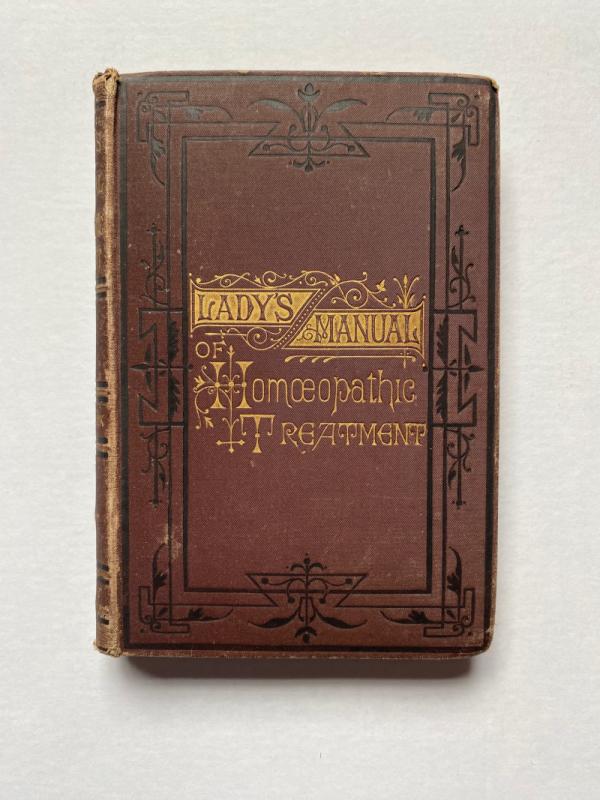
The Lady’s Manual of Homeopathic Treatment in the...
Ruddock
Homeopathic Publishing Company
£35.00
Offered by Arthur Hook
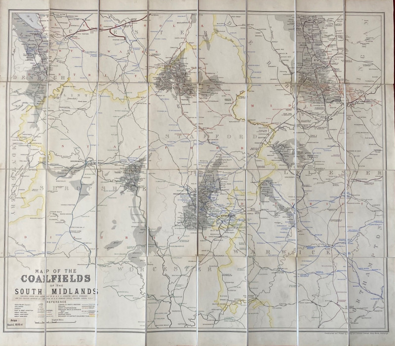
Map of the Coalfields of the South Midlands circa...
Johnston
Johnston
£100.00
Offered by Arthur Hook
The Experienced English Housekeeper, for the use a...
Raffald
Baldwin
£210.00
Offered by Arthur Hook
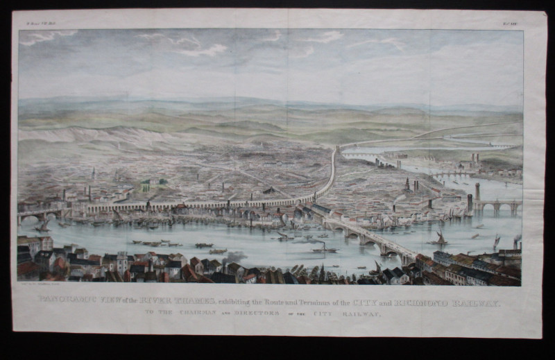
Panoramic View of the River Thames exhibiting the...
Schulthess
City and Richmond Railway
£310.00
Offered by Arthur Hook
Friends of the PBFA
For £10 get free entry to our fairs, updates from the PBFA and more.
Please email info@pbfa.org for more information