Map of Southern India La Presqu'Isle de L'Inde
Book Description
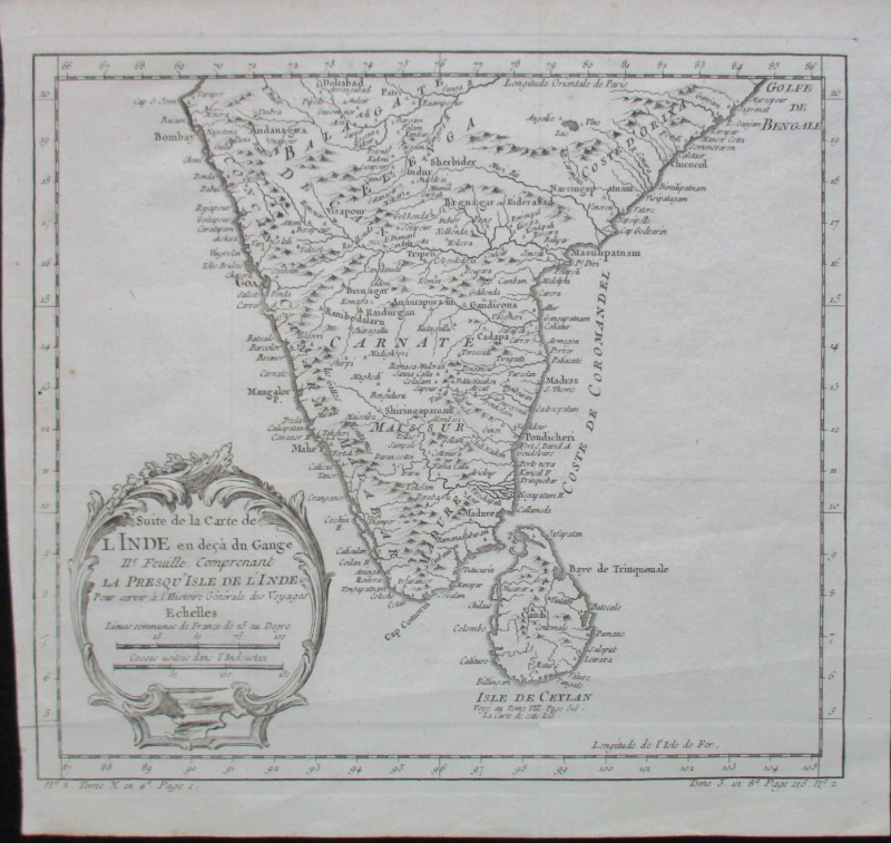
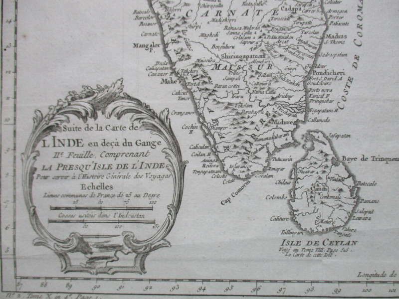
Map of La Presqu'Isle de L'Inde pour server a l'Histoire Generale des Voyages by Bellin, published Paris circa 1755. On paper size 26 by 23 cm. Uncoloured. Scale 50 French leagues to the inch and with a second scale in Indoustan cosses. Shows India south of a line from Bombay across to Marapour with the Isle de Ceylan or Sri Lanka. A detailed map with towns, rivers, coastal features and with hills and mountains shown in a stylised form. Title is in a decorative cartouche. Good to VG condition.
Author
Bellin
Date
1755
Publisher
Bellin
Illustrator
Bellin
Condition
VG
Other books
If you liked the book you've just seen, you might be interested in other books from the same dealer below.
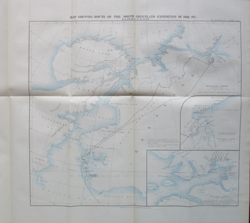
Map Shewing Route of the North Greenland Expeditio...
Peary
Royal Geographical Society
£55.00
Offered by Arthur Hook

Boston School Kitchen Text-Book. Lessons in Cookin...
Lincoln
Roberts Brothers
£60.00
Offered by Arthur Hook
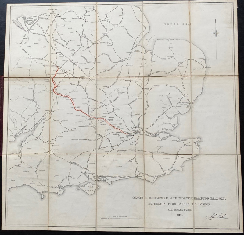
Map of the Oxford, Worcester and Wolverhampton Rai...
Anon
Unpublished
£130.00
Offered by Arthur Hook

Friends of the PBFA
For £10 get free entry to our fairs, updates from the PBFA and more.
Please email info@pbfa.org for more information