Map and Sections of the Severn Tunnel Railway 1875

Book Description
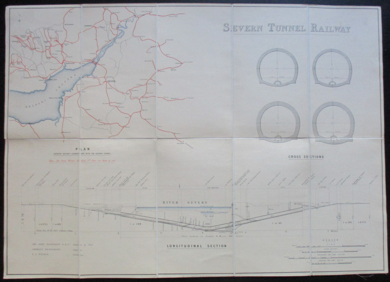
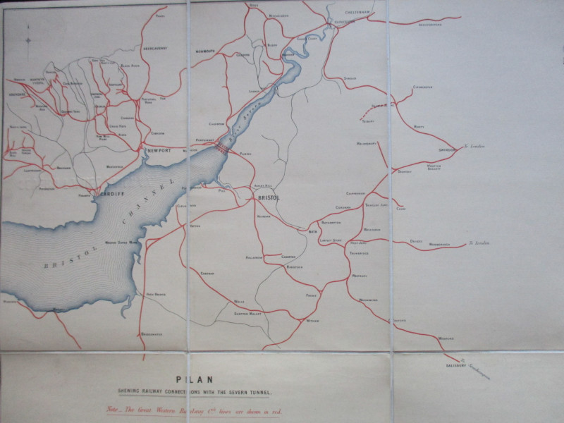
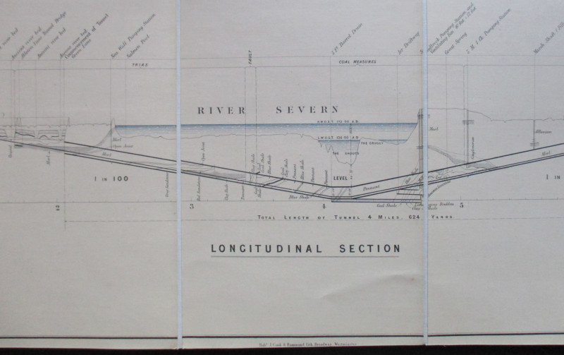
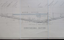
Map and Sections of the Severn Tunnel Railway. No date but circa 1875. On folding linen in 10 sections, size 71 by 50 cm. Attributed to Hawkshaw, Engineer in Chief, and to Richardson, Engineer. These names appear on the plans. The scale of the map is approximately 5 miles to the inch and there are 3 scales for the various sections (a cross section of the tunnel plus horizontal and vertical sections, with a longitudinal section under the Severn). The map shows railway connections to the Severn Tunnel with Great Western Railway lines in red. Hand-coloured. VG condition
Author
Hawkshaw and Richardson
Date
1875
Publisher
Unpublished
Illustrator
Hawkshaw
Condition
VG
Other books
If you liked the book you've just seen, you might be interested in other books from the same dealer below.
The War of Steel and Gold- Bertrand Russell Signed...
Brailsford
Bell
£450.00
Offered by Arthur Hook
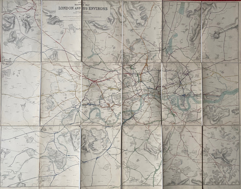
Railway Clearing House Map of London 1915
Emslie
Railway Clearing House
£195.00
Offered by Arthur Hook
Friends of the PBFA
For £10 get free entry to our fairs, updates from the PBFA and more.
Please email info@pbfa.org for more information