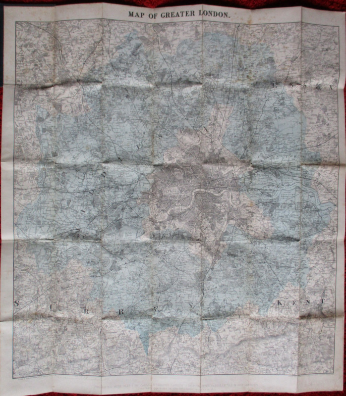
District Railway Map of Greater London 1902

Book Description
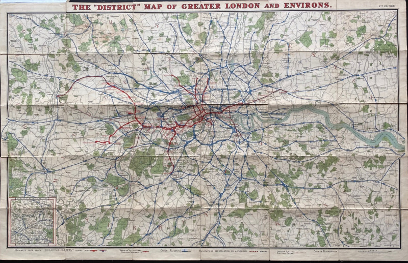
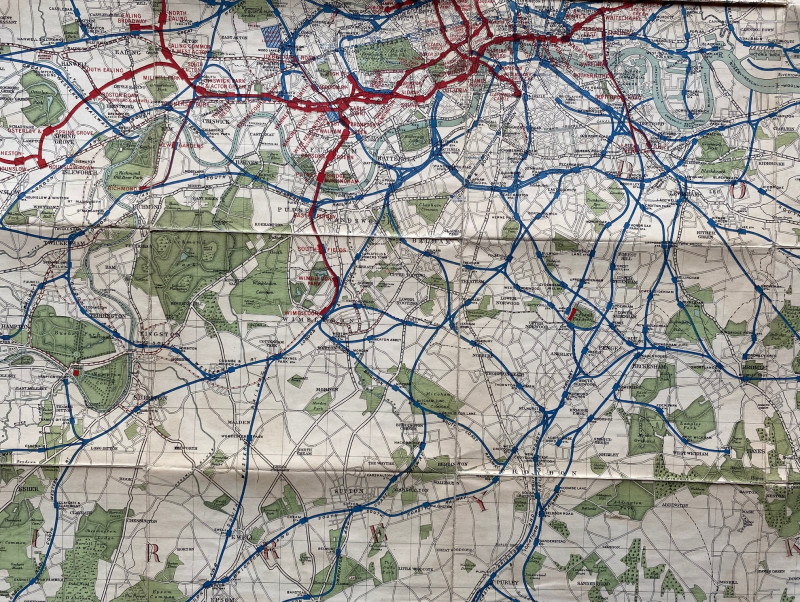
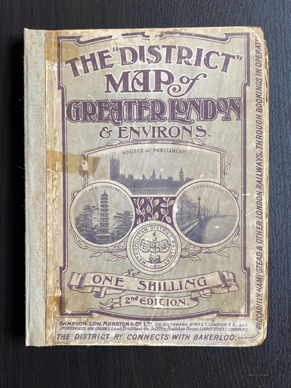
District Railway Map of Greater London and Environs, published by Samson Low, Marston, London 1907. The 2nd edition. On folding linen size 107 by 68 cm. Covers an area from Chalfont St. Giles across to Brentwood in the north and from Weybridge to Wrotham in the south. Lines of the various companies are colour-coded. A key shows District Railway lines, Bakerloo, Picadilly and Hampstead Railway lines, London United Electric trams, other steam and electric railways and lines under construction. Includes inset map of Henley and Reading section. Full colour. New cloth spine. Back board has a vertical crack but otherwise Good condition.
Author
Anon
Date
1902
Binding
Folds into stiff boards
Publisher
District Railway
Condition
Good
Other books
If you liked the book you've just seen, you might be interested in other books from the same dealer below.
A Plan of the Proposed Docks and Line of a Canal w...
Cracklow
Hansard
£95.00
Offered by Arthur Hook

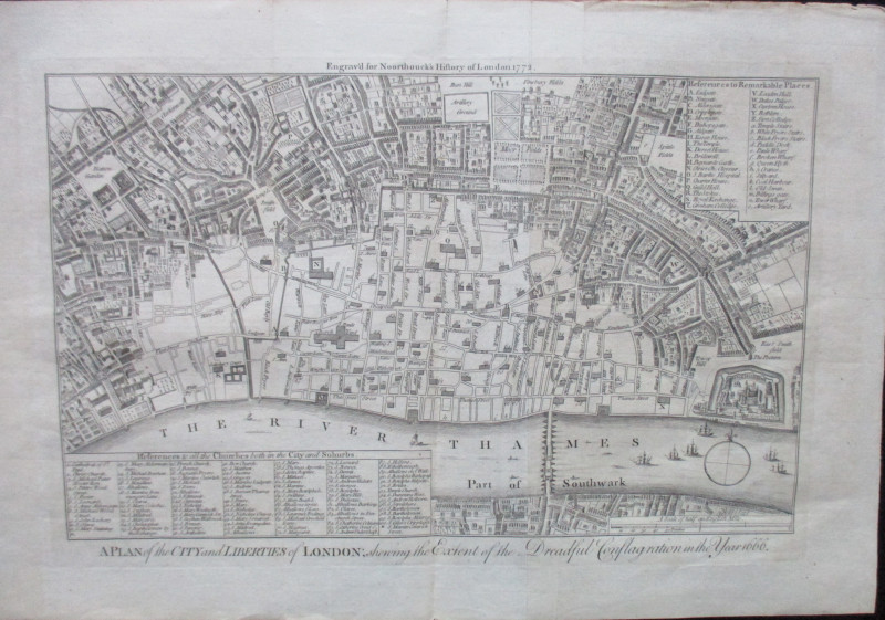
A Plan of the City and Liberties of London; shewin...
Anon
Noorthouck
£120.00
Offered by Arthur Hook
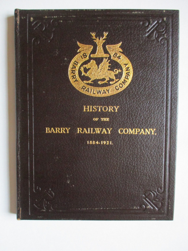
History of the Barry Railway Company 1884-1921
Rimmell
Barry Railway Company
£165.00
Offered by Arthur Hook
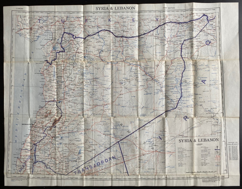
OS War Office Map of Syria and Lebanon 1942
British War Office
British War Office
£30.00
Offered by Arthur Hook
Friends of the PBFA
For £10 get free entry to our fairs, updates from the PBFA and more.
Please email info@pbfa.org for more information