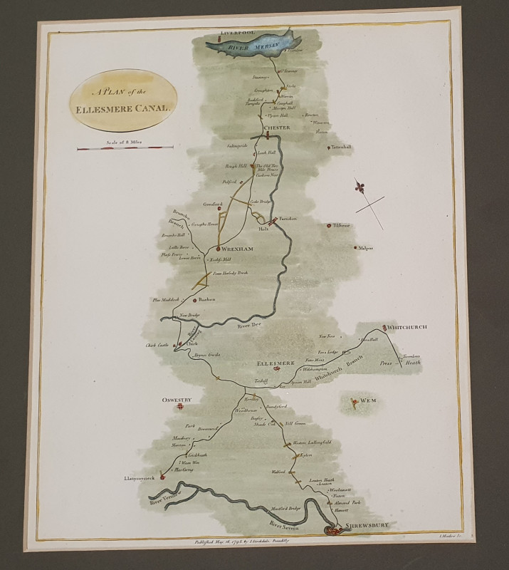
CANANL MAP: Plan of the Ellesmere Canal

Book Description
Other books
If you liked the book you've just seen, you might be interested in other books from the same dealer below.
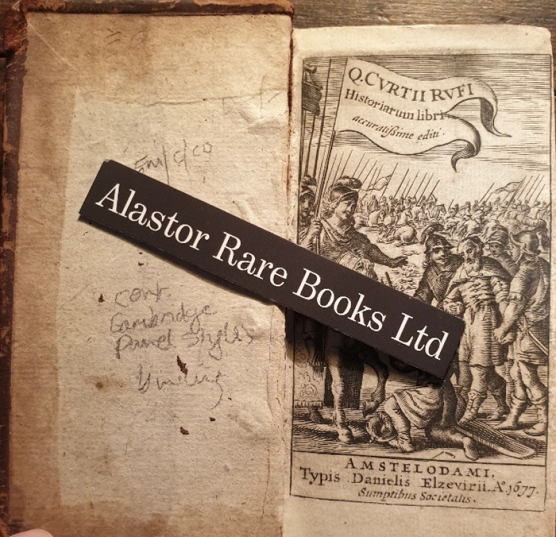
[A ROMAN HISTORY OF ALEXANDER THE GREAT IN A CONTE...
Rufius, Q.[uintus] Curtius. Historiarum Libri.
Amstelodami i.e. Amsterdam: Typis Danielis Elzevirii,
£100.00
Offered by Alastor Rare Books
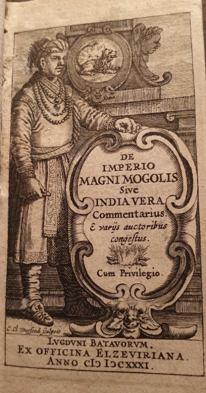
[A POCKET 17TH C HISTORY OF INDIA BY THE DIRECTOR...
De Laet, Joannes. De Imperio Magni Mogolis Sive India Vera Commentarius....
Lvgdvni Batavorvm i.e. Leiden:Ex Officina Elzeviriana,
£140.00
Offered by Alastor Rare Books
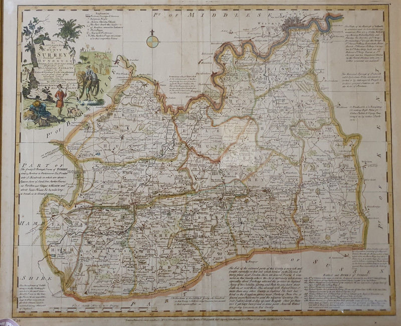
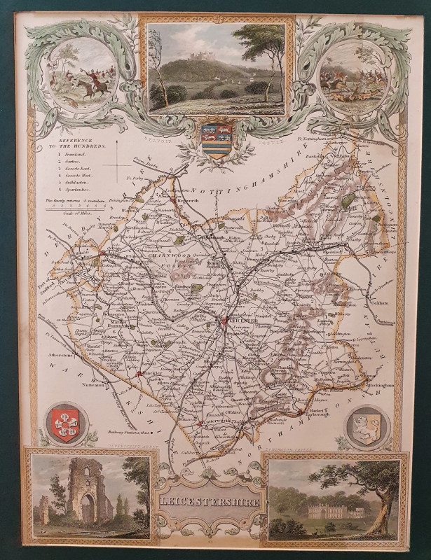
AN ACCURATE MAP OF THE COUNTY OF SURREY DIVIDED IN...
Emanuel and Thomas Bowen
Printed for Carington Bowles
£350.00
Offered by Alastor Rare Books
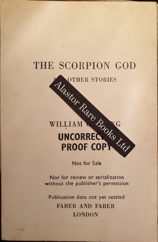
[UNCORRECTED PROOF COPY] The Scorpion God And othe...
Golding, William.
London: Faber & Faber,
£40.00
Offered by Alastor Rare Books
De Annulis Liber Singularis [Bound with] Longi, Ge...
[BINDING; A LATIN TRACTATUS ON THE HISTORY AND SIGNIFICANCE OF THE RING]. Kirchmann, Johann.
Lugd[unum] Batav[orum] i.e.Leiden. Apud Hackios:
£380.00
Offered by Alastor Rare Books
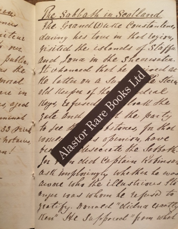
[A WESLEYAN PREACHER'S MANUSCRIPT COMMONPLACE BOOK...
[Simon, Rev. John.]. [Manuscript Commonplace Book, 1846-1857]
[Staffordshire, England]
£120.00
Offered by Alastor Rare Books
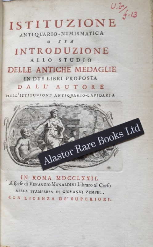
[NUMISMATICS]
Monaldini, Giuseppe Antonio. Istituzione Antiquario-Numismatica o sia Introduzione allo Studio delle Antiche Medaglie in due Libri Proposta dall Autore dell' Istituzione Antiquario-Lapidaria.
In Roma i.e. Rome: A Spese di Venanzio Monaldini Libraro al Corso Nella Stamperia Di Giovanni Zempel,
£120.00
Offered by Alastor Rare Books
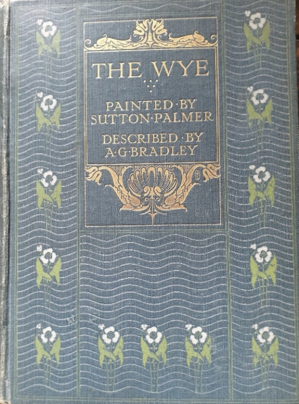
[A & C. BLACK COLOUR BOOK]. The Wye.
Bradley, A.G
London: Adam And Charles Black,
£30.00
Offered by Alastor Rare Books
Friends of the PBFA
Please email info@pbfa.org for more information