Atlas national illustré des 86 départements et des possessions de la France : .....
Book Description
Other books
If you liked the book you've just seen, you might be interested in other books from the same dealer below.
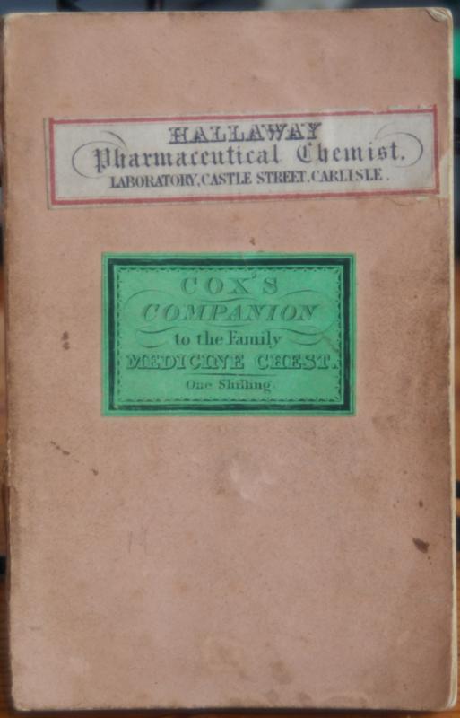
Companion to the Medicine Chest, with plain rules...
[COX. E.?]
London: Simpkin Marshall & Co; Stationers' Court. H. Silverlock, 92, Blackfriars Road, and Earl Street, Doctors' Commons. 1870.
£250.00
Offered by Roger J Treglown
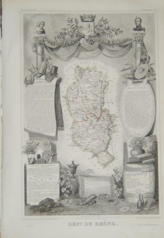
Atlas national illustré des 86 départements et d...
LEVASSEUR, V.
Paris : A. Combette, Editeur, Rue de la Parcheminerie, No.15, 1856.
£350.00
Offered by Roger J Treglown
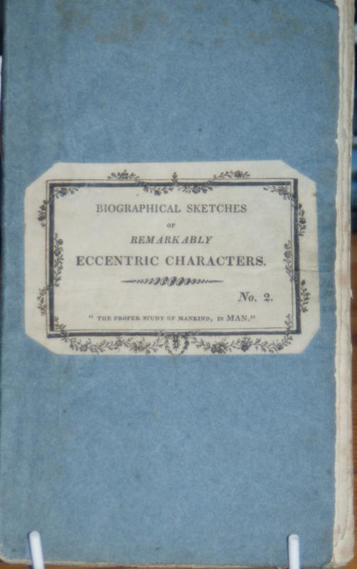
Biographical Sketches of Remarkably Eccentric Char...
VARIOUS UNKNOWN AUTHORS.
£195.00
Offered by Roger J Treglown

Share Ledger, 1837 - 1867. (With loosely tipped i...
(MANUSCRIPT.) YORK CITY AND COUNTY BANKING COMPANY.
[York ?]: York City and County Banking Company, 1837 - 1867.
£250.00
Offered by Roger J Treglown
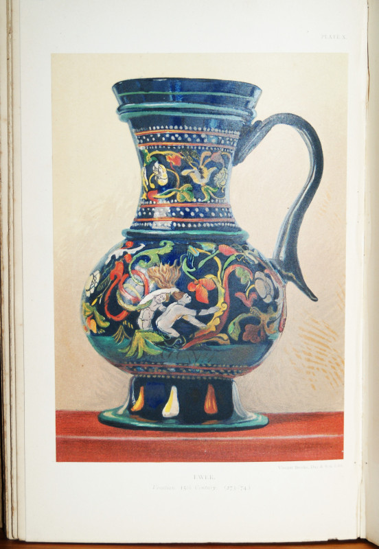
A descriptive catalogue of the Glass Vessels in th...
NESBITT, Arthur. South Kensington Museum.
Printed by George E. Eyre and William Spottiswoode, Printers to the Queen's Most Excellent Majesty , ....
£65.00
Offered by Roger J Treglown
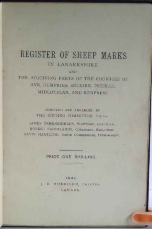
Register of sheep marks in Lanarkshire and the adj...
VARIOUS AUTHORS.
Lanark: J.D. Morrison, Printer. 1907.
£70.00
Offered by Roger J Treglown
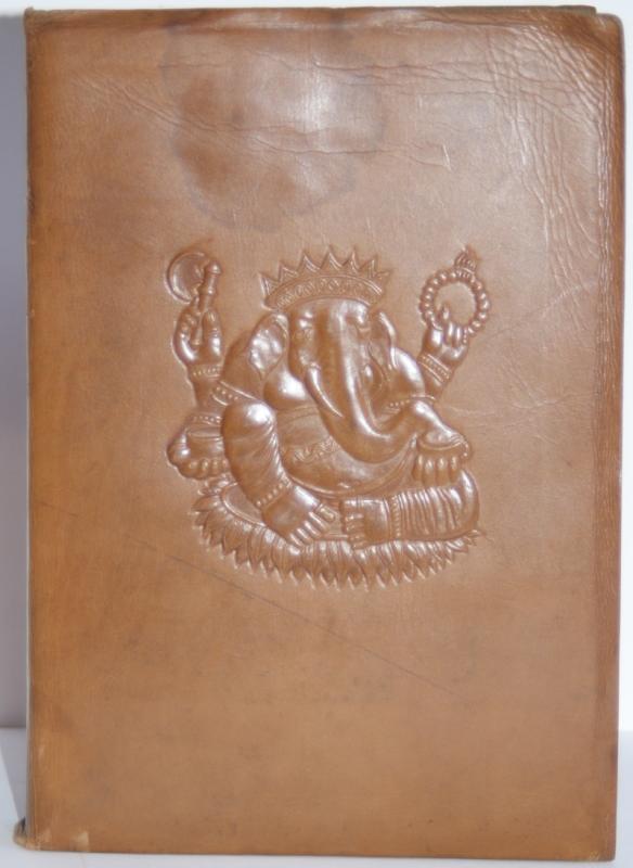
Myths of the Hindus & Buddhists.
NIVEDITA, THE SISTER (Margaret E. Noble); COOMARASWAMY, Ananda K.
London: George G. Harrap & Company ..... [1913.]
£375.00
Offered by Roger J Treglown
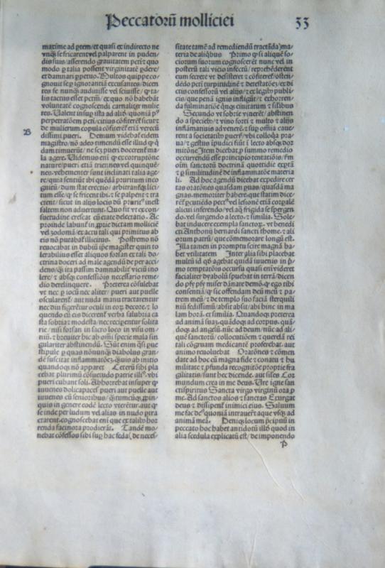
Opera. Ed: Johannes Geiler von Kaisersberg ?
INCUNABLE LEAF. [ Gerson, Johannes.] [1488 ?]
[Strassburg : Johann (Reinhard) Grüninger, partly with the types of Johann Prüss and Martin Flach, 1488.]
£75.00
Offered by Roger J Treglown
Friends of the PBFA
Please email info@pbfa.org for more information