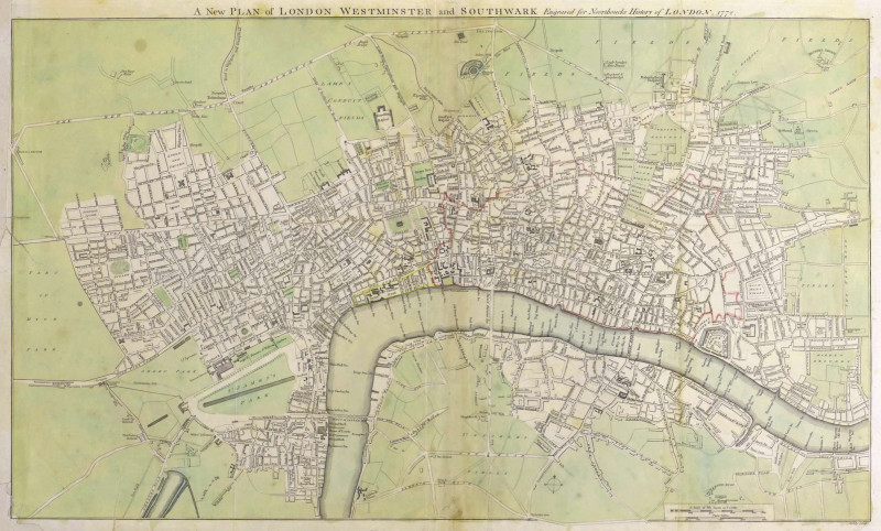
A New Plan of London Westminster and Southwark,
Book Description
Dealer Notes
Other books
If you liked the book you've just seen, you might be interested in other books from the same dealer below.
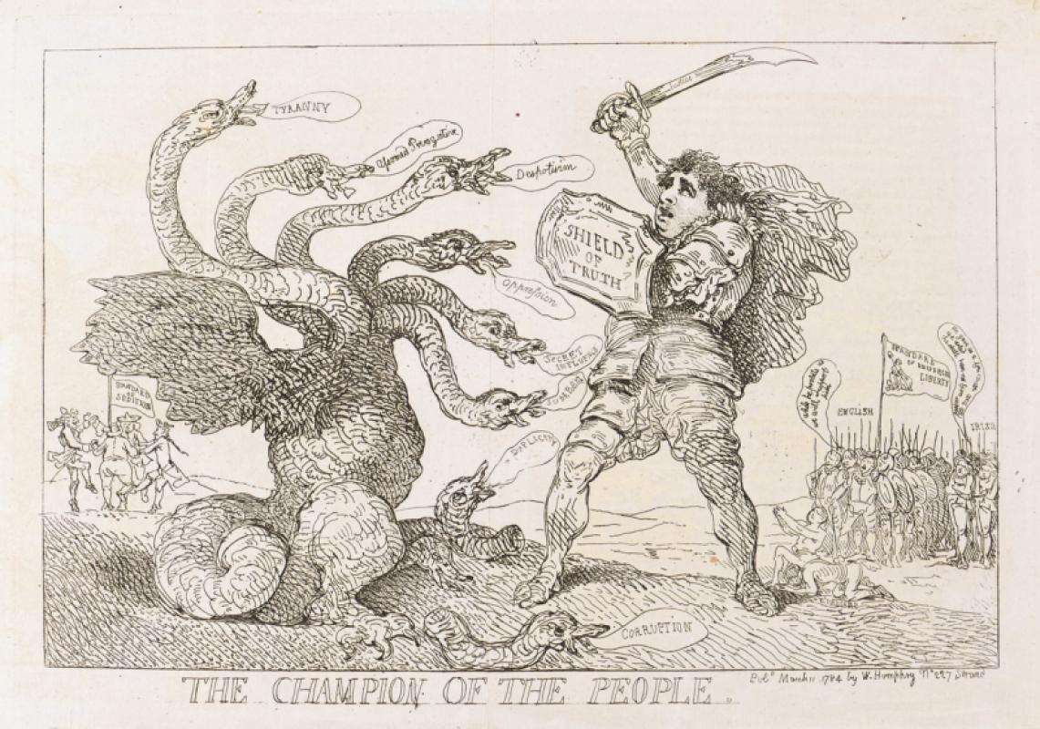
The Champion of the People.
Rowlandson (Thomas)
William Humphrey
£175.00
Offered by Robert Hall Pictures
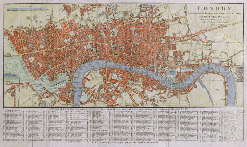
London, extending from the Head of the Paddington...
Russell (John)
James Stratford, London
£375.00
Offered by Robert Hall Pictures
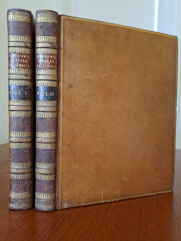
Travels into the Interior of Southern Africa.
Barrow (John)
London, for T. Cadell & W. Davies
£1000.00
Offered by Robert Hall Pictures
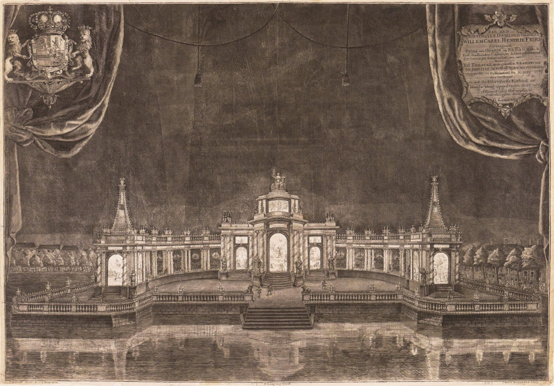
Aan Zyn Doorluchtigheyt Willem Carel Hendrik Friso...
Besoet (Iven)
The Hague, Daniel Joannes Langeweg,
£1250.00
Offered by Robert Hall Pictures
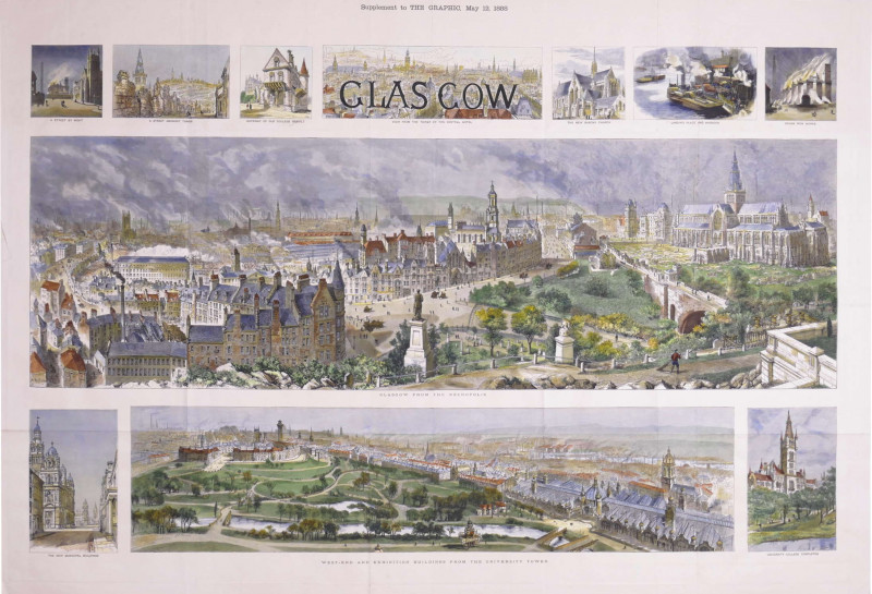
Glasgow, Supplement to The Graphic, May 12, 1888
Brewer (Henry William)
The Graphic, London
£875.00
Offered by Robert Hall Pictures
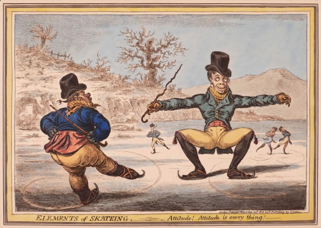
Elements of Skateing. Attitude! Attitude is every...
Gillray (James)
Hannah Humphrey
£375.00
Offered by Robert Hall Pictures
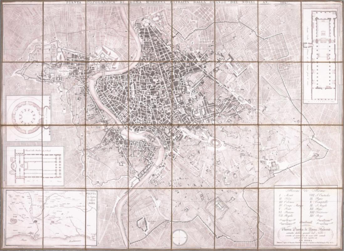
Pianta Topografica di Roma Moderna
Mondaldini (Venanzio)
Rome
£450.00
Offered by Robert Hall Pictures
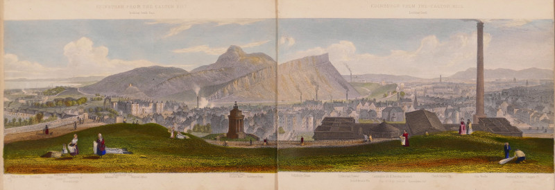
Edinburgh, A Complete View of The City and Environ...
Steuart (T.)
Ackermann & Co.; and J. Menzies, London and Edinburgh
£750.00
Offered by Robert Hall Pictures
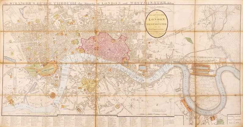
The Stranger's Guide Through the Streets of London...
Darton (William)
£750.00
Offered by Robert Hall Pictures
Friends of the PBFA
Please email info@pbfa.org for more information