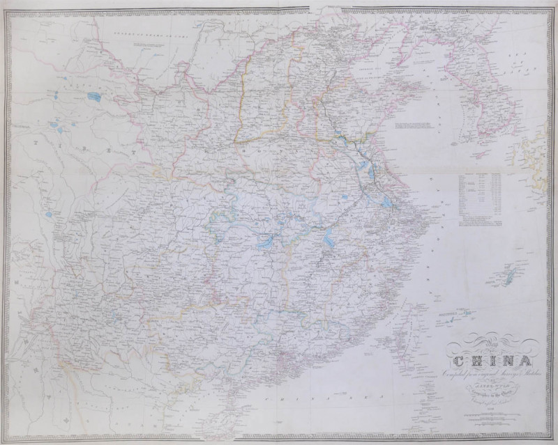
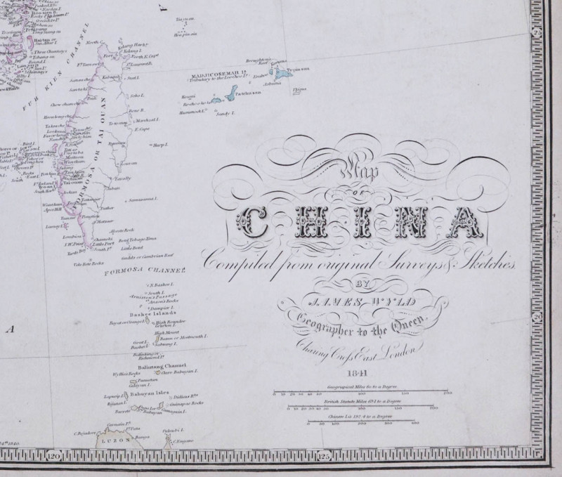
Map of China.
Book Description
Dealer Notes
Showing Chinese provinces from Corea (sic) to Tibet and Haenan to the Gobi. The table provides figures for the area of each province plus population.
Other books
If you liked the book you've just seen, you might be interested in other books from the same dealer below.
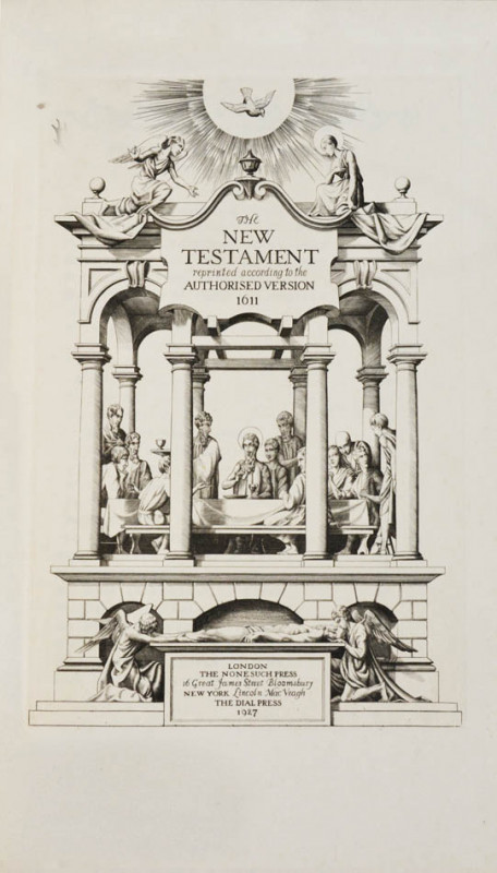
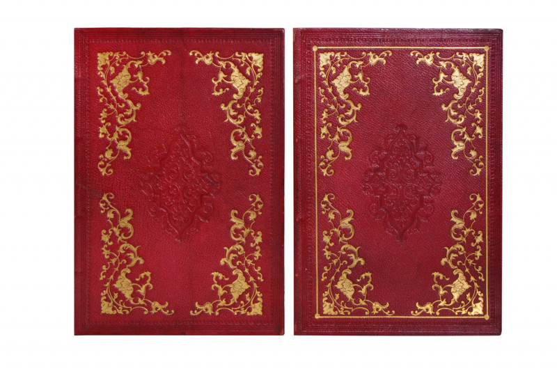
The Holy Bible [together with] The Apocrypha.
NONESUCH PRESS; GOODEN, Stephen.
Nonesuch Press
£450.00
Offered by Shapero Rare Books Ltd

The Story of a Troll-Hunt.
McBRYDE, James.
Printed at the University Press, Cambridge
£975.00
Offered by Shapero Rare Books Ltd
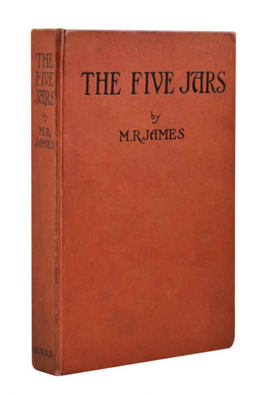
The Five Jars. Being more or less of a fairy tale...
JAMES, M.R.
London, Edward Arnold & Co.,
£380.00
Offered by Shapero Rare Books Ltd
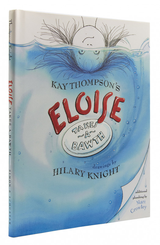
Eloise Takes a Bawth...additional plumbing by Mart...
THOMPSON, Kay; KNIGHT, Hilary.
Simon & Schuster Books for Young Readers
£160.00
Offered by Shapero Rare Books Ltd

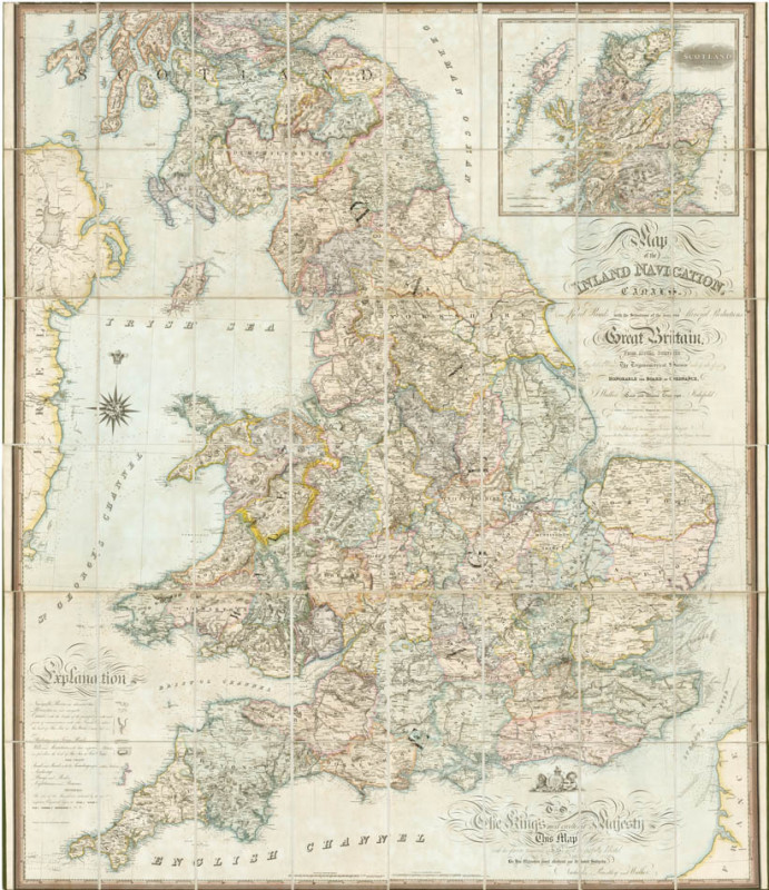
Map of the Inland Navigations, Canals, and Railroa...
WALKER, J[ames].
Wakefield, Richard Nichols, Bookseller, [and] London, Longmann, Rees, Orme, Brown and Green,
£1800.00
Offered by Shapero Rare Books Ltd
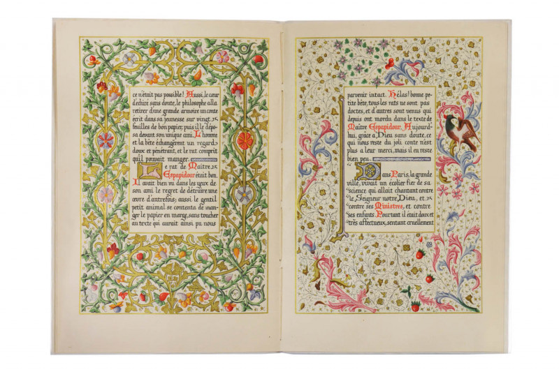
Conte de Maitre Espapidour.
SARDA, Daniel.
for Vincent Brookes Day & Son, under the direction of the Nonesuch Press, for Mrs. Fern L. Bedaux
£150.00
Offered by Shapero Rare Books Ltd
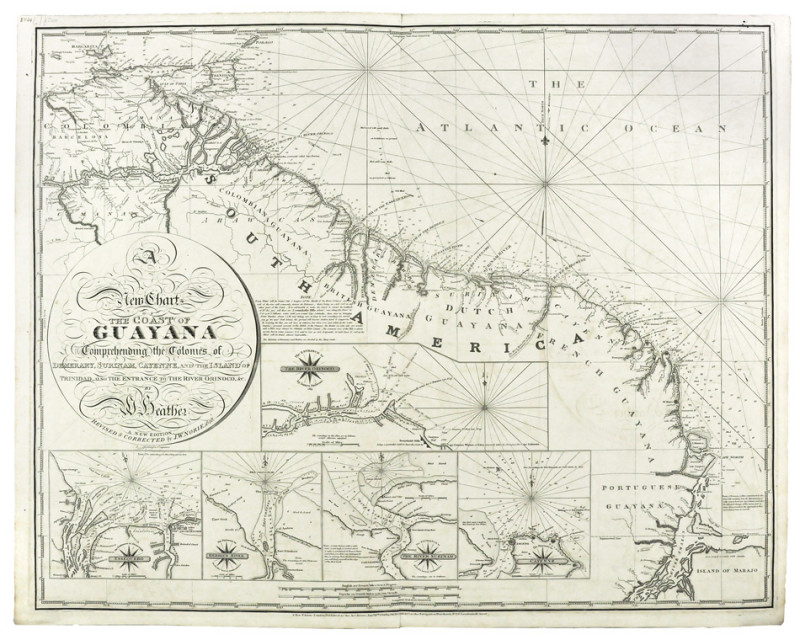
A New Chart of the Coast of Guayana
HEATHER, William & NORIE, J.W.
London, Norie,
£1500.00
Offered by Shapero Rare Books Ltd
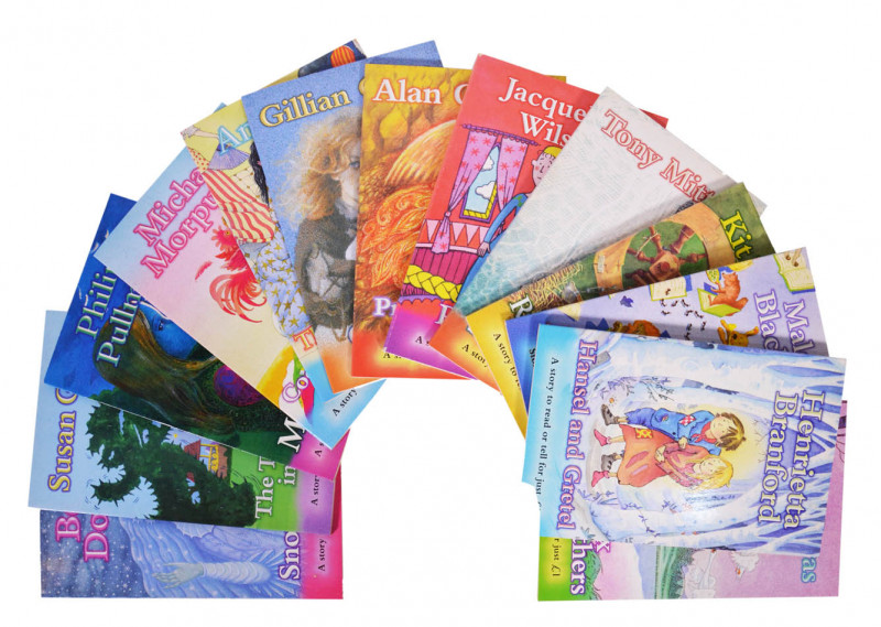
A story to read or tell...[A complete set of 13 bo...
SCHOLASTIC CHILDREN'S BOOKS; FICKLING, David (editor).
Scholastic Children’s Books, ‘Magic Beans’ series
£650.00
Offered by Shapero Rare Books Ltd
Finden's illustrations of the life and works of Lo...
[BYRON]; BROCKEDON, W[illiam].
London, John Murray,
£850.00
Offered by Shapero Rare Books Ltd
Friends of the PBFA
Please email info@pbfa.org for more information