IMPORTANT ORIGINAL "TOP SECRET" INVASION MAP OF CAEN 1:25,000 WITH LARGE ORIGINAL AERIAL PHOTOGRAPH


Book Description
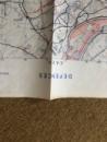
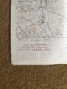
Important original Top Secret map of Caen produced by British Intelligence as part of the Invasion planning for Overlord in June 1944. As part of the Invasion Plan Caen was expected to be captured very soon after D-Day, which explains the inclusion of the city in the Invasion Plan. In fact it took many weeks of bitter fighting, with numerous civilian and Military casualties before the City fell.
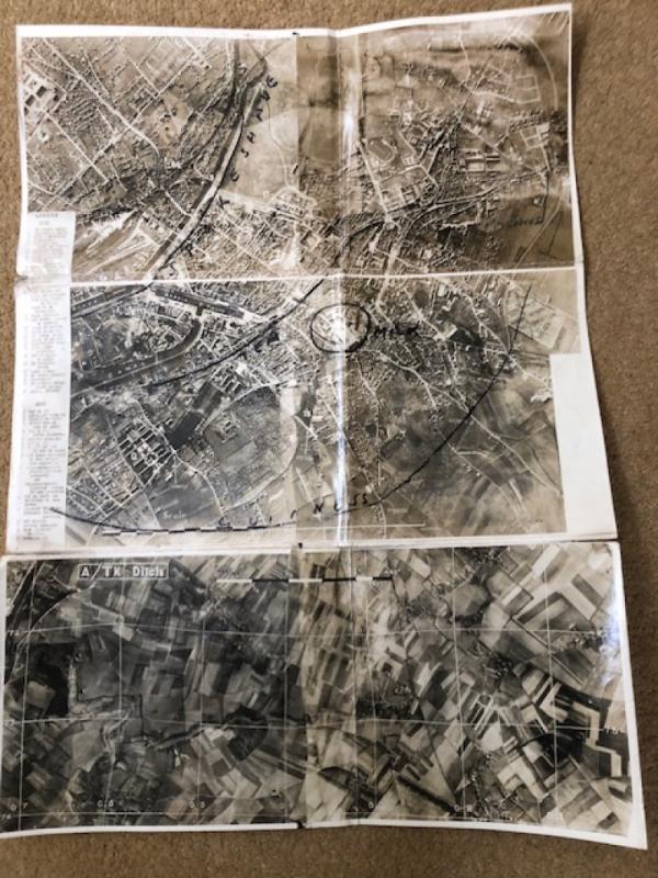
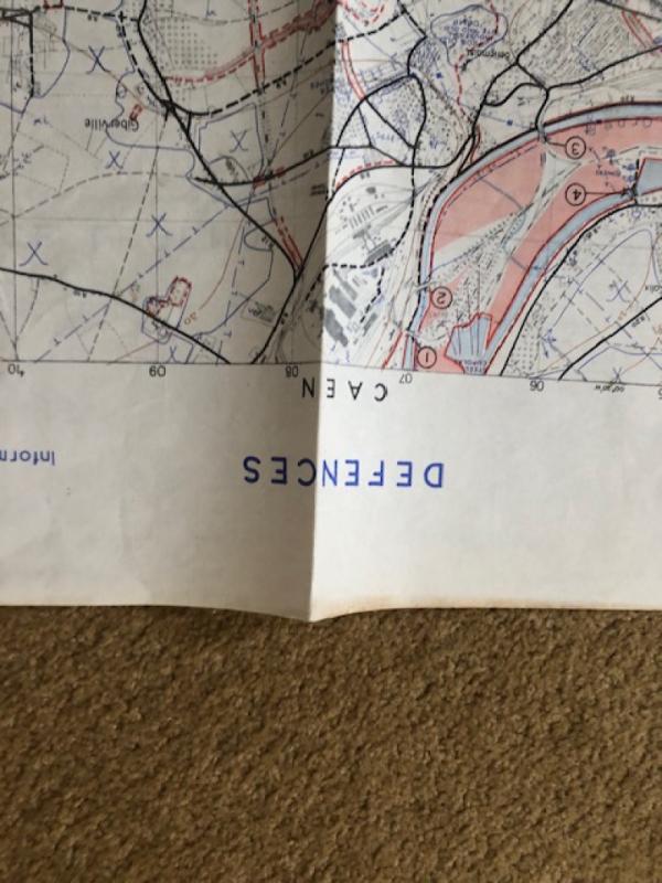
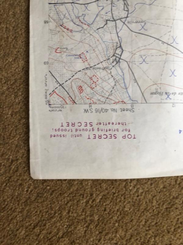
This Map is dated May 1944 (information at May 44)and has the Defence Overprint key on the rear of the Map, this explains the defence detail printed on the front of the map. size c.70cms x 50 cms with "Top Secret until issued for briefing ground troops thereafter Secret". Unusually an Original contemporary aerial photograph of Caen with detailed key of important Military installations etc., is included. In combination these make a unique piece of Normandy invasion history. Both are in very good condition apart from modest marks to rear of map, consistent with use and both items are folded.
Author
BRITISH INTELLIGENCE
Date
1944
Binding
paper
Publisher
War Office
Condition
Very Good
Pages
2
Other books
If you liked the book you've just seen, you might be interested in other books from the same dealer below.
IMPORTANT ORIGINAL "TOP SECRET" INVASION MAP OF CA...
BRITISH INTELLIGENCE
War Office
£4250.00
Offered by World War Books
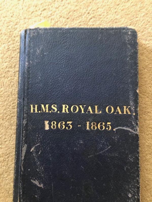
NAVAL LOG OF HMS ROYAL OAK 1863-1865
CAPTAIN A.W.HAMILTON ROYAL NAVY
N/A
£595.00
Offered by World War Books
Friends of the PBFA
For £10 get free entry to our fairs, updates from the PBFA and more.
Please email info@pbfa.org for more information