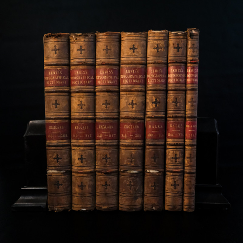
A Topographical Dictionary of England […]; A Topographical Dictionary of Wales […]; An Atlas to the Topographical Dictionaries of England and Wales […].
Book Description
Dealer Notes
Other books
If you liked the book you've just seen, you might be interested in other books from the same dealer below.
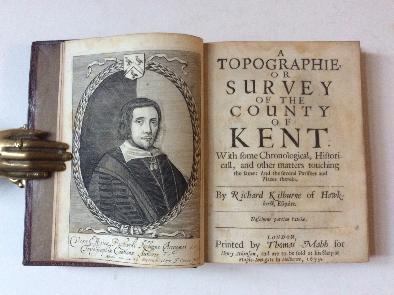
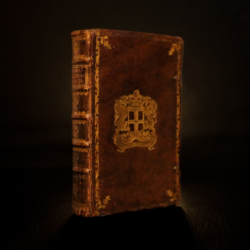
A Topographie or Survey of the County of Kent.
Kilburne, Richard
London: Thomas Mabb for Henry Atkinson [...],
£650.00
Offered by Unsworth's Antiquarian Booksellers
Pantheum mythicum, seu fabulosa deorum historia [....
Pomey, F.: (Pitiscus, S.:)
Amstelodami [Amsterdam] & Trajecti ad Rhenum [Utrecht]: Schouten & J.J.A. Poolsum,
£225.00
Offered by Unsworth's Antiquarian Booksellers
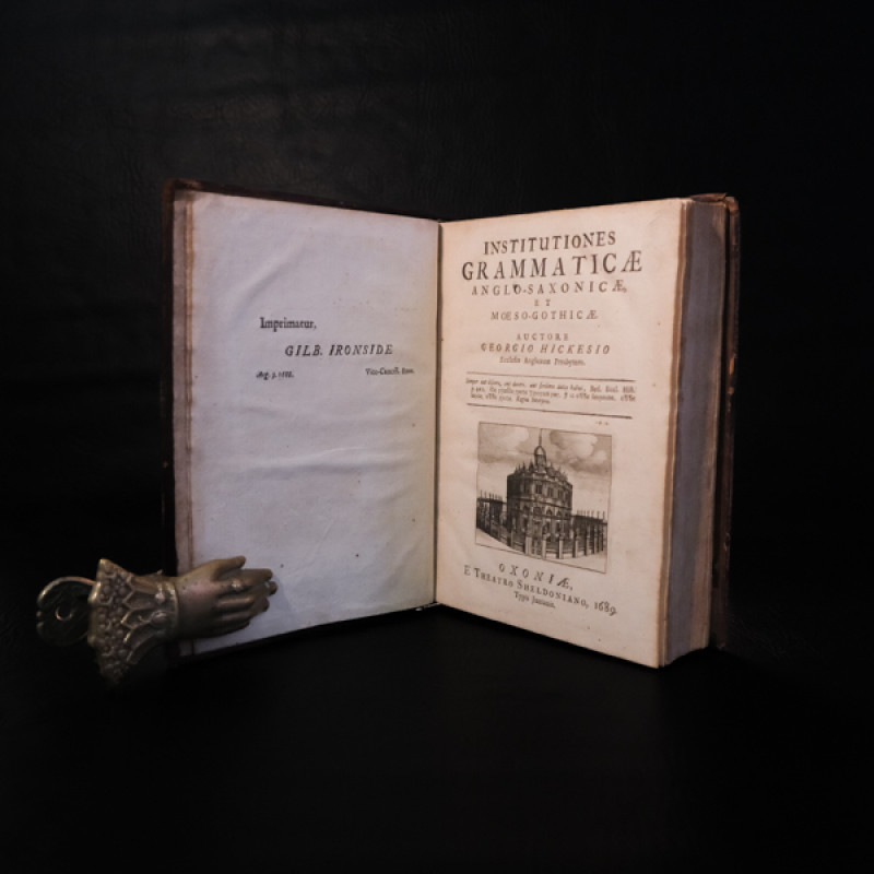
Institutiones Grammaticae Anglo-Saxonicae et Moeso...
Hickes, George:
Oxoniæ [Oxford]: Theatro Sheldoniano. Typis Junianis,
£1800.00
Offered by Unsworth's Antiquarian Booksellers
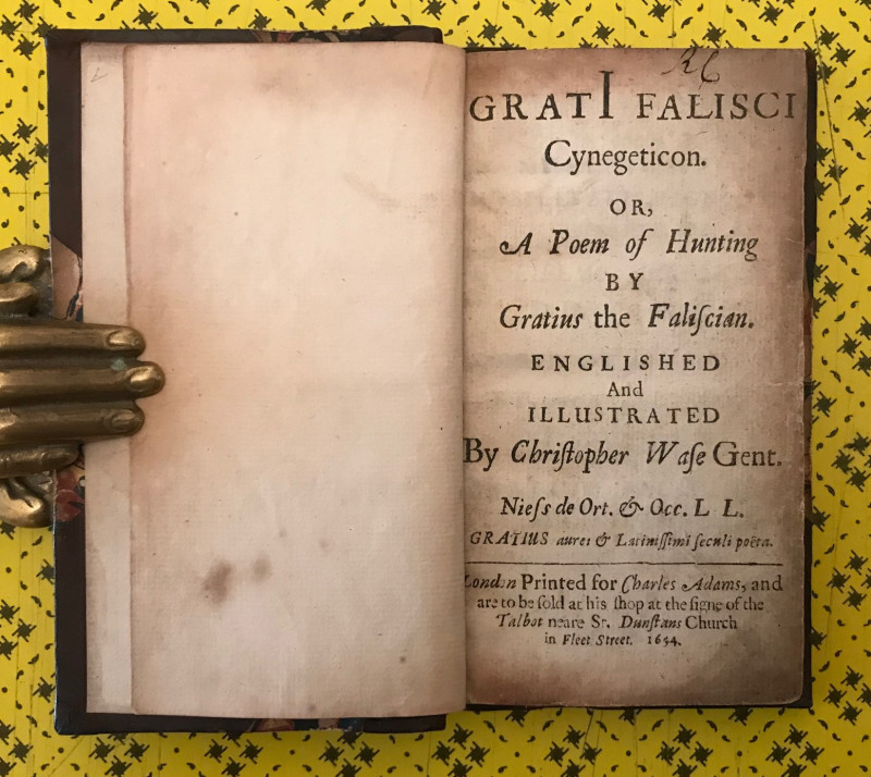
Cynegeticon. Or, A Poem of Hunting by Gratius the...
[Hunting] Gratius (or Grattius) Faliscus: (Wase, Christopher, trans.:)
London: Charles Adams,
£750.00
Offered by Unsworth's Antiquarian Booksellers
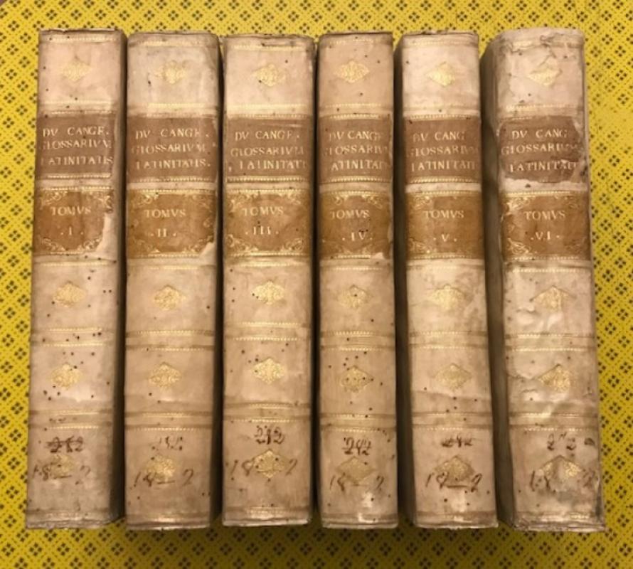
Glossarium ad Scriptores Mediae et Infimae Latinat...
Du Cange, Charles du Fresne:
Venetiis [Venice]: apud Sebastianum Coleti,
£900.00
Offered by Unsworth's Antiquarian Booksellers
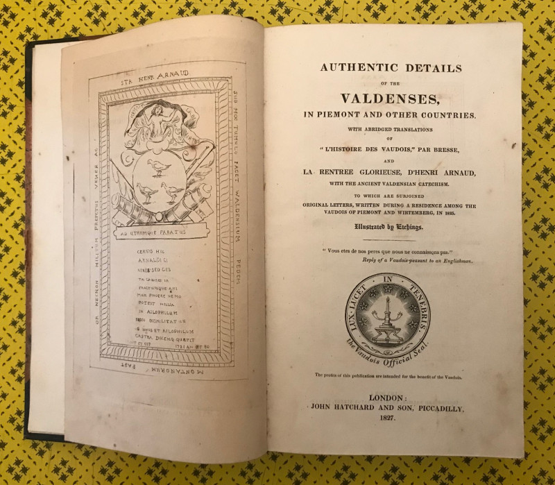
Authentic Details of the Valdenses, in Piemont and...
(Bracebridge, Charles Holte:)
London: John Hatchard and Son,
£225.00
Offered by Unsworth's Antiquarian Booksellers
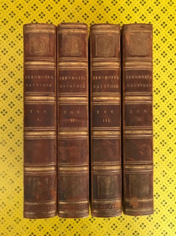
Herodoti Halicarnassei Historiarum Libri IX.
Herodotus: (Gaisford, Thomas, ed.:)
Oxonii [Oxford]: excudebant S. et J. Collingwood; [...],
£240.00
Offered by Unsworth's Antiquarian Booksellers
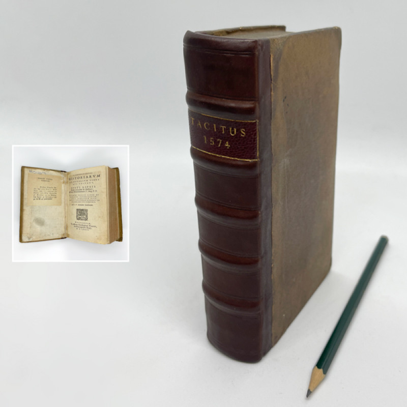
Historiarum et annalium libri qui exstant [...]
Tacitus, Caius(?) Cornelius: (Lipsius, Justus, ed.:)
Antuerpiæ [Antwerp]: ex officina Christophori Plantini,
£1750.00
Offered by Unsworth's Antiquarian Booksellers
De Rebus Gestis Alexandri Magni, Regis Macedonum,...
Curtius Rufus, Quintus: (Snakenburg, Hendrik, ed.:)
Delphis, & Lugd. Bat. [Delft & Leiden]: apud Adrianum Beman, Samuelem Luchtmans,
£350.00
Offered by Unsworth's Antiquarian Booksellers

The History of the Rebellion and Civil Wars in Eng...
Clarendon, Edward (Hyde), Earl of:
Oxford, at the University Press,
£280.00
Offered by Unsworth's Antiquarian Booksellers
Friends of the PBFA
Please email info@pbfa.org for more information