RARE MAP OF YORKSHIRE
Book Description
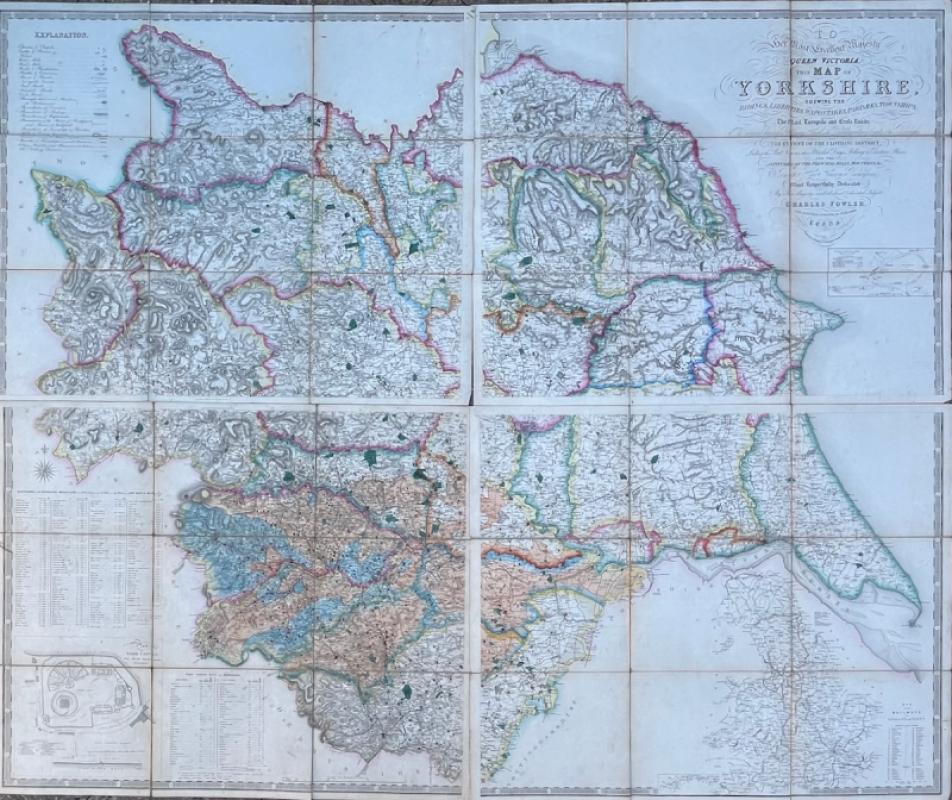
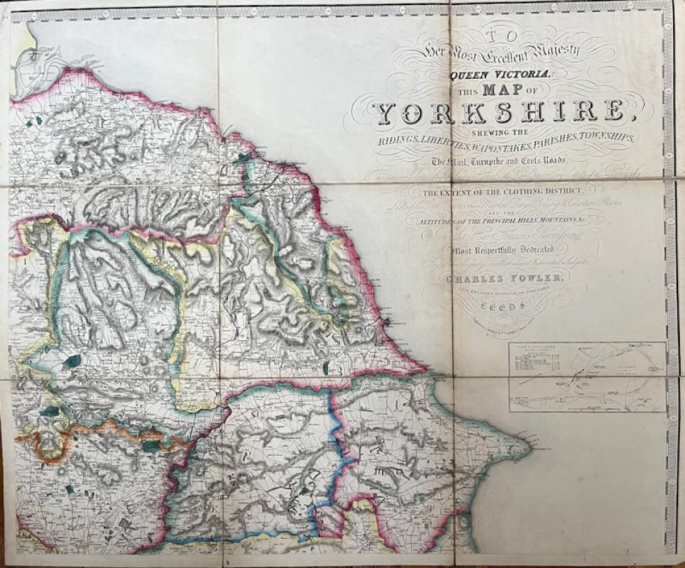
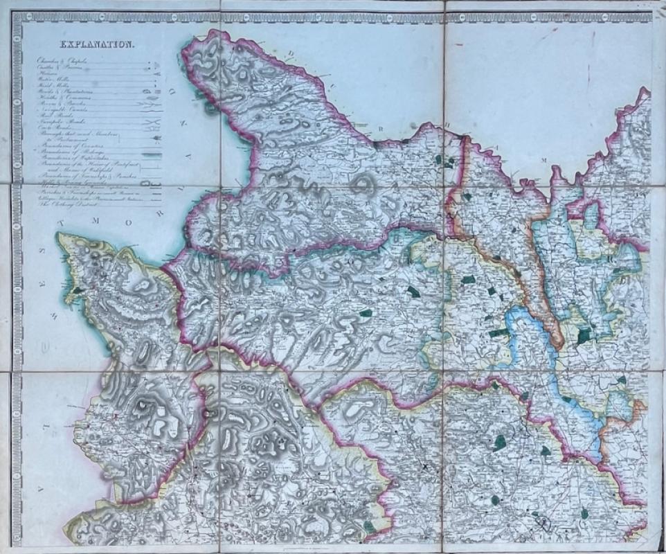
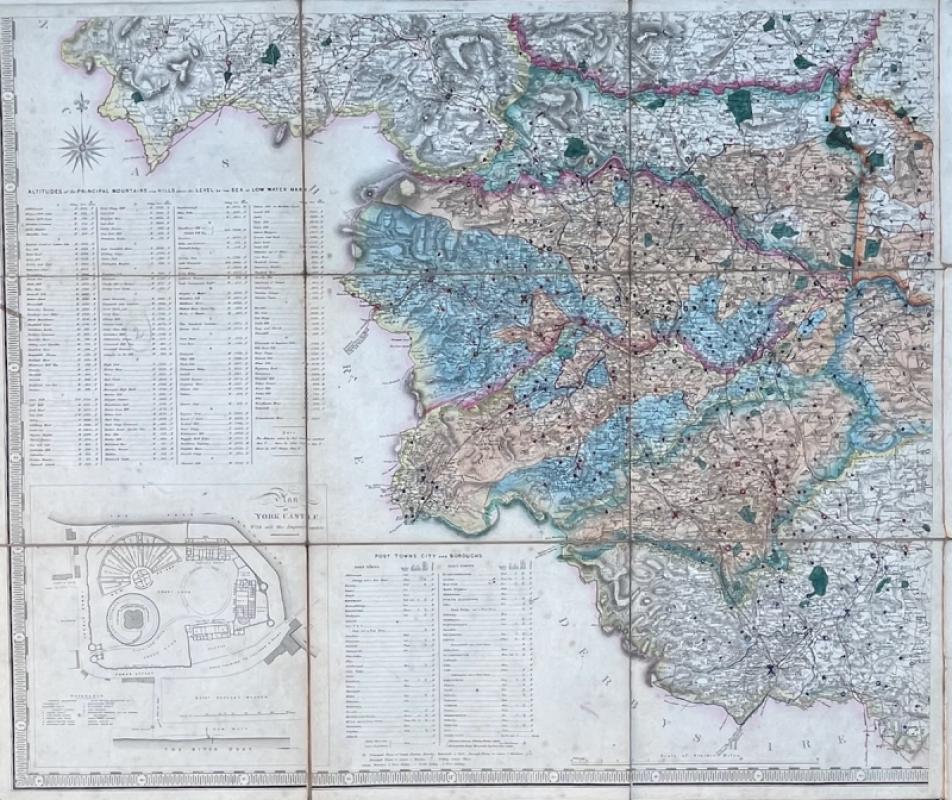
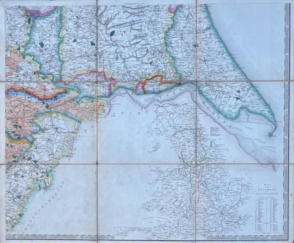
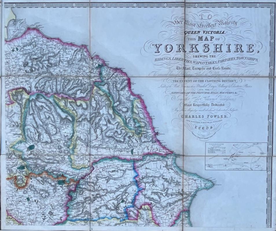
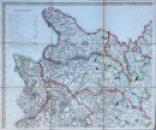
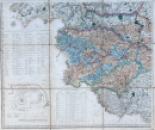
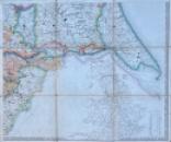
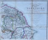
FOWLER, Charles Map of Yorkshire shewing the Ridings, Liberties, Wapontakes, Parishes, Townships, the Mail, Turnpike and Crossroads, the Several Lines of Railways, Canals, the Parliamentary Limits of the Boroughs, the Extent of the Clothing District, Lists of the Post Towns, Their Market Days, Polling and Election Places, and the Altitudes of the Principal Hills, Mountains, &c. Leeds: Charles Fowler, engraved by J. Neele and Co., c. 1840.
Large hand coloured 4 sheet map, 1530 x 1260 mm. dissected and mounted on linen, folded into a cloth case. a little wear to some folds. Paper label to cover lettered in manuscript “Fowler’s (1834) [sic] Map of Yorkshire shewing where the Members of the West Riding Constabulary are stationed [key] Superintendents, Inspectors, Sergeants, Constables.”
Dealer Notes
Although the ms label states 1834, this is an error since it is dedicated to Queen Victoria who ascended the throne in 1837. Little is known of Charles Fowler; he was active from c. 1819 until at least 1844 and produced the maps for Baines’ 2 volume History, Directory & Gazetteer, of the County of York [1822/3], as well as assorted local town plans and estate surveys.
Author
CHARLES FOWLER
Date
c. 1840
Publisher
Charles Fowler
Other books
If you liked the book you've just seen, you might be interested in other books from the same dealer below.
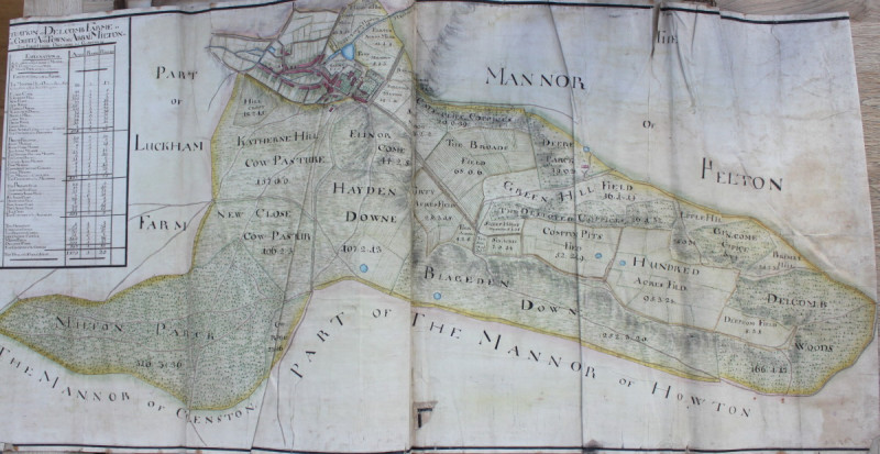
ALBUM OF ESTATE MAPS & PLANS 1656 & 1734.
MILTON ABBAS, DORSET
£15000.00
Offered by Michael S Kemp Bookseller
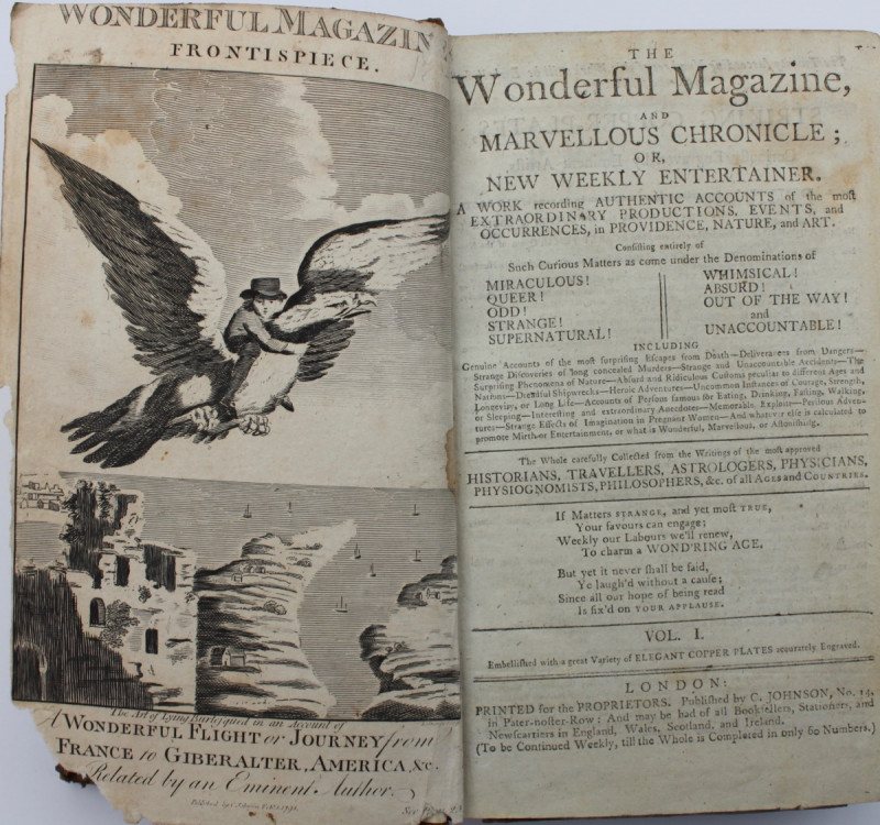
THE WONDERFUL MAGAZINE
ECCENTRICS, FREAKS, GIANTS & DWARVES
£1500.00
Offered by Michael S Kemp Bookseller
Friends of the PBFA
For £10 get free entry to our fairs, updates from the PBFA and more.
Please email info@pbfa.org for more information