The West Riding of Yorkshire
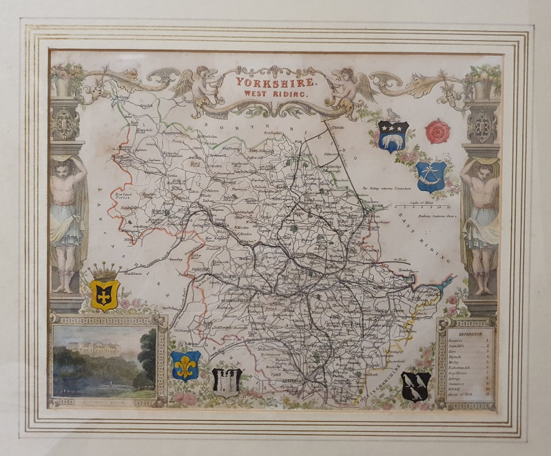
Book Description
Other books
If you liked the book you've just seen, you might be interested in other books from the same dealer below.
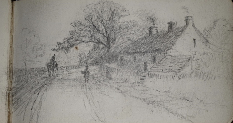
[Martin, F].
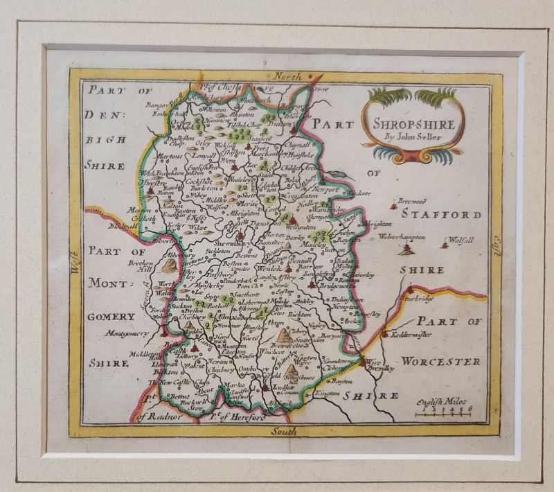
[A MANUSCRIPT SKETCHBOOK OF SCENES IN THE PEAK DISTRICT & CWMDALE, SHROPSHIRE]
£80.00
Offered by Alastor Rare Books
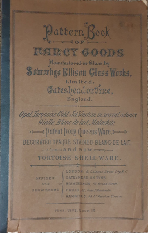
[A VICTORIAN GLASSMAKERS CATALOGUE].
Pattern Book of Fancy Goods Manufactured in Glass by Sowerbys Ellison Glass Works, Limited, Gateshead on Tyne, England.
Newcastle: B.Robinson & co.,
£70.00
Offered by Alastor Rare Books
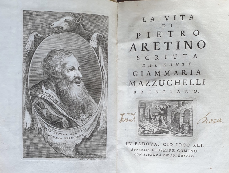
[AN EARLY LIFE & BIBLIOGRAPHY OF THE PUNISHING 16T...
Mazzuchelli, Conte Giammaria. La Vita Di Pietro Aretino.
In Padova i.e. Padua:Giuseppe Comino,
£220.00
Offered by Alastor Rare Books
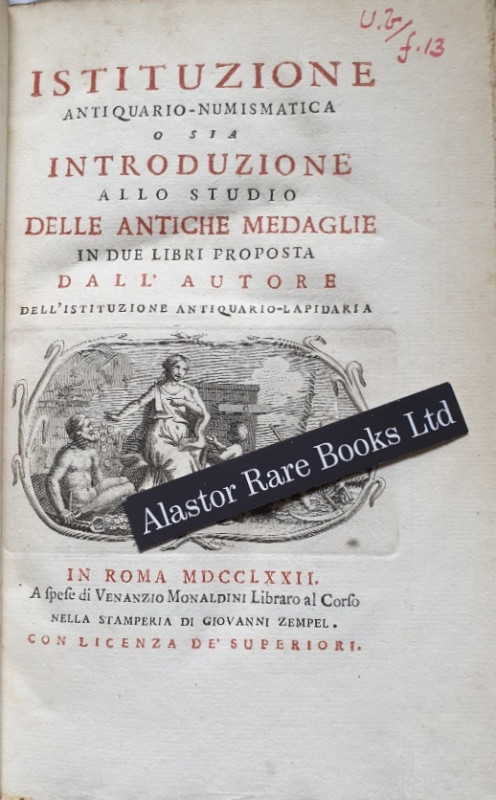
[NUMISMATICS]
Monaldini, Giuseppe Antonio. Istituzione Antiquario-Numismatica o sia Introduzione allo Studio delle Antiche Medaglie in due Libri Proposta dall Autore dell' Istituzione Antiquario-Lapidaria.
In Roma i.e. Rome: A Spese di Venanzio Monaldini Libraro al Corso Nella Stamperia Di Giovanni Zempel,
£120.00
Offered by Alastor Rare Books
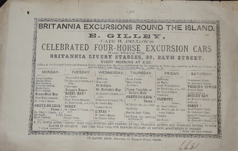
[CHANNEL ISLANDS ADVERTISING HANDBILL].
Britannia Excursions Round The Island. E.Gilley (Late H.Pellows), Celebrated Four-Horse Excursion Cars Will Leave The Britannia Livery Stables, 39, Bath Street, Every Morning At 9.30....
Jersey: Le Lievre, Bros., Printers, 13, Halkett Place,
£40.00
Offered by Alastor Rare Books
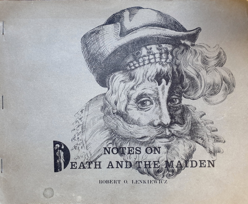
Notes On Death And The Maiden.
[ARTISTS BOOK]. Lenkiewicz, Robert.O.
[Plymouth, England]: [By the author],
£150.00
Offered by Alastor Rare Books
Friends of the PBFA
Please email info@pbfa.org for more information