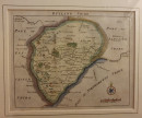
RUTLAND SHIRE

Book Description
Other books
If you liked the book you've just seen, you might be interested in other books from the same dealer below.
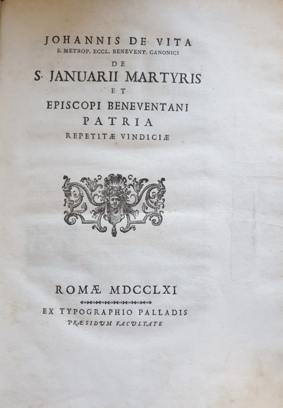
DE S. JANUARII MARTYRIS ET EPISCOPI BENEVENTANI PA...
[MARTYROLOGY]. DE VITA, Giovanni.
Romae i.e. Rome: ex Typographio Palladis,
£230.00
Offered by Alastor Rare Books
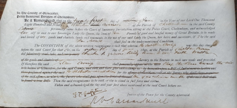
[WOMEN; WOMEN IN THE CRIMINAL JUSTICE SYSTEM].
[Victorian Court Judgement And Binding Over To Keep The Peace Order].
[s.i.],
£30.00
Offered by Alastor Rare Books
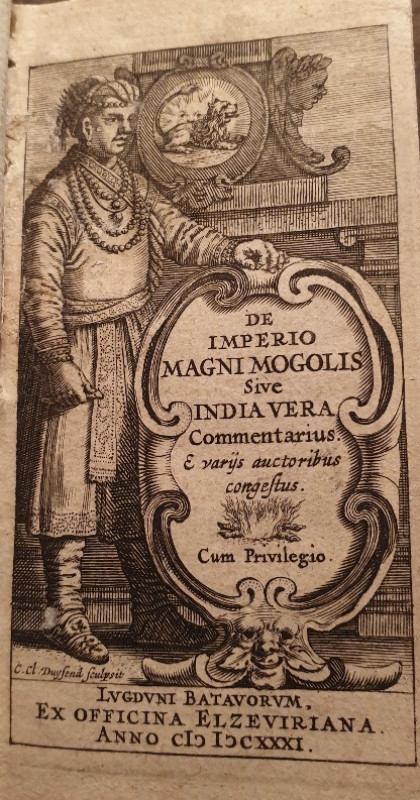
[A POCKET 17TH C HISTORY OF INDIA BY THE DIRECTOR...
De Laet, Joannes. De Imperio Magni Mogolis Sive India Vera Commentarius....
Lvgdvni Batavorvm i.e. Leiden:Ex Officina Elzeviriana,
£140.00
Offered by Alastor Rare Books
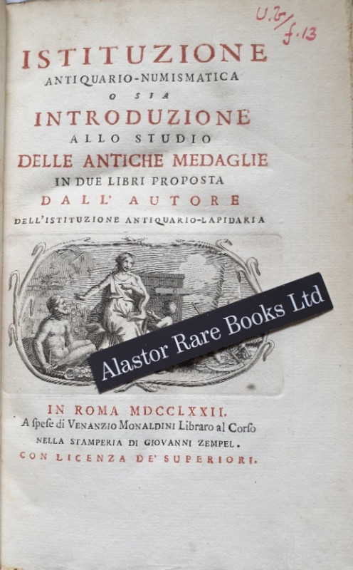
[NUMISMATICS]
Monaldini, Giuseppe Antonio. Istituzione Antiquario-Numismatica o sia Introduzione allo Studio delle Antiche Medaglie in due Libri Proposta dall Autore dell' Istituzione Antiquario-Lapidaria.
In Roma i.e. Rome: A Spese di Venanzio Monaldini Libraro al Corso Nella Stamperia Di Giovanni Zempel,
£120.00
Offered by Alastor Rare Books
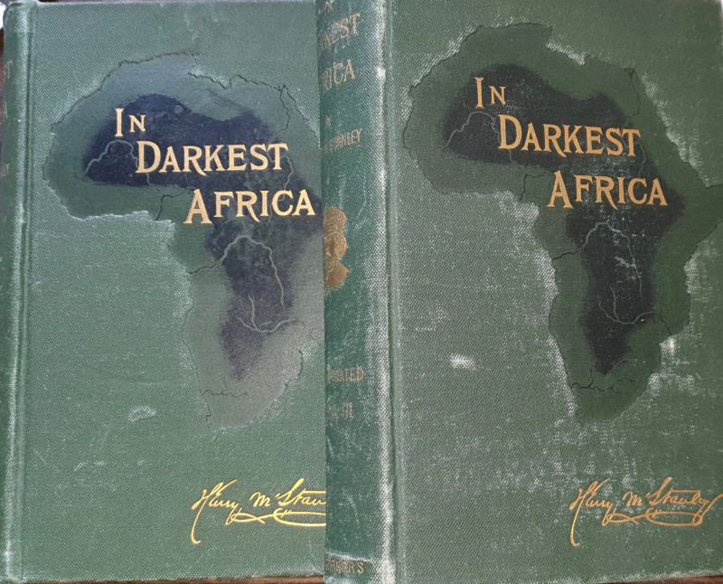
In Darkest Africa; or, The Quest, Rescue, and Retr...
Stanley, Henry M.
New York: Charles Scribner’s Sons,
£120.00
Offered by Alastor Rare Books
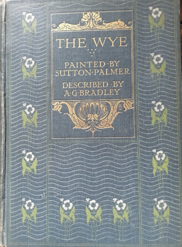
[A & C. BLACK COLOUR BOOK]. The Wye.
Bradley, A.G
London: Adam And Charles Black,
£30.00
Offered by Alastor Rare Books
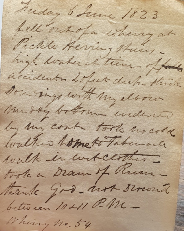
[Short, B].
[Miniature Manuscript Commonplace Book & Diary].
[London]:
£80.00
Offered by Alastor Rare Books
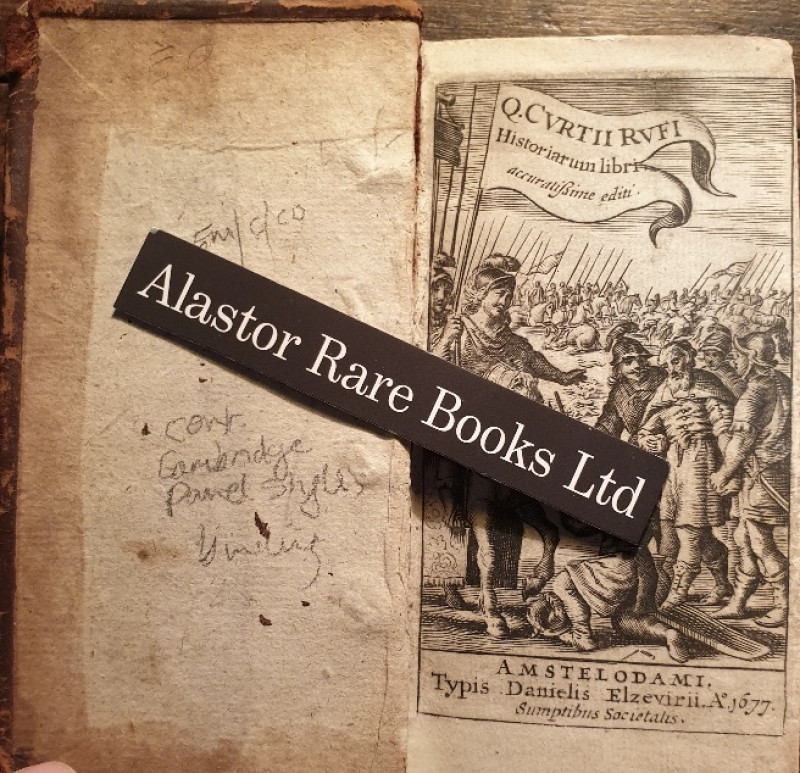
[A ROMAN HISTORY OF ALEXANDER THE GREAT IN A CONTE...
Rufius, Q.[uintus] Curtius. Historiarum Libri.
Amstelodami i.e. Amsterdam: Typis Danielis Elzevirii,
£100.00
Offered by Alastor Rare Books
Friends of the PBFA
Please email info@pbfa.org for more information