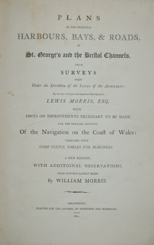
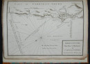
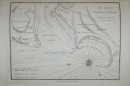
Plans of the Principal Harbours, Bays, & Roads, in St. George's and the Bristol Channels, from Surveys made Under the Direction of the Lords of the Admiralty: By the late intelligent and ingenious Hydrographer, Lewis Morris, Esq.
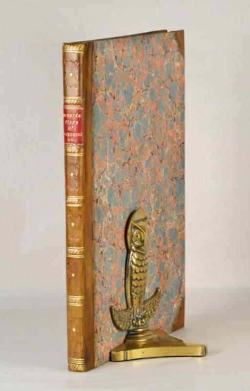
Book Description
Dealer Notes
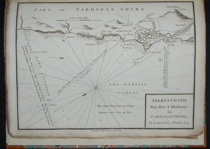
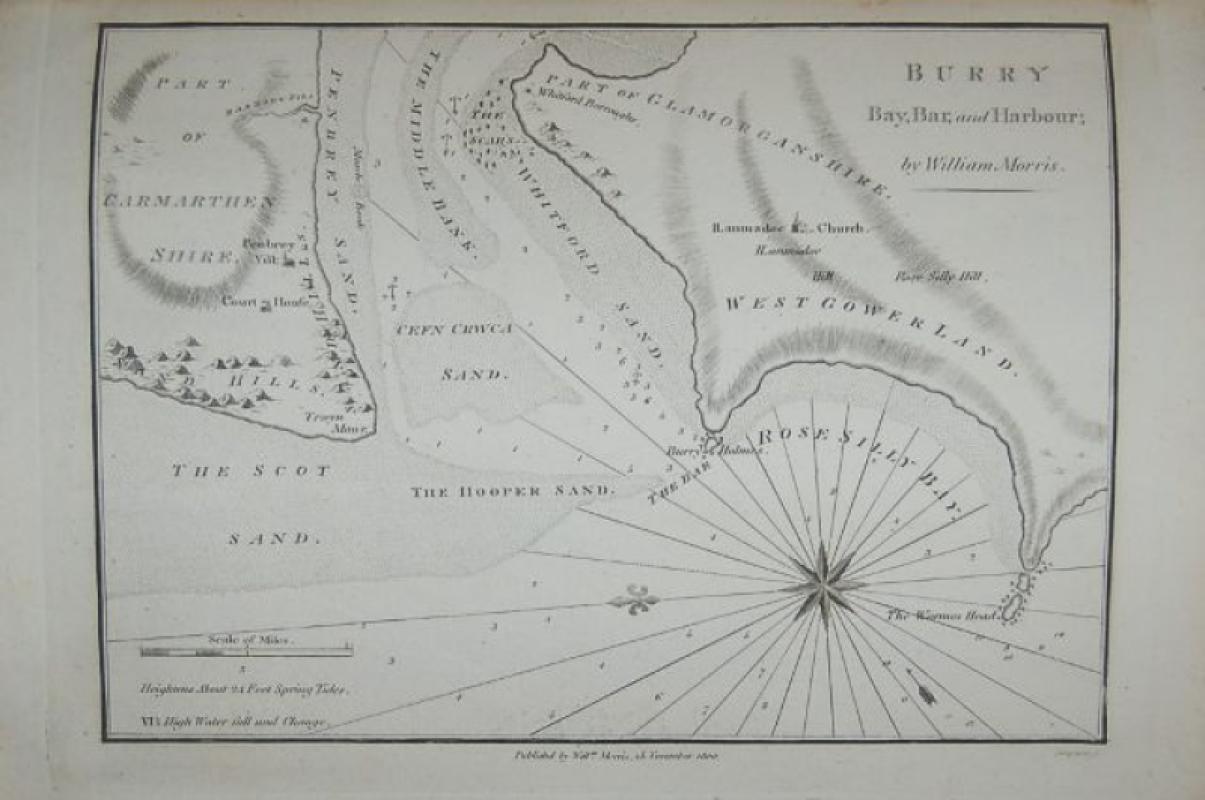
“Welsh poet, antiquary and surveyor. As a result of the numerous wrecks and casualties on the Welsh coast, the Admiralty instructed him in 1737 to undertake a new survey. Morris had surveyed the whole of the west coast of Wales by the declaration of war against France in 1744. But the work was fatally interrupted by lack of funds for the project. The partially completed work was published in 1748 as ‘Plans of harbours... in the St. George’s Channel. As a result of his many other interests, Lewis Morris never returned to coastal surveying.”—NMMC.
National Maritime Museum Catalogue III (part one), 402; Phillips, 2889.
Other books
If you liked the book you've just seen, you might be interested in other books from the same dealer below.
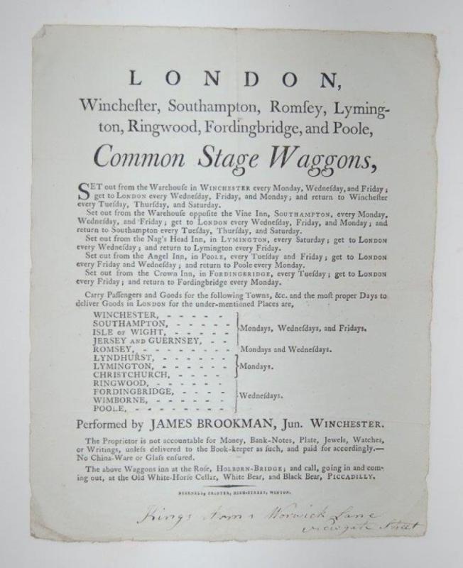
London, Winchester, Southampton, Romsey, Lymington...
COMMON STAGE WAGGONS.
Winton: Bucknell, Printer, High-Street,
£375.00
Offered by Forest Books
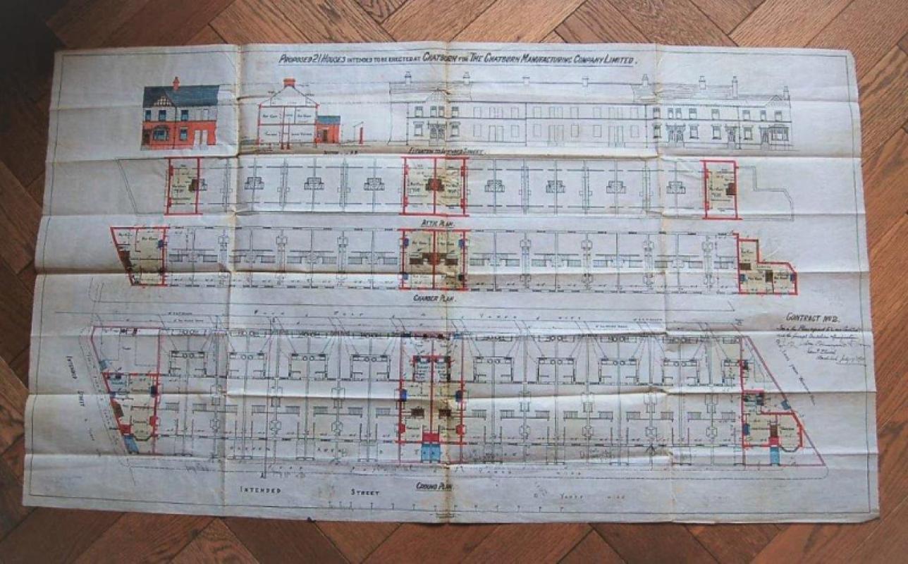
Proposed plan for 21 houses intended to be erected...
ARCHITECTURAL PLANS. CHATBURN, NEAR CLITHEROE, LANCASHIRE.
£145.00
Offered by Forest Books
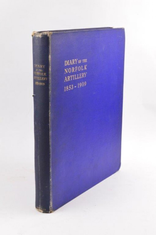
Diary of the Norfolk Artillery 1853-1909.
HOLMES (J. Sancroft)
Norwich:
£50.00
Offered by Forest Books

Pain’s British Palladio: or, The Builder’s General...
PAIN (William & James)
London: Printed for I. and J. Taylor,
£1250.00
Offered by Forest Books
Plans of the Principal Harbours, Bays, & Roads, in...
MORRIS (William)
Shrewsbury: Printed for the Author, by Sandford and Maddocks,
£995.00
Offered by Forest Books

The Costume of the Hereditary States of The House...
MOLEVILLE ( Antoine François Bertrand de)
London: Printed for William Miller, by William Bulmer and Co.,
£795.00
Offered by Forest Books
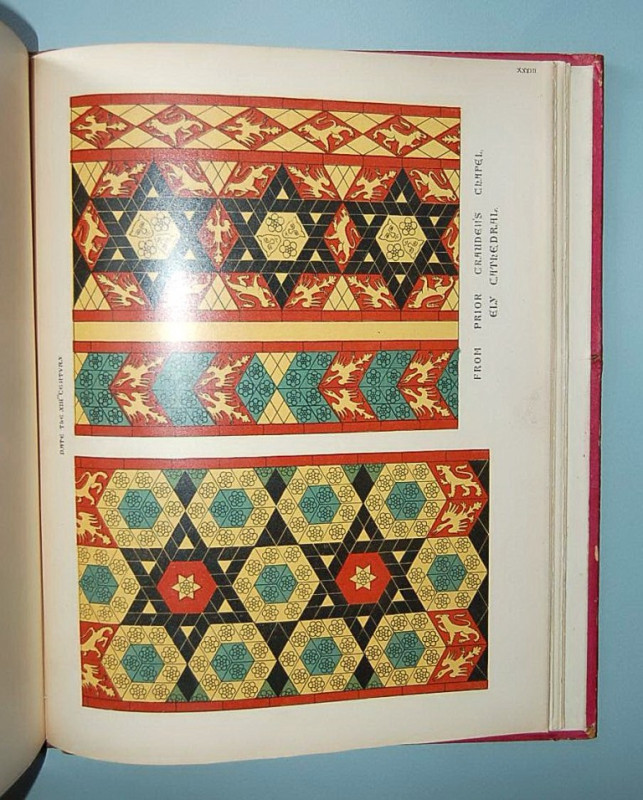
Specimens of Tile Pavements Drawn from Existing Au...
SHAW (Henry)
London: Basil M. Pickering,
£745.00
Offered by Forest Books
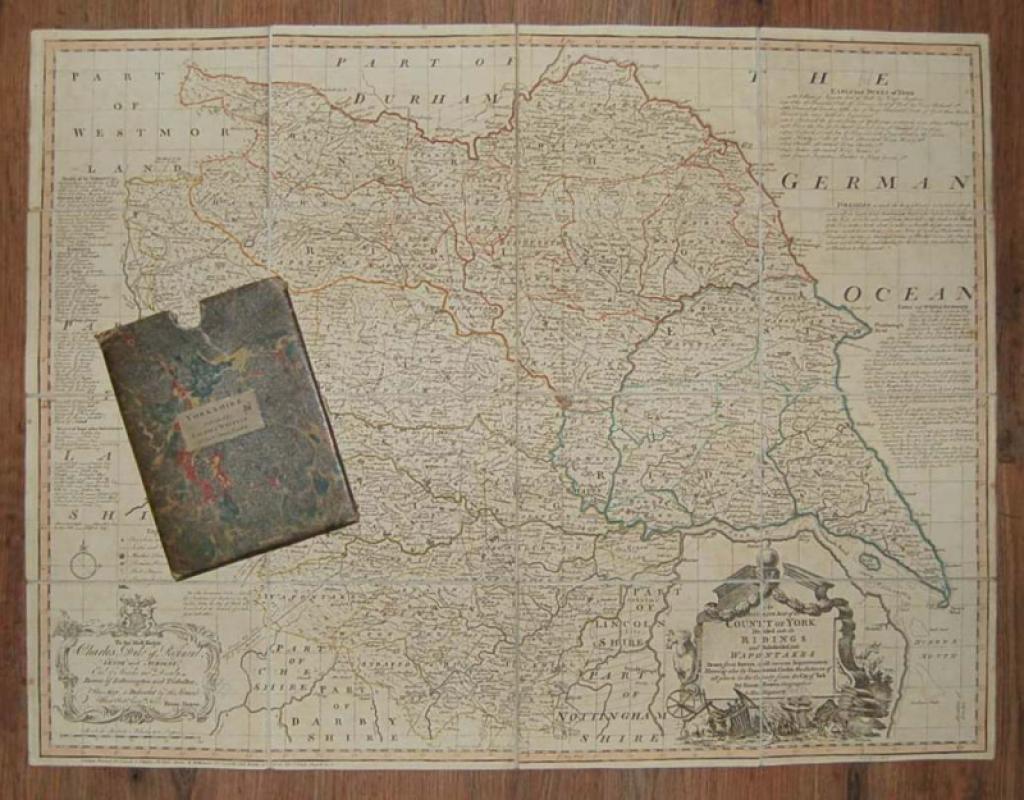
An Accurate Map of the County of York, Divided int...
YORKSHIRE MAP. BOWEN (Emanuel)
London: Printed for Laurie & Whittle,
£295.00
Offered by Forest Books
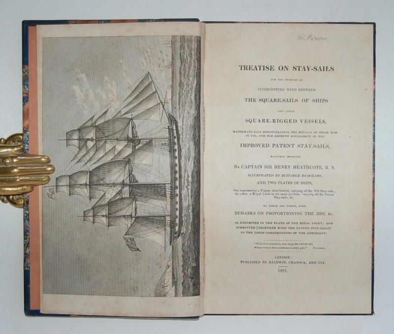
Treatise on Stay-Sails for the Purpose of Intercep...
HEATHCOTE (Captain Sir Henry)
London: Published by Baldwin, Cradock, and Joy,
£375.00
Offered by Forest Books
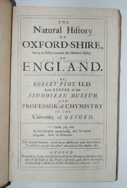
The Natural History of Oxford-Shire, Being an Essa...
PLOT (Robert)
Oxford: Printed for Leon. Lichfield, for Charles Brome and John Nicholson,
£1795.00
Offered by Forest Books
Friends of the PBFA
Please email info@pbfa.org for more information