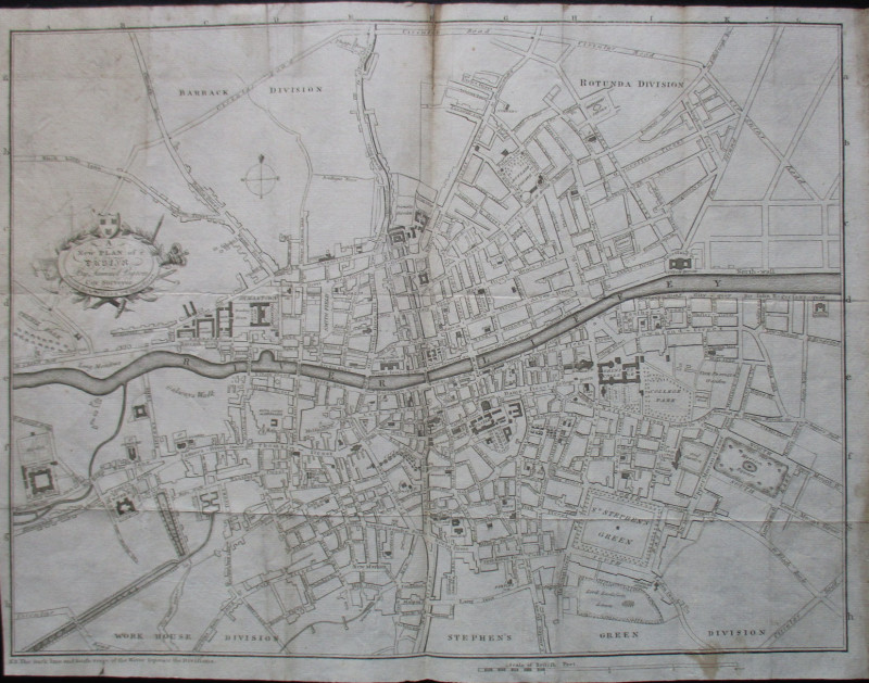
Map of Rome : Pianta Topografica di Roma

Book Description
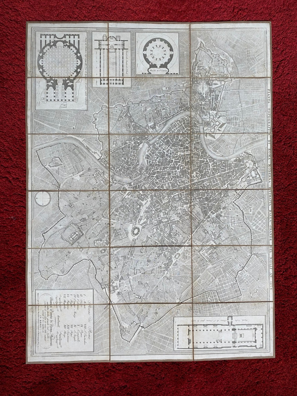
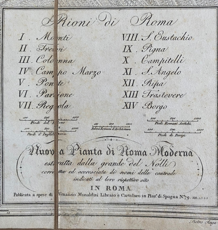
Map of Rome 1828. Pianta Topografica di Roma by Nolli, published by Monaldini, Rome 1828. Engraved by Pietro Ruga. On folding linen in 18 sections, size 87 by 63 cm. With five scales including Piedi Romani Antichi, Piedi di Parigi and Piedi d’Inghilterra, approximating to 750 feet to the mile. The title Pianta Topografica di Roma Estrata Della Grande Del Nolli An. 1828 appears above the map and a cartouche below the map contains a key to the 14 districts of the city and details of the publisher. Includes inset plans of the Pantheon, the Basilica of St. Paul, the Constantine mausoleum and the church of St. Lorenzo. Uncoloured. An incorrect date of publication has been written in ink to the reverse. Good to VG condition.
Author
Nolli
Date
1828
Binding
Folding map on cloth
Publisher
Monaldini
Illustrator
Nolli
Condition
Good to VG
Other books
If you liked the book you've just seen, you might be interested in other books from the same dealer below.
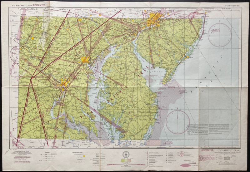
Map of Washington Air Defence Zone 1942
Colbert
US Coast and Geodetic Survey
Reserved
Offered by Arthur Hook


A set of four road maps of France for motorists pu...
De Dion Bouton Puteaux
De Dion Bouton Puteaux
£75.00
Offered by Arthur Hook

The Lady’s Manual of Homeopathic Treatment in the...
Ruddock
Homeopathic Publishing Company
£35.00
Offered by Arthur Hook
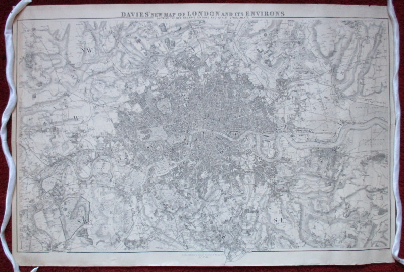
Davies’ New Map of London and its Environs showing...
Davies
Stanford
£175.00
Offered by Arthur Hook
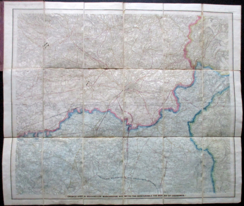
Ordnance Survey Map of Manchester & Neighbourhood...
Simms
Ordnance Survey
£65.00
Offered by Arthur Hook
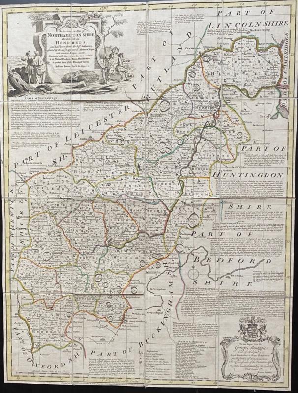
An Accurate Map of Northampton Shire Divided into...
Bowen
Carrington Bowles
£200.00
Offered by Arthur Hook
Friends of the PBFA
For £10 get free entry to our fairs, updates from the PBFA and more.
Please email info@pbfa.org for more information