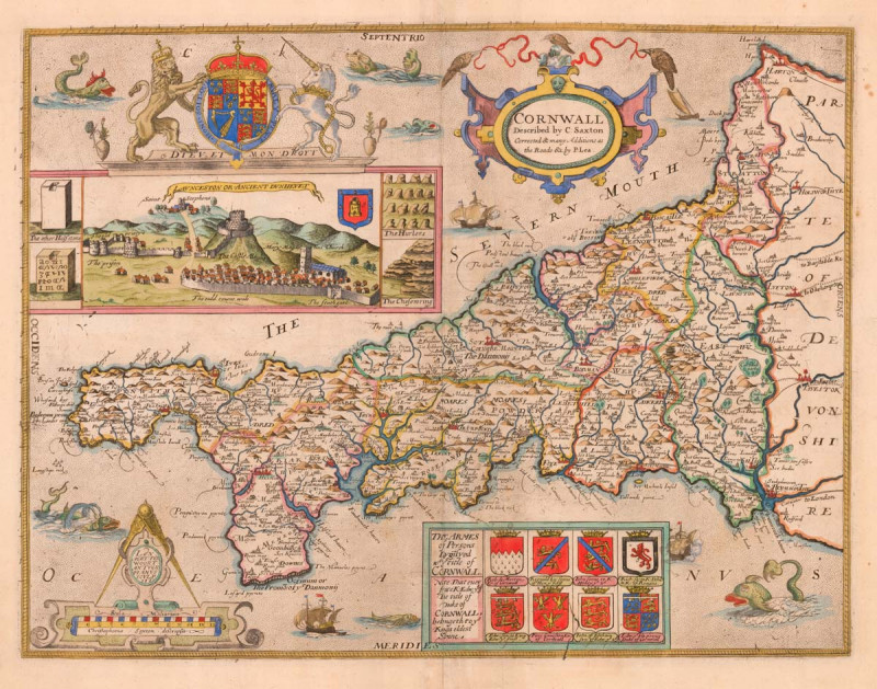
Cornwall Described by C. Saxton Corrected and many Additions as the Roads &c. by P. Lea.


Book Description
Saxton's map of Cornwall as revised by Philip Lea.
A fine example of the first map of the county of Cornwall, here published 120 years after its original publication. Over the years a number of changes had been made to the plate: the original title was replaced by the view of Launceston c.1665; the arms of Elizabeth I were replaced by those of Charles I then Charles II; the panel of armorials were added c.1665 by an unknown publisher; Lea added his name and Ogilby's roads in 1689 and changed the title for the second time in 1694, as this example.
Still this was not the end of the Saxton plates: they were republished by George Willdey c.1732 and again by Thomas Jefferys and Cluer Dicey in the 1770s.
Despite the number of editions any example of Saxton's map of Cornwall is uncommon.
Author
SAXTON, Christopher.
Date
c.1694
Publisher
Philip Lea
Condition
Wide margins. Evidence of a crack in the printing plate, affecting armorials.
Pages
1
Other books
If you liked the book you've just seen, you might be interested in other books from the same dealer below.
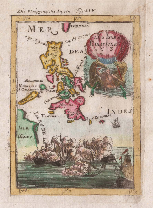
Les Isles Philippines 1684.
MALLET, Alain Manesson.
£475.00
Offered by Altea Antique Maps & Old Charts
Cornwall Described by C. Saxton Corrected and many...
SAXTON, Christopher.
Philip Lea
£3250.00
Offered by Altea Antique Maps & Old Charts
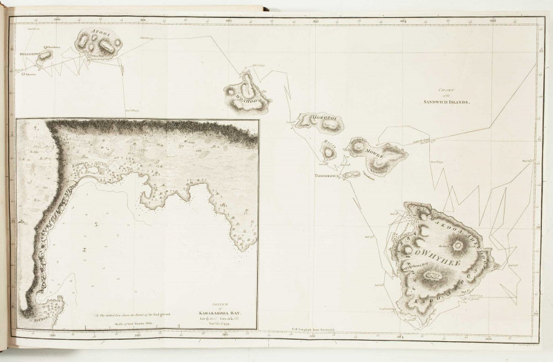
A Voyage to the Pacific Ocean, Undertaken, By the...
COOK, Captain James.
Nichol & Cadell
£4000.00
Offered by Altea Antique Maps & Old Charts
Friends of the PBFA
For £10 get free entry to our fairs, updates from the PBFA and more.
Please email info@pbfa.org for more information