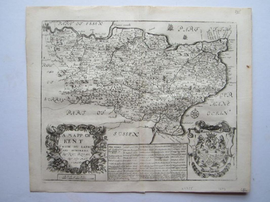
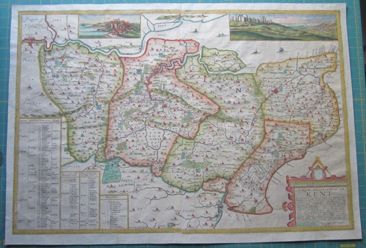
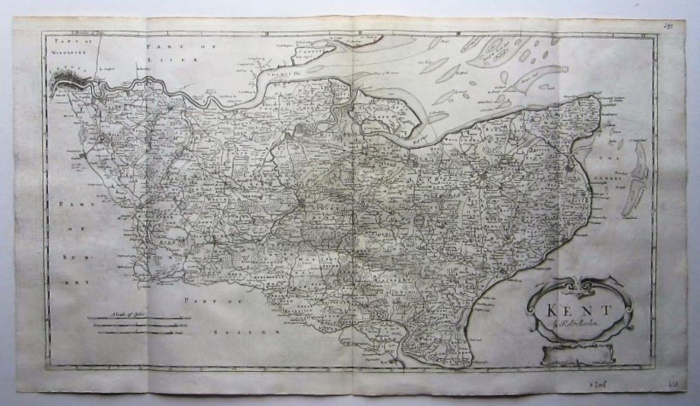
A Mapp of Kent with its Laths and Hundreds...


Book Description
A very attractive map of Kent with a large decorative cartouche, coat-of arms and various sailing ships and a compass rose. From Blome’s "Britannia: or, a Geographical Description of the Kingdoms of England, Scotland, and Ireland with the Isles and Territories thereto belonging". Based on Speed.
[ref: 4755]
Author
Blome, Richard (1635-1705)
Date
1673
Publisher
London
Condition
copper engraved map; overall 31 x 37 cm, plate 26 x 33 cm. fold as issued; light patina; 1 marginal rust spot; some light off-set; o/w vg cond.
Other books
If you liked the book you've just seen, you might be interested in other books from the same dealer below.
A New description of Kent
Philip Symonson (fl.1577-1598)
Robert Sayer (c.1745-1751), London.
£1200.00
Offered by Angelika C J Friebe Ltd
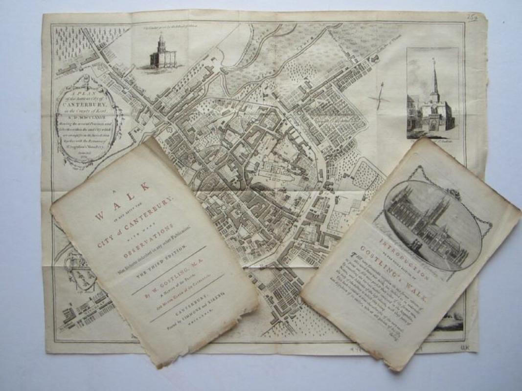
A Plan of the Ancient City of Canterbury in the Co...
Gostling, William
Simmons & Kirkby & Flackton, Canterbury
£200.00
Offered by Angelika C J Friebe Ltd
Friends of the PBFA
For £10 get free entry to our fairs, updates from the PBFA and more.
Please email info@pbfa.org for more information