Tape Indicator Map of London

Book Description
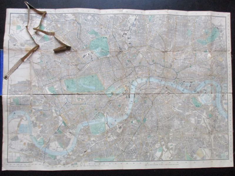
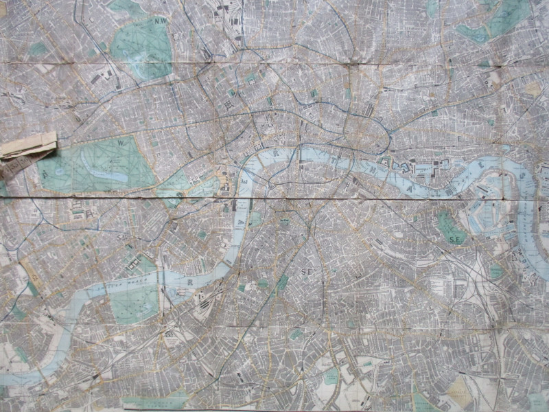
Tape Indicator Map of London, published by C Smith London circa 1906. On folding linen size 91 by 63 cm. Scale three and a half miles to the inch. Colour. Covers an area from Willesden across to Hackney Marsh in the north and from Barnes Common to Lewisham station in the south. Complete with the original measuring tape. Shows underground and electric railways, bus and tram-car routes. Folds into stiff decorated covers. Lacks the visitors’ guide that was issued with the map. Head of spine scuffed and the intersection of one of the folds is worn but overall the map is in Good condition.
Author
Smith
Date
1906
Binding
Stiff cloth covered boards
Publisher
Smith
Condition
Good
Other books
If you liked the book you've just seen, you might be interested in other books from the same dealer below.
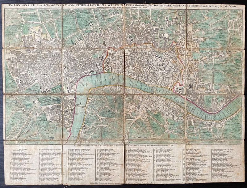
The New London Guide or a Pocket Plan of the Citie...
Ellis
Carington Bowles
£295.00
Offered by Arthur Hook
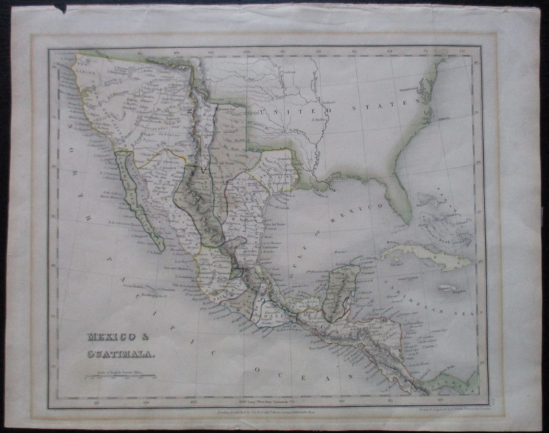
Four Plans for the development of the Central Lond...
Pennethorne
Hansard
£125.00
Offered by Arthur Hook
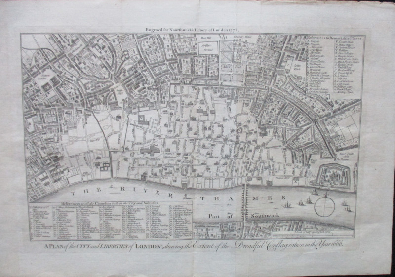
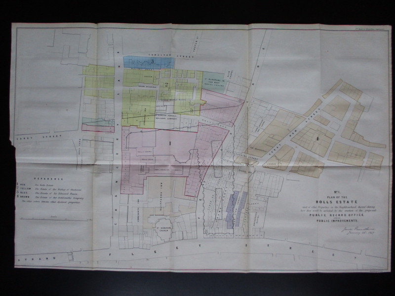
A Plan of the City and Liberties of London; shewin...
Anon
Noorthouck
£120.00
Offered by Arthur Hook

Friends of the PBFA
For £10 get free entry to our fairs, updates from the PBFA and more.
Please email info@pbfa.org for more information