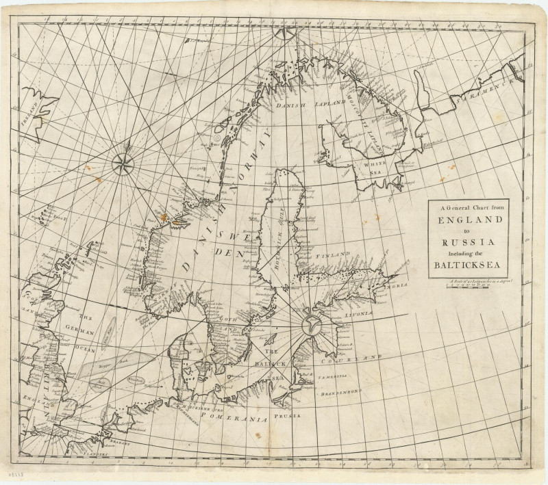
A General Chart of England to Russia Including the Baltick Sea.

Book Description
Dealer Notes
The atlas was purely commercial and was not a real rival to the ‘English Pilot’: unlike the Pilot it compressed global coverage into one book, as well as describing the the south and west coast of America, omitted by the former.
Other books
If you liked the book you've just seen, you might be interested in other books from the same dealer below.

Chronicle of the Conquest of Granada...Author’s Re...
IRVING, Washington.
G.P. Putnam’s Sons
£475.00
Offered by Shapero Rare Books Ltd
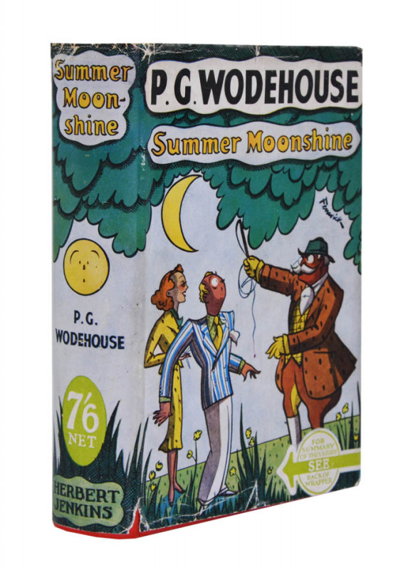
Summer Moonshine.
WODEHOUSE, P.G.
London, Herbert Jenkins Limited,
£1250.00
Offered by Shapero Rare Books Ltd

Narrative of a ten years' residence at Tripoli in...
TULLY, Richard.
London, Colburn
£1850.00
Offered by Shapero Rare Books Ltd
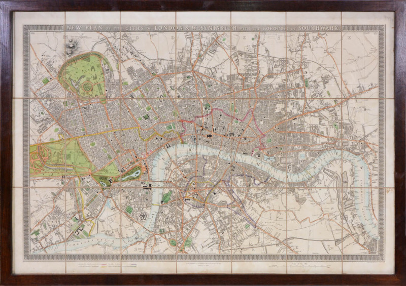
An entire new plan of the cities of London and Wes...
MOGG, Edward.
London, E. Mogg
£1250.00
Offered by Shapero Rare Books Ltd

Charlie and the Great Glass Elevator.
DAHL, Roald; SCHINDELMAN, Joseph.
Alfred A. Knopf
£375.00
Offered by Shapero Rare Books Ltd

Lord Randolph Churchill.
CHURCHILL, Winston Spencer.
London, MacMillan and Co. Limited
£750.00
Offered by Shapero Rare Books Ltd

Finden's illustrations of the life and works of Lo...
[BYRON]; BROCKEDON, W[illiam].
London, John Murray,
£850.00
Offered by Shapero Rare Books Ltd
The Aeropleustic Art, or Navigation in the Air, by...
POCOCK, George.
London, Wilson for Sherwood,
£4000.00
Offered by Shapero Rare Books Ltd


Serge de Diaghileff’s Ballet Russe. Souvenir.
[BALLETS RUSSES].
New York, Morris Gest & Metropolitan Opera
£1250.00
Offered by Shapero Rare Books Ltd
Friends of the PBFA
Please email info@pbfa.org for more information